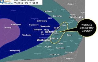
My First Call For Snowfall And Model Maps Wednesday To Friday
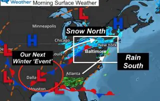
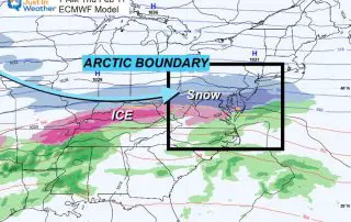
February 9 2021 The arctic air we’ve been talking about has made a move into the central US and will be the driving force for a few impulses of snow
February 9 2021 The arctic air we’ve been talking about has made a move into the central US and will be the driving force for a few impulses of snow
Tuesday Morning February 9 2021 This morning we had a squeeze play between a band of snow passing through Harrisburg PA and rain in southern Maryland creeping north. This played
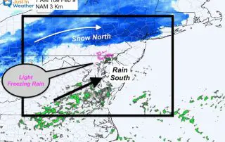
Tuesday Morning we will watch a developing system to our north and south. Our region is caught in the middle as they ‘almost phase’. The net result could be some
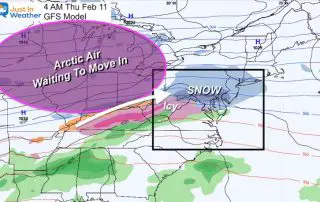
Monday February 8 2021 - Afternoon Update The cold air in place today is just a taste of what is on the way. This is going to be an active
Monday February 8 2021 This morning our temperatures are frigid as we catch a breather between weather systems. This will be a very active week with multiple weather systems and
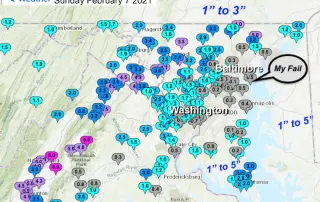
The Radar That Represents This Storm Before we get to the snow reports to compare my forecast and grade, I have a question for you. How could anyone nail this?

Sunday February 7 2021 at 9:45 AM I know there were doubters, but the snow has taken over for most of our region. The transition may have been an hour
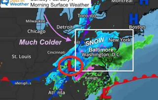
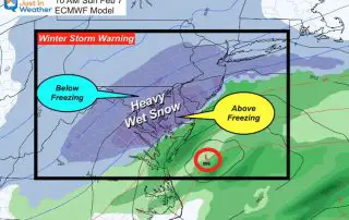
Sunday February 7 2021 Snow and rain began earlier this morning as expected, with temperatures above freezing as expected. Our region remains under either a Winter Storm Warning or Winter
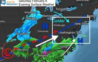
Saturday February 6 2021 The storm looks impressive on the weather map as multiple pieces of energy are coming together. This will be a race of the cold air trying
Saturday February 6 2021 Today will be the nicer of the two weekend days, but Sunday will not be a complete loss. Th Winter Storm Warning is an upgrade for