Monday February 8 2021
This morning our temperatures are frigid as we catch a breather between weather systems. This will be a very active week with multiple weather systems and arctic air lingering nearby just waiting to take hold.
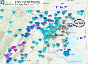
Tuesday will bring a split of snow to our north, with rain across our southern half. Then on that arctic boundary we can expect a band of snow and ice arriving Wednesday night, and not departing until Friday. With this first signal, we can identify that pattern. But specifics and fine tuning will take more work. Based on the spread of Sunday’s snow that stuck and melted, it’s best to work a little more before locking in totals, right?
Odds are, the trend continues and we bump this a little north. See the timelines below.
Wintry Pattern Ahead
Did You Grade My Forecast?
So far a wide spread of ‘Perfect’ to ‘BUST and FAIL’. Here’s another chance to contribute to this Poll.
Poll is open until 8 PM Tue Feb 9
Grade My Forecast: Feb 7 2021
- A (36%, 1,365 Votes)
- B (27%, 1,006 Votes)
- C (16%, 585 Votes)
- D (11%, 429 Votes)
- F (10%, 384 Votes)
Total Voters: 3,769
See My Full Storm Recap Here:
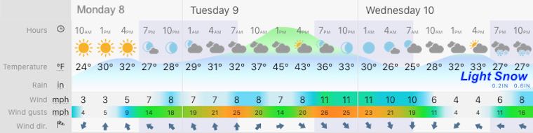
Weather Today
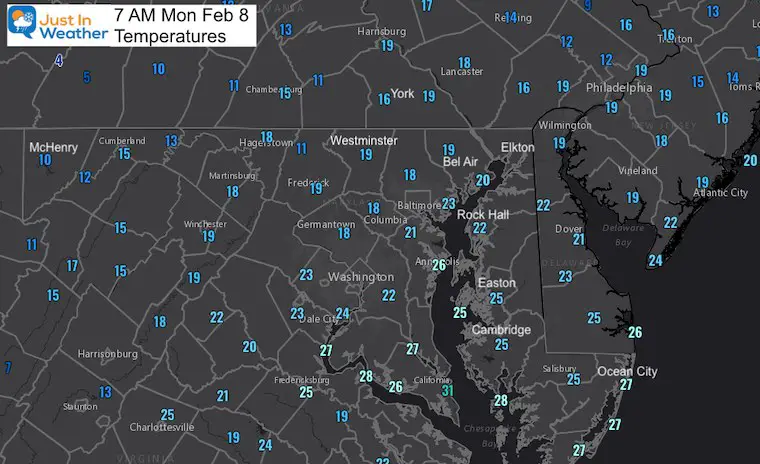
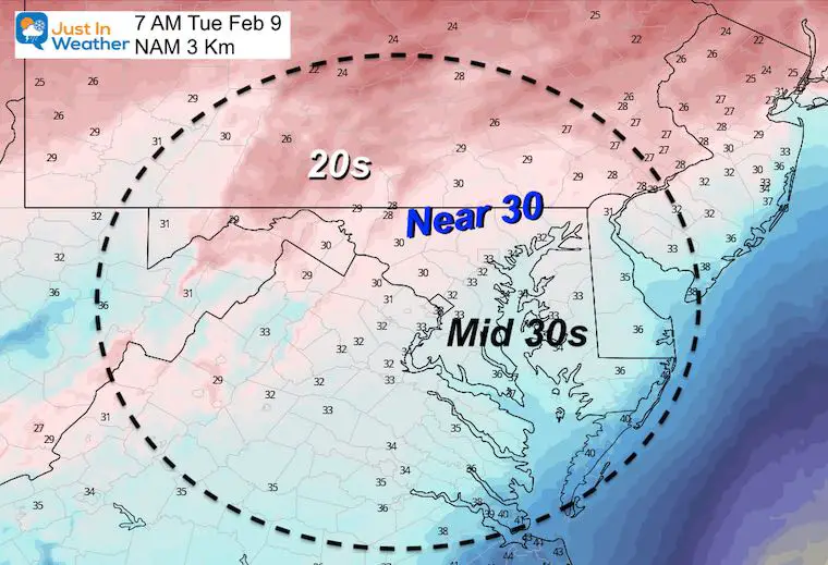
Morning Temperatures
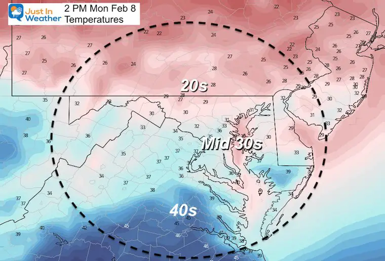
Afternoon Forecast
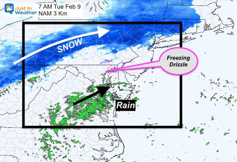
Tuesday Morning
Split moisture with snow north in PA and rain across southern Maryland. There is a chance for light spotty freezing drizzle in our metro area in the morning. I would not change any plans at this time.
Closer Look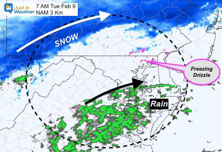
Forecast Snapshot: Central Maryland
Wednesday Night Through Friday
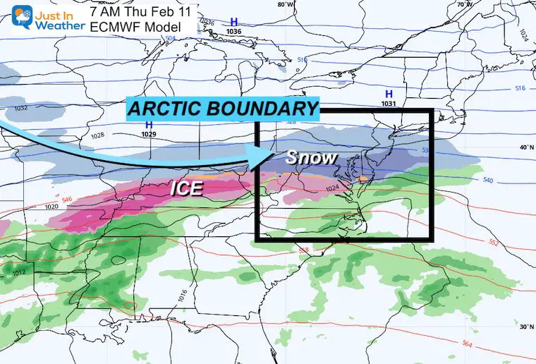
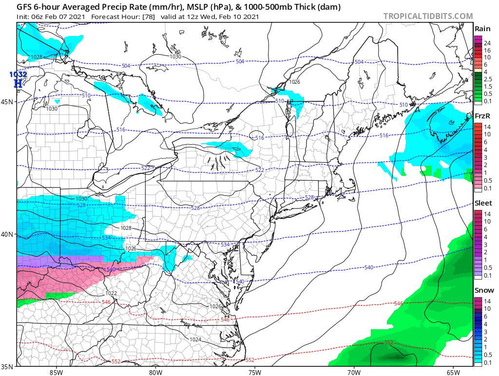
A band of snow and ice will develop along an arctic boundary. This will be draped over our area for a few days. I will get into more detail about the arctic air in my next report. For now, let’s compare two possible solutions:
ECMWF Model = Colder and more snow
GFS Model = A little north with more ice and rain mixed in.
Storm Simulation ECMWF Model —> slider


COMPARE TO A MORE ICY SOLUTION
Storm Animation GFS Model
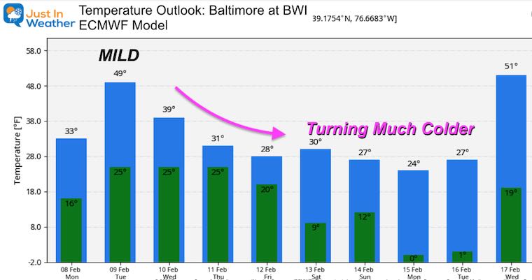
Temperature Outlook: About That Arctic Air…
The European Model is the colder solution for this week and the air that follows. If you have been wondering about that Polar Vortex, here’s an idea when we might get a taste.
Please share your thoughts, best weather pics/video, or just keep in touch via social media
Facebook: Justin Berk, Meteorologist
Twitter: @JustinWeather
Instagram: justinweather
Winter Outlook Series


14 Local Maryland Pages (and York PA)
We have made a page for Maryland Weather which gives you the current conditions for 14 present area locations.


FITF Shop Open
My ‘bonus’ daughter Jaiden and wife showing off our popular Maryland Hoodies. Unisex and women’s items all produced in Maryland.
Click here to see this and many other new items.

