Tuesday Morning February 9 2021
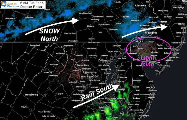
This morning we had a squeeze play between a band of snow passing through Harrisburg PA and rain in southern Maryland creeping north. This played out as expected… until 6 AM (as I write this). The question over the next few hours will be if light freezing drizzle develops in between.
Next Up will be a few waves of Low Pressure along that arctic boundary. We will be on the cold side and expect mostly snow Wednesday into Friday, then a possibly coastal storm on Valentine’s Day Sunday.
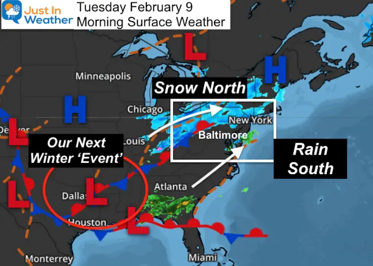
Morning Surface Weather
Check out the radar loop I saw before 5 AM
Early morning radar loop tells the story:
Snow line passed through Harrisburg PA
Rain trying to creep north
from So MD.
Freezing Drizzle ‘might’ develop in between (metro areas)
b/t 6-8 AM. pic.twitter.com/wtrp2Iqb9T— Justin Berk (@JustinWeather) February 9, 2021
At 6 AM
Doppler Radar Snapshot
The tough part is that there may be some very light drizzle or flurries in between. It would be very light, but all it takes is a light glaze to be an issue.
Just a heads up: If you are driving and see anything hit the windshield, then look out of possible icy spots.
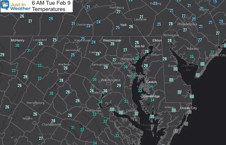
Temperatures
Most areas near Annapolis along Rt 50 and north are below freezing.
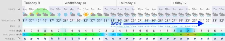
Forecast Snapshot:
- If anything falls this morning, it will be light and over quickly.
- This afternoon breaks out some sun and the warmest air of the week (40s)
- Snow: The next event arrives Wednesday night.
Next Up: Snow Wednesday night into Friday…
About That Snow….
I want to show you the ECMWF Model timeline slider below. The snow will last 24 to 36 hours and come in 2 waves. But this is one of a few solutions and my concern:
- This model shows more snow south.
- There is a tendency for weather systems to verify a little north.
How Much Snow Through Friday?
I see the range of
- Low End: 2 Inches
- High End: 8 inches
Where does that set up?
At this time there is a range across the modeling. I hope to get more agreement in the morning package. I will post snow maps early this afternoon.
Radar Simulation ECMWF —> slider


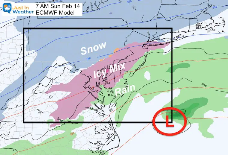
After This: Next Up A Valentine’s Day Storm
This is the expectation… A Third Sunday in a row with Low Pressure off of the Delmarva Coast (Atmospheric Memory).
At this time it looks like an icy mix. However, once there is new snowpack on the ground, I expect the modeling to incorporate that and this will adjust.
So take this as an idea of a winter event that should be watched closely for changes and possible impact on your plans.
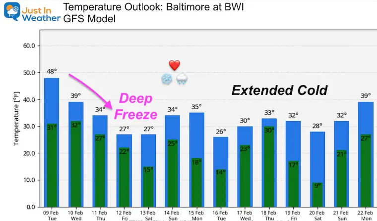
Temperature Outlook
The trend holds sustained cold….
Next Update:
I am aiming to post snow maps and more between noon and 1 PM today.
Please share your thoughts, best weather pics/video, or just keep in touch via social media
Facebook: Justin Berk, Meteorologist
Twitter: @JustinWeather
Instagram: justinweather
Winter Outlook Series


14 Local Maryland Pages (and York PA)
We have made a page for Maryland Weather which gives you the current conditions for 14 present area locations.


FITF Shop Open
My ‘bonus’ daughter Jaiden and wife showing off our popular Maryland Hoodies. Unisex and women’s items all produced in Maryland.
Click here to see this and many other new items.

