4th Noreaster Outlook 5 Days Away Still Uncertain Of Snow Line
Thursday March 15 2018 Beware the ides of March they say. Well, I realize that this storm is not going away and will require some more attention. This article's title

Thursday March 15 2018 Beware the ides of March they say. Well, I realize that this storm is not going away and will require some more attention. This article's title
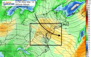
Thursday March 15 2018 Beware the ides of March... The wind will be less intense today and temperatures will be close to average. But we are still under the influence
March 14 2018 Today is Pi Day when we honor the birthday of Albert Einstein and the most popular irrational number (3.1415926535...) I still remember it out to 60 places
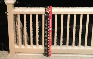
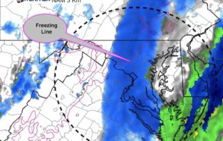
Tuesday March 13 2018 That band of snow overnight was persistent and dropped between 1 and 2 inches of snow north of Baltimore and across southern Pennsylvania. This made
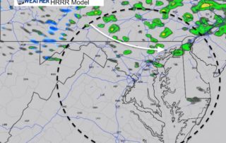
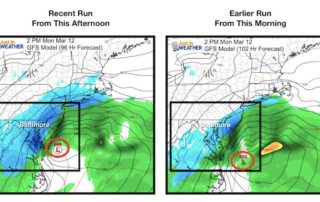
March 12 2018 4:20 PM The coastal storm is taking form and looking at Doppler Radar it does appear to have some influence over our region. But, it is really

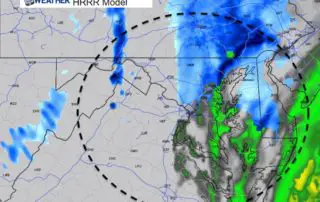
Monday March 12 2018 6 AM This is just NOT our storm. I wanted to get through the weekend with a break from the storm chat but with area roads
Sunday March 11 2018 6:30 PM The time change wasn't enough for us, now we need to continue to watch this 3rd Nor'easter in the series. I have said last
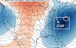
Saturday March 10 2018 8:30 AM We definitely have a winter pattern in place and the amplitude of the jet stream is impressive. But I did not want to jump
9:55 PM Thursday March 8 2018 I didn't really want to write about this storm yet, but I understand the excitement or concern. I need to warn you that the
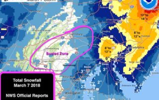
March 8 2018 The late season Nor'easter that brought snow to our area was a complex event. It was talked up for days and this post is only to simplify