 March 14 2018
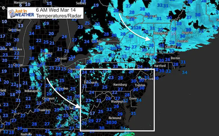
Today is Pi Day when we honor the birthday of Albert Einstein and the most popular irrational number (3.1415926535…) I still remember it out to 60 places and may hold a contest later today to see who can recite more. One thing for sure, we will want to stay inside all day as winds will grow stronger and the cold air remains. The later Nor’easter is still spinning to our northeast and will be sending cold air down our way. The pressure gradient will increase the winds this afternoon through tonight that will gust over 30 mph. Combine that with afternoon highs in the lower 40s and it will feel like the 20s.
Stats For March 13
Average High: 53ºF
Record High: 83ºF in 2007
Average Low: 33ºF
Record Low: 14ºF in 1888
Snow Record: 5.8″ in 1937
Seasonal Snow To Date (at BWI): 10.5″
Sunrise: 7:19 AM
Sunset 7:12 PM
*Daylight = 2:34 longer than yesterday
*Bay Water Temperature = 41ºF at Thomas Pt. Light House
Keep In Touch Every Day
Click here to sign up for email alerts…. Just in case you don’t get the post on your social media feed
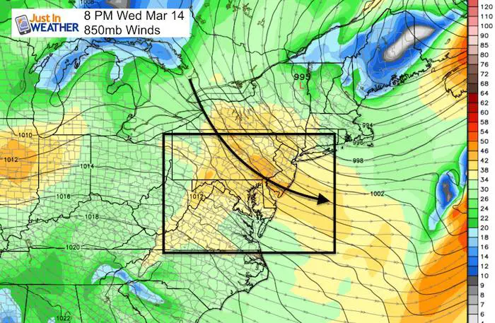
Upper Level Winds
Flurries or Showers: Next Three Days
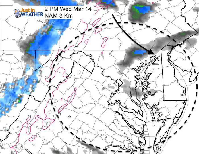
Today’s best chance of snow flurries will be in the mountains and northeastern Maryland (northern Baltimore, Harford, and Cecil)
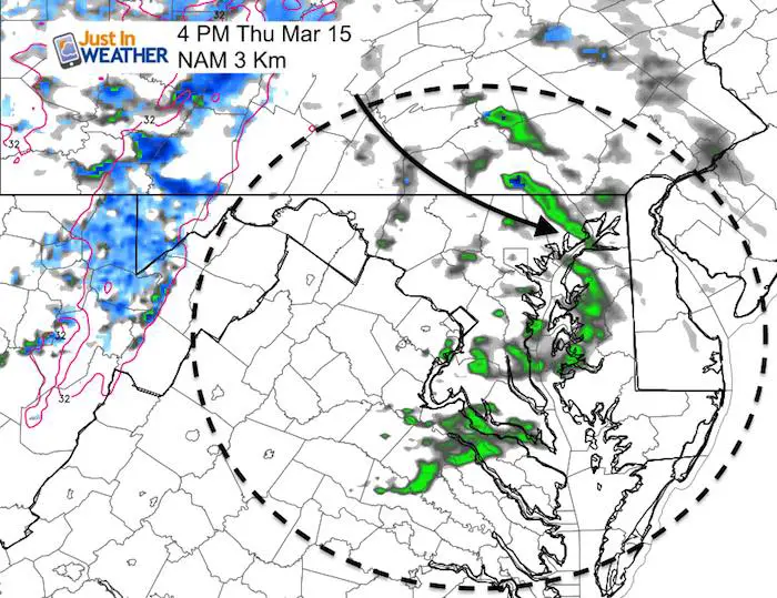
Thursday will bring rain or snow showers in the afternoon
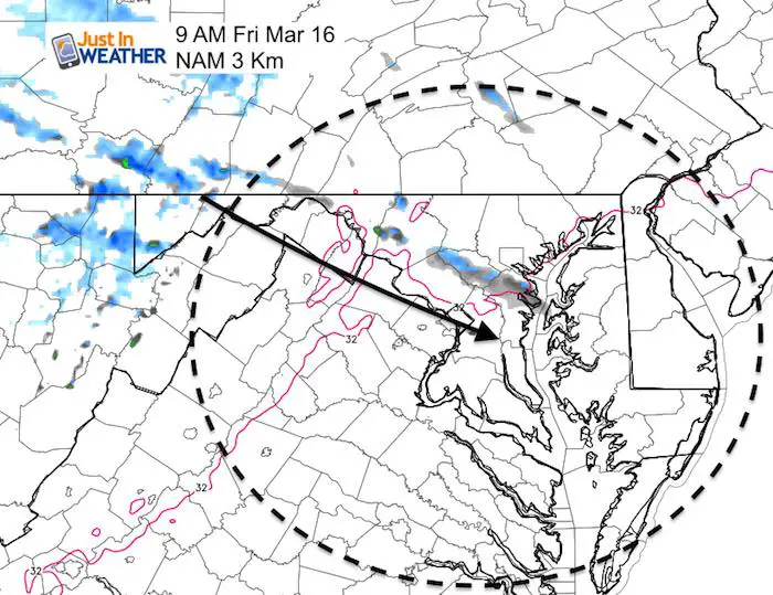
Friday morning may begin with a band of snow straight out of Lake Erie with a lot of upper level supper. This may cut across central Maryland.
Outlook Next Week
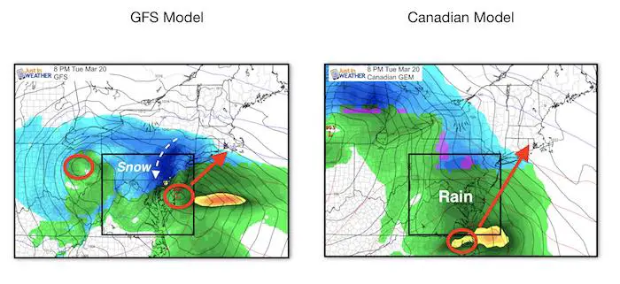
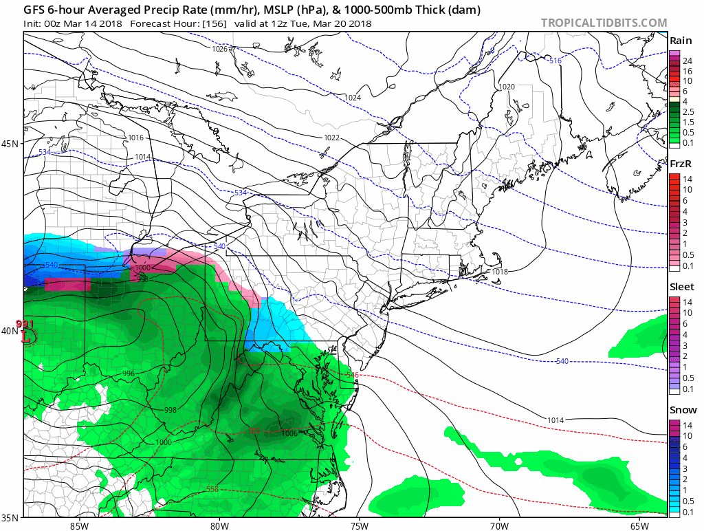
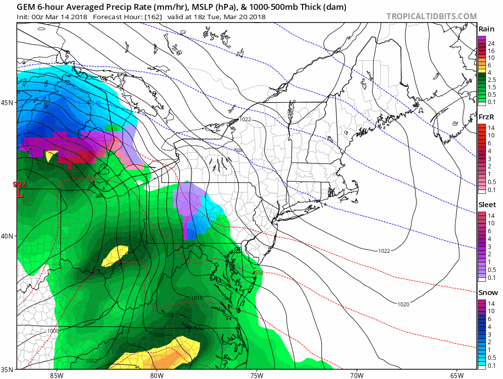
As I wrote in my prior report, it is too early to lock in on computer models and I didn’t want to talk about it so soon. But since the rumor mill was churning I needed to address it. Well, now the European and Canadian Model have that storm warmer pushing the snow to our north. The GFS Model is the hold out keeping us with a transition to snow Tuesday evening. Expect this to adjust so each day will show some change. But next Tuesday does look sloppy as Spring arrives. The purpose of showing the models at this point is to look for a trend or any consistency. I am not changing my plans yet.
Storm Animations
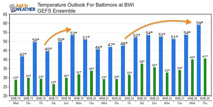
Temperature Outlook
Sunday keeps looking cooler with each run, but the winds should ease this weekend. After the next storm we should get into a return to reality.
Please share your thoughts, best weather pics/video, or just keep in touch via social media
-
Facebook: Justin Berk, Meteorologist
-
Twitter: @JustinWeather
-
Instagram: justinweather
Keep In Touch Every Day
Click here to sign up for email alerts…. Just in case you don’t get the post on your social media feed
FITF Items Will Close At The End Of This Week For The Season
It’s almost time for spring and a new line of items.

Snowstix- We Need You To Measure Snow Too
We are giving 10% of each sale to programs that benefit pediatric oncology patients.

 Get the award winning Kid Weather App I made with my oldest son and support our love for science, weather, and technology. Our 3 year anniversary of the release and our contribution to STEM education is this November. It has been downloaded in 60 countries, and works in both temperature scales. With your support we can expand on the fun introduction to science and real weather.
Keep In Touch Via Email
Click here to sign up for email alerts…. Just in case you don’t get the post on your social media feed
Also See:
My Winter Outlook 2017-2018 for more snow
La Nina Formed: What it could mean to our winter
NOAA Winter Outlook: Not The Best But Not The Worst For Snow
Two Farmers Almanacs Winter 2018 Outlooks
Winter Weather Folkore: Suggestions from Animals and Crops
First Frost and Freeze Dates For Maryland (southern PA and northern VA)
My Preliminary Winter Outlook Notes
Low Snow Winters In Baltimore: To Repeat Or Not Repeat
NOAA Ranks Blizzard 2016 4th Worst Snowstorm On Record
Blizzard 2016 Record Top Snowstorm: Area Totals
Extreme Weather of 2015 balanced out on both ends