
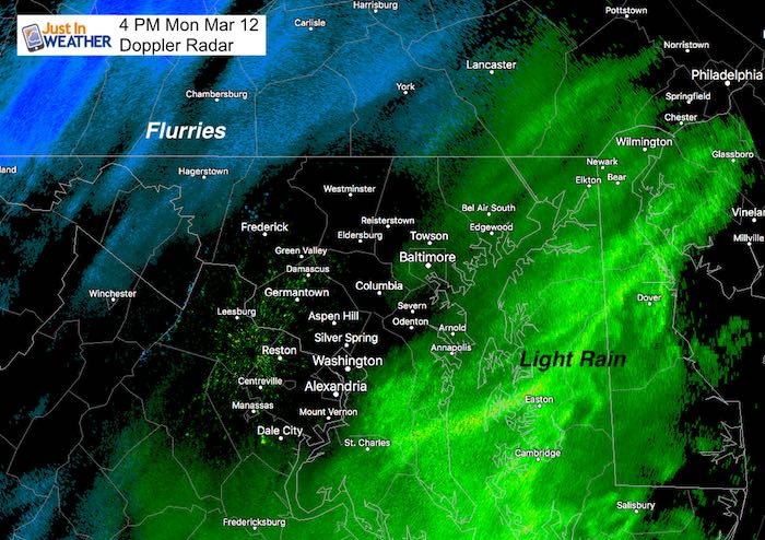
The coastal storm is taking form and looking at Doppler Radar it does appear to have some influence over our region. But, it is really light and a mix of flurries inland or rain around the southern Chesapeake Bay. There is actually more snow to the south in St. Mary’s County and towards Richmond VA. But temps are above freezing. Let’s be real here: This is going to be a powerful event, but not our storm. Again! Snow lovers who never lose Faith in the Flakes and even those that just want one last push of winter may be itching for some action. Well, let’s focus on some. There will be a band of snow open the very back edge of this storm developing tonight. I do not thing it will amount to much more than coating the grass in some spots and possibly some slush on a few side roads up north. Temperatures are just marginal and will get colder after this thing moves away.
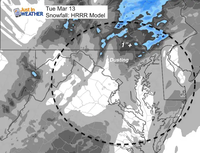
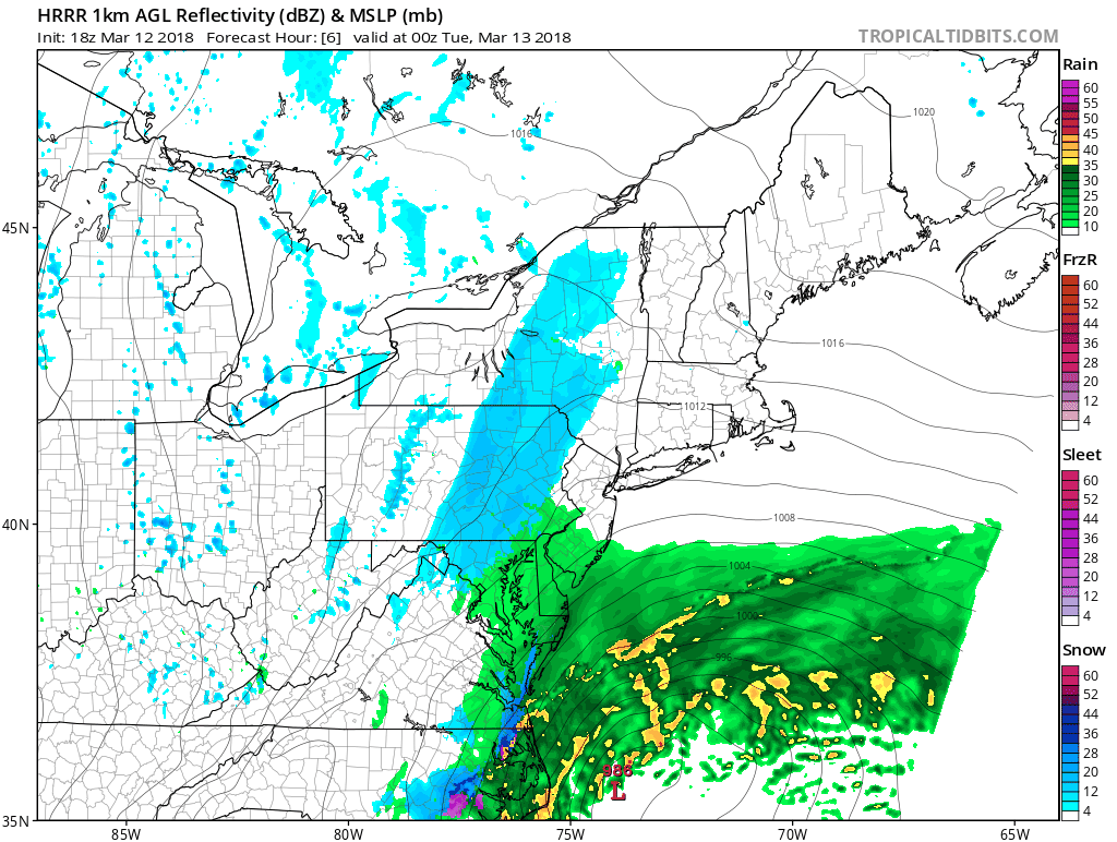
Here is a look at the radar simulation through Tuesday morning from the HRRR model. Please take this as just a guide as the best potential for something falling from the sky. Also see the temperatures below. While the suggested snow totals are here as well, that is a worse case scenario. FITF
Radar Simulation —> slider
See the regional animation at the bottom of the post. This shows where the harder hit areas in New England will be
[metaslider id=60119]
Snowfall Potential
How much can actually stick of this? Consider some melting and the road temps are still warmer than freezing.
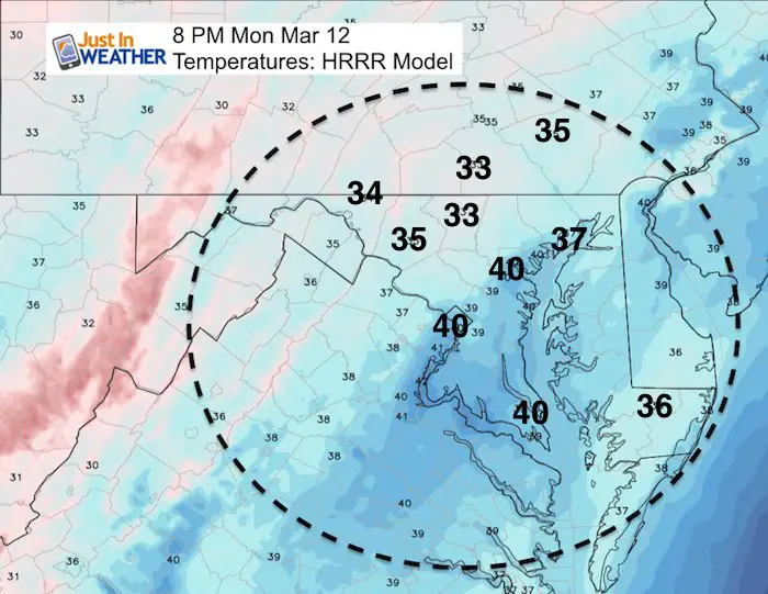
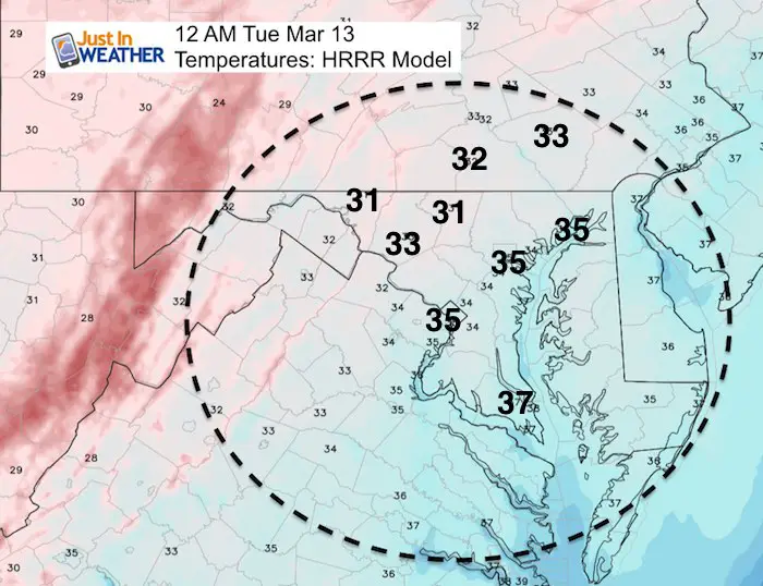
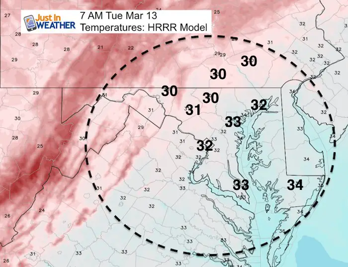
Temperatures
Evening snow and rain showers while temperatures stay above freezing
Midnight snow while temperatures just hit freezing far north/west
Morning temperatures show the normally colder areas with some possible icing if there is slush or snow nearby
Regional Animation From The HRRR Model
Please share your thoughts, best weather pics/video, or just keep in touch via social media
-
Facebook: Justin Berk, Meteorologist
-
Twitter: @JustinWeather
-
Instagram: justinweather
Keep In Touch Every Day
Click here to sign up for email alerts…. Just in case you don’t get the post on your social media feed
FITF Items Will Close At The End Of This Week For The Season
It’s almost time for spring and a new line of items.

Snowstix- We Need You To Measure Snow Too
We are giving 10% of each sale to programs that benefit pediatric oncology patients.

 Get the award winning Kid Weather App I made with my oldest son and support our love for science, weather, and technology. Our 3 year anniversary of the release and our contribution to STEM education is this November. It has been downloaded in 60 countries, and works in both temperature scales. With your support we can expand on the fun introduction to science and real weather.
Keep In Touch Via Email
Click here to sign up for email alerts…. Just in case you don’t get the post on your social media feed
Also See:
My Winter Outlook 2017-2018 for more snow
La Nina Formed: What it could mean to our winter
NOAA Winter Outlook: Not The Best But Not The Worst For Snow
Two Farmers Almanacs Winter 2018 Outlooks
Winter Weather Folkore: Suggestions from Animals and Crops
First Frost and Freeze Dates For Maryland (southern PA and northern VA)
My Preliminary Winter Outlook Notes
Low Snow Winters In Baltimore: To Repeat Or Not Repeat
NOAA Ranks Blizzard 2016 4th Worst Snowstorm On Record