Tuesday March 13 2018
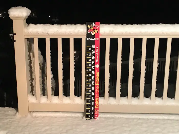
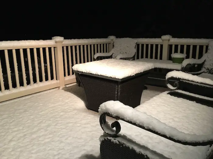
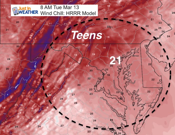
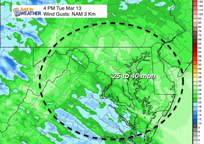
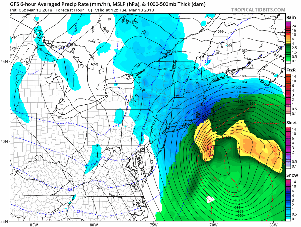
That band of snow overnight was persistent and dropped between 1 and 2 inches of snow north of Baltimore and across southern Pennsylvania. This made up for the missed snow last week, at least for teachers and kids with school delays in York County. Temperatures dropped into the 20s and wet roads iced up. The storm is departing now but the winds will be whipping to 40 mph. Wind restrictions are in effect in area bridges.
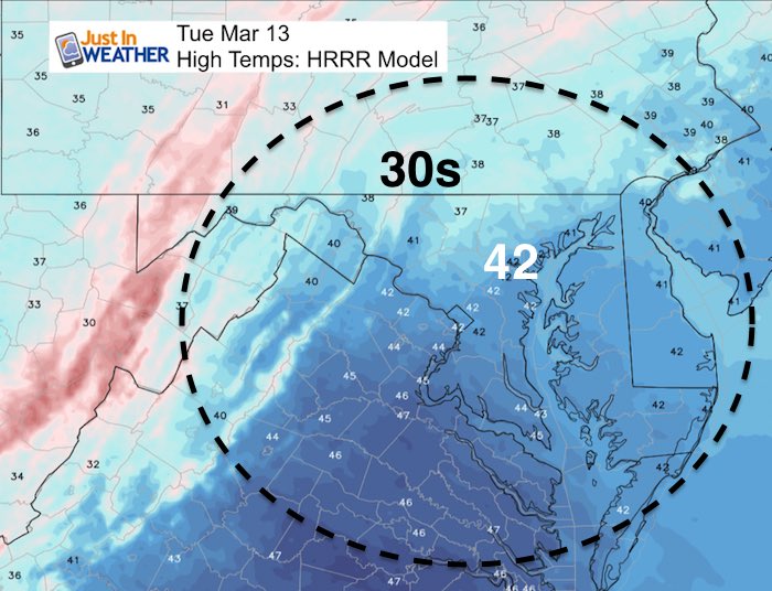
It will remain chilly all week and there may be more flurries or snow showers. Then we set out sights on a little warm up this weekend. The outlook however shows more cold trying to fight back over the next two weeks.
Stats For March 13
Average High: 53ºF
Record High: 85ºF in 1990
Average Low: 33ºF
Record Low: 12ºF in 1888
Snow Record: 11.3″ in 1993
Seasonal Snow To Date (at BWI): 10.5″
Sunrise: 7:21 AM
Sunset 7:11 PM
*Daylight = 2:34 longer than yesterday
*Bay Water Temperature = 41ºF at Thomas Pt. Light House
Keep In Touch Every Day
Click here to sign up for email alerts…. Just in case you don’t get the post on your social media feed
Morning Weather
Moderate to heavy snow continues from eastern Philadelphia to New York and New England.

Wind Chill
Afternoon

Rest Of This Week
Flurries or snow showers, especially north and northeast of Baltimore Wednesday and Thursday evenings
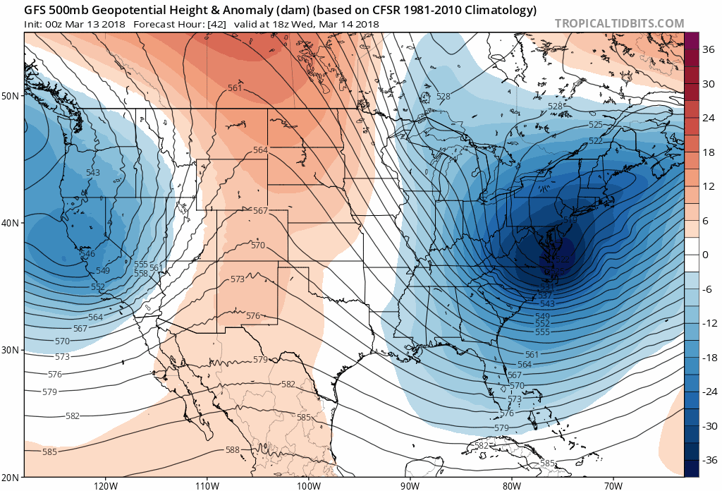
Outlook: Jet Stream
Temperature Outlook

Please share your thoughts, best weather pics/video, or just keep in touch via social media
-
Facebook: Justin Berk, Meteorologist
-
Twitter: @JustinWeather
-
Instagram: justinweather
Keep In Touch Every Day
Click here to sign up for email alerts…. Just in case you don’t get the post on your social media feed
FITF Items Will Close At The End Of This Week For The Season
It’s almost time for spring and a new line of items.

Snowstix- We Need You To Measure Snow Too
We are giving 10% of each sale to programs that benefit pediatric oncology patients.

 Get the award winning Kid Weather App I made with my oldest son and support our love for science, weather, and technology. Our 3 year anniversary of the release and our contribution to STEM education is this November. It has been downloaded in 60 countries, and works in both temperature scales. With your support we can expand on the fun introduction to science and real weather.
Keep In Touch Via Email
Click here to sign up for email alerts…. Just in case you don’t get the post on your social media feed
Also See:
My Winter Outlook 2017-2018 for more snow
La Nina Formed: What it could mean to our winter
NOAA Winter Outlook: Not The Best But Not The Worst For Snow
Two Farmers Almanacs Winter 2018 Outlooks
Winter Weather Folkore: Suggestions from Animals and Crops
First Frost and Freeze Dates For Maryland (southern PA and northern VA)
My Preliminary Winter Outlook Notes
Low Snow Winters In Baltimore: To Repeat Or Not Repeat
NOAA Ranks Blizzard 2016 4th Worst Snowstorm On Record