Saturday March 10 2018
8:30 AM
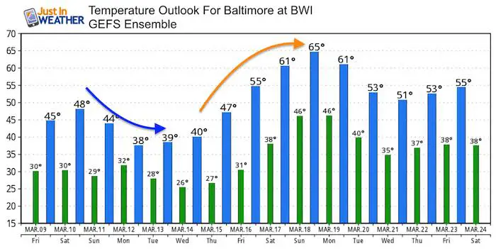
We definitely have a winter pattern in place and the amplitude of the jet stream is impressive. But I did not want to jump on the storm bandwagon and now it appears the strong jet stream will suppress the coastal event too far away. However, the net result will be colder air for us for a few days. So the first few days of daylight Saving Time may not allow us to appreciate the later daylight. Then a taste of the high amplitude ridge will reach us next weekend. The old adage of balance of average will show just in terms of temperatures. While we may be 10 to 15 degrees below average to start the weekend, we could be 10 to 15 degrees above average next weekend.
Stats For March 10
*Turn clocks forward 1 hour tonight/Change batteries in smoke detectors. I will have more info on Daylight Saving Time history in my next update
Average High: 52ºF
Record High: 80ºF in 2016
Average Low: 32ºF
Record Low: 11ºF in 1996
Snow Record: 8.0″ in 1892
Seasonal Snow To Date (at BWI): 10.5″
Sunrise: 6:25 AM
Sunset 6:08 PM
*Daylight = 2:34 longer than yesterday
*Bay Water Temperature = 41ºF at Thomas Pt. Light House
Keep In Touch Every Day
Click here to sign up for email alerts…. Just in case you don’t get the post on your social media feed
This Morning
Chilly but sunny
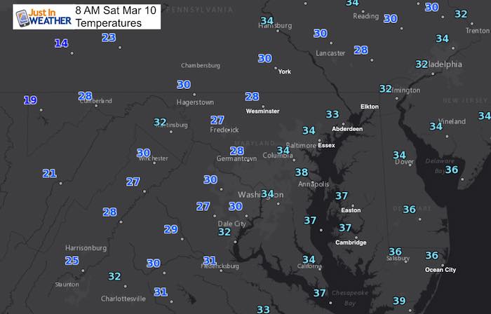
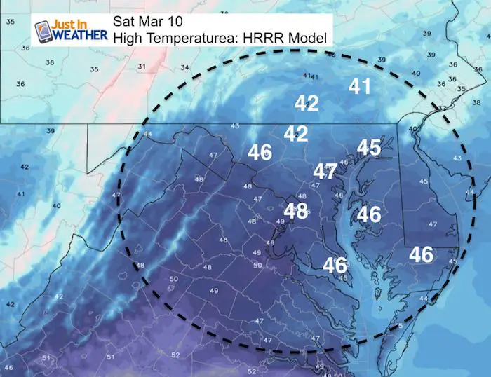
This Afternoon
Remaining cool but more sun than yesterday.
Outlook
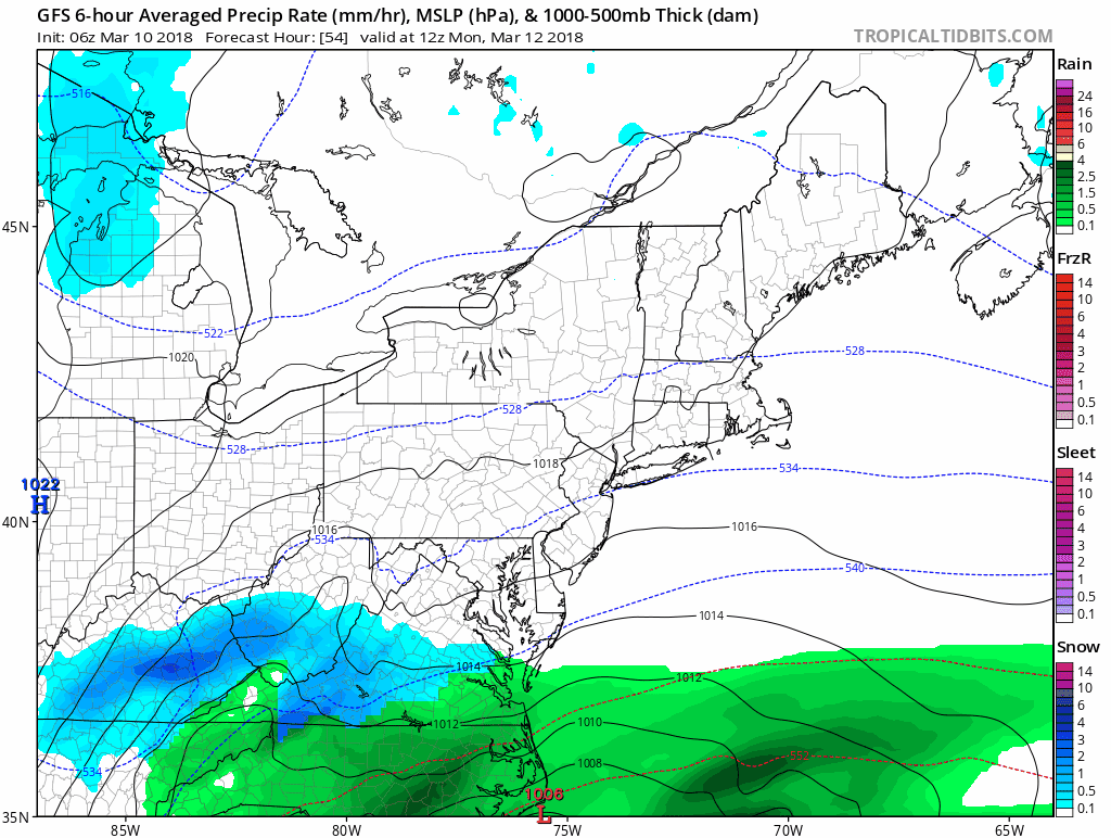
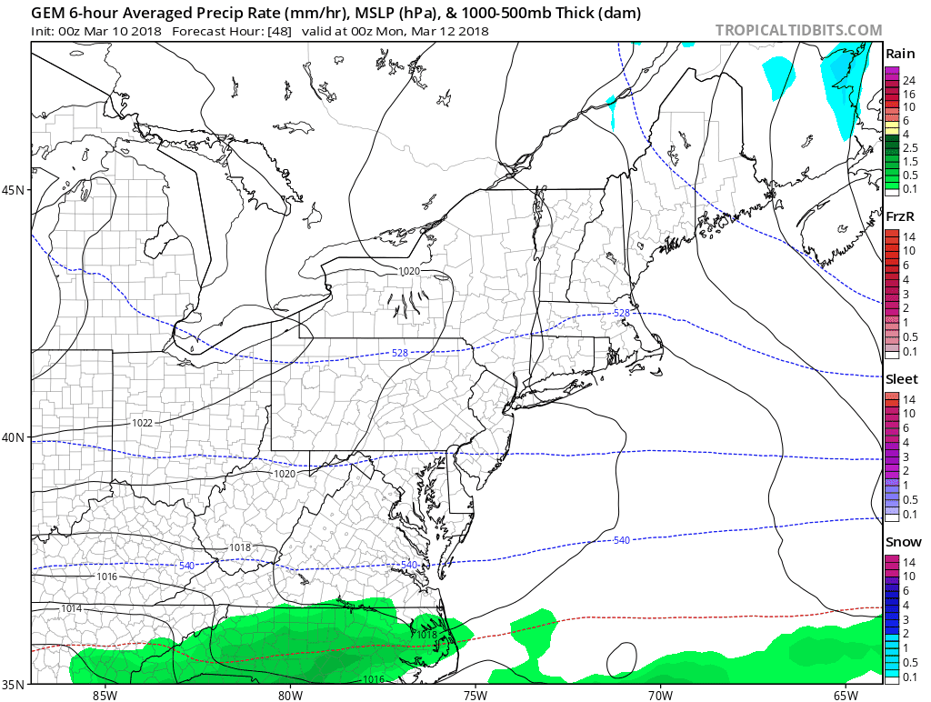
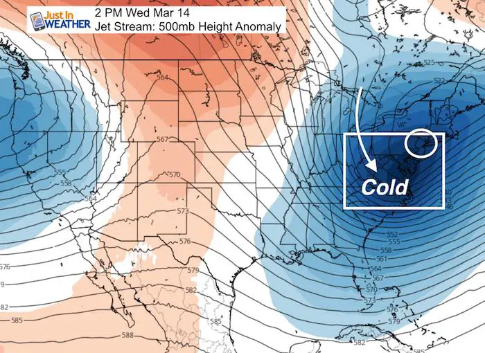
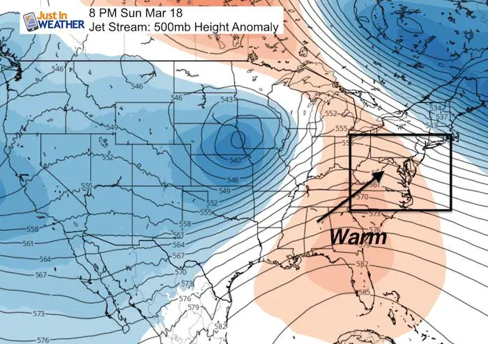
The storm I said was not worth getting excited over has more evidence now of staying south. The coastal storm will form, but too far south to produce much more than many light snow or rain on our southern sections. Baltimore and central Maryland/southern Pennsylvania misses this. But that Southern track reflects the stronger push of colder air for the first half of the week. Here are two model storm animations and the jet stream, which will flip to a warm weekend.
Storm Animations
GFS Model
Canadian Model
Jet Stream
Wednesday = Chilly
Sunday = Warmer
Temperature Outlook
Please share your thoughts, best weather pics/video, or just keep in touch via social media
-
Facebook: Justin Berk, Meteorologist
-
Twitter: @JustinWeather
-
Instagram: justinweather
Keep In Touch Every Day
Click here to sign up for email alerts…. Just in case you don’t get the post on your social media feed
FITF Items Will Close Next Week For The Season
It’s almost time for spring and a new line of items.

Snowstix- We Need You To Measure Snow Too
We are giving 10% of each sale to programs that benefit pediatric oncology patients.

 Get the award winning Kid Weather App I made with my oldest son and support our love for science, weather, and technology. Our 3 year anniversary of the release and our contribution to STEM education is this November. It has been downloaded in 60 countries, and works in both temperature scales. With your support we can expand on the fun introduction to science and real weather.
Keep In Touch Via Email
Click here to sign up for email alerts…. Just in case you don’t get the post on your social media feed
Also See:
My Winter Outlook 2017-2018 for more snow
La Nina Formed: What it could mean to our winter
NOAA Winter Outlook: Not The Best But Not The Worst For Snow
Two Farmers Almanacs Winter 2018 Outlooks
Winter Weather Folkore: Suggestions from Animals and Crops
First Frost and Freeze Dates For Maryland (southern PA and northern VA)
My Preliminary Winter Outlook Notes
Low Snow Winters In Baltimore: To Repeat Or Not Repeat
NOAA Ranks Blizzard 2016 4th Worst Snowstorm On Record