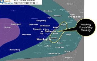
My First Call For Snowfall And Model Maps Wednesday To Friday
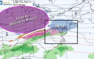
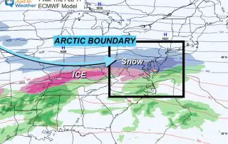
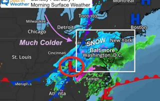
February 9 2021 The arctic air we’ve been talking about has made a move into the central US and will be the driving force for a few impulses of snow
February 9 2021 The arctic air we’ve been talking about has made a move into the central US and will be the driving force for a few impulses of snow
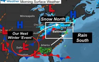
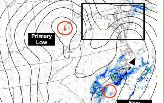
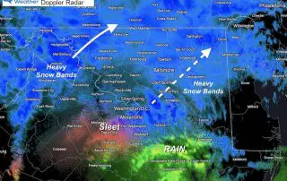
Tuesday Morning February 9 2021 This morning we had a squeeze play between a band of snow passing through Harrisburg PA and rain in southern Maryland creeping north. This played
Monday February 8 2021 - Afternoon Update The cold air in place today is just a taste of what is on the way. This is going to be an active
Monday February 8 2021 This morning our temperatures are frigid as we catch a breather between weather systems. This will be a very active week with multiple weather systems and
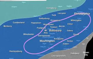
Sunday February 7 2021 Snow and rain began earlier this morning as expected, with temperatures above freezing as expected. Our region remains under either a Winter Storm Warning or Winter
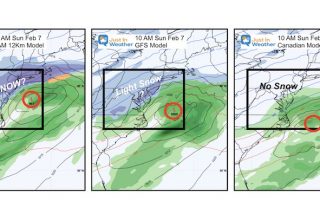
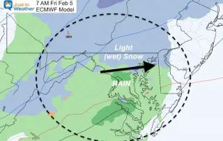
Friday February 5 2021 We can expect a quick ‘Thumping’ of snow on Sunday. It should be a quick hit of moderate snow that will begin before sunrise and end
Thursday February 4 2021 There are two weather systems to watch over the next from days, then the arctic arrival next week. The first system will be Friday morning.
Thursday February 4 This is the first day of the week with no snow or ice falling from the sky. After a cold start, it should feel better with sunshine
Sunday January 31 2021 At 9 PM Baltimore’s BWI is still reporting snow. This leftover snow has been light but it is important because it does not fit with what
Sunday January 31 at 5 PM After what many have deemed a slow start this morning, snow has evolved and expanded this afternoon. It may have seemed light, but most