Mild Tuesday Then Snow Outlook Thursday And Friday
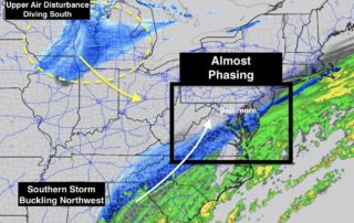
Monday December 11 The clipper system racing across the northern Plains and Great Lakes looks impressive on satellite. This has expanded the snow region and something I mentioned last night
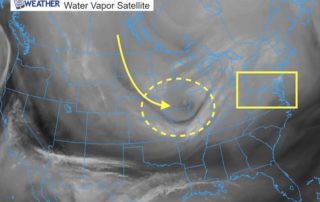
Monday December 11 The clipper system racing across the northern Plains and Great Lakes looks impressive on satellite. This has expanded the snow region and something I mentioned last night
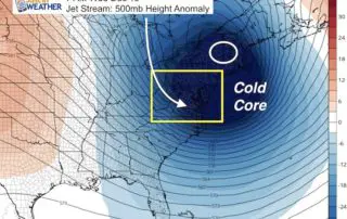
December 11 2017 We had some flurries overnight that you may have slept through, but it shows the atmosphere is ready. There next event will be more of a wintry
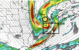
Sunday December 10 As if we haven't had enough of our fill of snow with Saturday's event, well... we didn't. Yes that one system matched or surpassed all of last
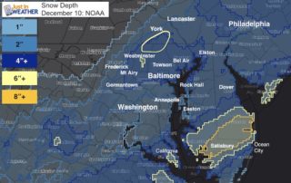
December 10 2017 Our first snow storm of the season on December 9 had a slow start, but a strong finish. Here is a compilation of the snow reports around
12:20 PM Saturday December 9 The storm is now doing what it was supposed to do and we are getting some adjustments to the advisories and warnings from the National
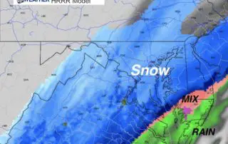
Saturday December 9 Blame it on the dry slot but I will take the heat. The arrival of the snow did not happen overnight as I forecasted. But the storm
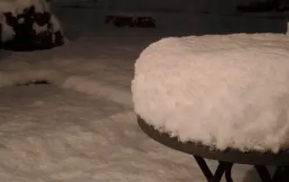
10 PM Friday December 2017 Already an over achiever! This photo from Salisbury at 9 PM already looks like over 6 inches of snow fell. Leslie Donnelly might in the
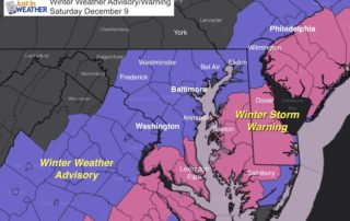
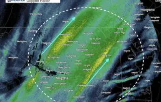
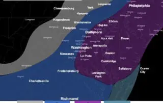
Friday December 8 The upgrade to a Winter Storm Warning in Southern Maryland and on the Delmarva is actually expected. What it does however is highlight the heaviest snow band
Friday December 8 The new computer models are confirming what I wrote in my prior post. The storm does appear to be over achieving. It already has done so to
9:30 AM Friday December 8 The snow on the way today and tomorrow is part of a very large storm that has over achieved. We have a Winter Weather Advisories