December 11 2017
We had some flurries overnight that you may have slept through, but it shows the atmosphere is ready. There next event will be more of a wintry mix, and then followed by truly arctic air Wednesday morning. The jet stream remains very active and the potential storms farther out in time show promise but nothing too organized to show for now. Let’s take a look.
Stats For December 11
Normal High: 46ºF
Record High: 69ºF in 1979
Normal Low: 29ºF
Record Low: 9ºF in 1968
Snow Record: 9.3″ in 1960
Sunrise: 7:16 AM
Sunset 4:44 PM
*Bay Water Temperature = 48ºF at Thomas Pt Light House
Click here to see: The December 9 Snow Report
Keep In Touch All Winter
Click here to sign up for email alerts…. Just in case you don’t get the post on your social media feed
Today
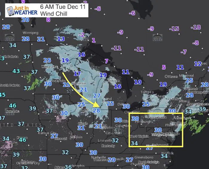
This be a quiet day with highs for us in the mid 40s. We are watching this quick moving system just entering the Great Lakes and it will be the source of very frigid air that reaches us Wednesday morning. The question I posed last night was how it will track, and I suspect it may dive a little father south and east. That is why it may have a more of an impact on us that shown on the models.
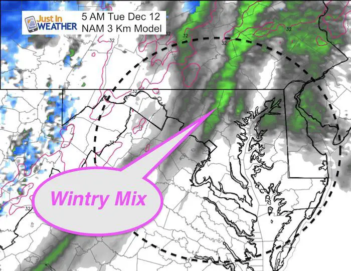
Tuesday
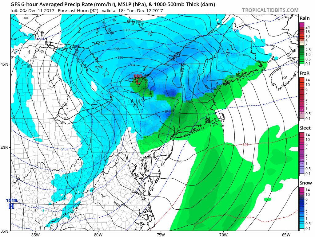
The morning hours may bring a wintry mix which is still not being shown well on the models. If snow arrives, it will be light. The worst set up would be sleet or freezing rain. That is worth close attention. The timing to pay attention to will be between 4 AM and 8 AM. This is the early drive time, but also when road temperatures will be coldest. Should the wait until later, then most of the commute will be over and the roads will be warmer. This is going to be one to watch hour by hour early that morning.
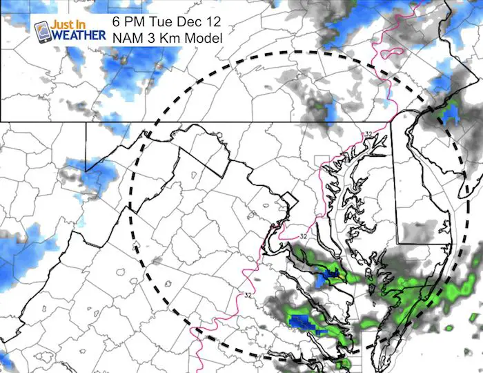
The evening will bring in some snow showers. Especially north of Baltimore. No accumulation expected.
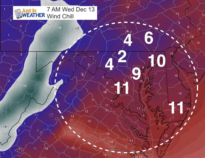
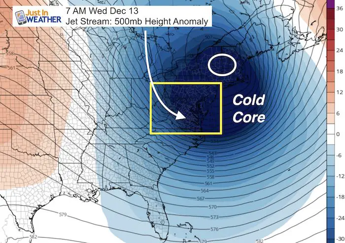
Wednesday: Arctic Arrival
The wind chills will be in the single digits
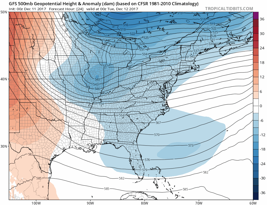
Jet Stream: Core Core Wednesday
Jet Stream Animation
Faith in the Flakes Online Store
PJ bottoms still inside out- They have to be to help bring on the snow.

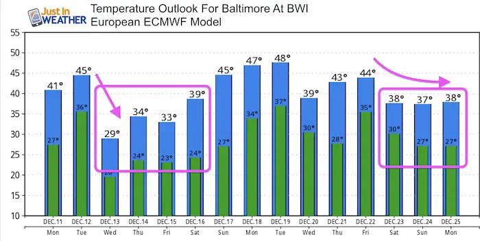
Temperature Outlook
Active Weather Pattern
I still do not trust the modeling, but here is a look at the active track and systems that could bring us another snow event but the weekend.
Snowstix- We Need You To Measure Snow Too
We are giving 10% of each sale to programs that benefit pediatric oncology patients.

 Get the award winning Kid Weather App I made with my oldest son and support our love for science, weather, and technology. Our 3 year anniversary of the release and our contribution to STEM education is this November. It has been downloaded in 60 countries, and works in both temperature scales. With your support we can expand on the fun introduction to science and real weather.
Please share your thoughts, best weather pics/video, or just keep in touch via social media
-
Facebook: Justin Berk, Meteorologist
-
Twitter: @JustinWeather
-
Instagram: justinweather
Also See:
My Winter Outlook 2017-2018 for more snow
La Nina Formed: What it could mean to our winter
NOAA Winter Outlook: Not The Best But Not The Worst For Snow
Two Farmers Almanacs Winter 2018 Outlooks
Winter Weather Folkore: Suggestions from Animals and Crops
First Frost and Freeze Dates For Maryland (southern PA and northern VA)
My Preliminary Winter Outlook Notes
Low Snow Winters In Baltimore: To Repeat Or Not Repeat
NOAA Ranks Blizzard 2016 4th Worst Snowstorm On Record