Showers Today But Less Wind Then Potential Wintry Mess Moving In
Saturday March 17 2018 St. Patricks Day brings a lot of green on the local radar screen. A jet streak is targeting a narrow band of moisture right towards Baltimore
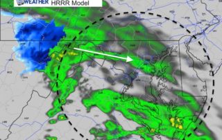
Saturday March 17 2018 St. Patricks Day brings a lot of green on the local radar screen. A jet streak is targeting a narrow band of moisture right towards Baltimore
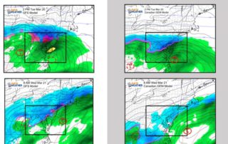
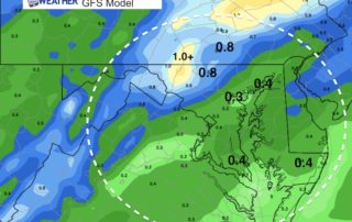
Friday March 16 2018 This updated outlook for the 4th consecutive Nor'easter expected on March 20 and 21 is purely to show the latest modeling. I have been reluctant to
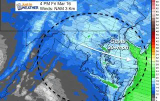
Friday March 16 2018 6:20 AM There are some flurries on Doppler Radar as another push of strong winds is holding the cold air in place. High temperatures today are

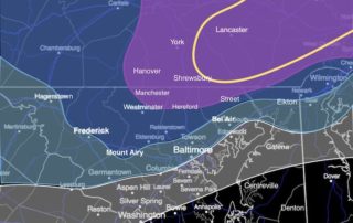
Thursday March 15 2018 Beware the ides of March they say. Well, I realize that this storm is not going away and will require some more attention. This article's title
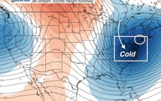
Saturday March 10 2018 8:30 AM We definitely have a winter pattern in place and the amplitude of the jet stream is impressive. But I did not want to jump
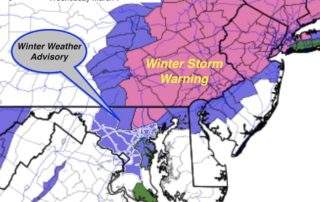
The National Weather Service has finally jumped on the snow bandwagon and upgraded the alerts for this storm. A Winter Storm Warning is now in place for northern Baltimore and
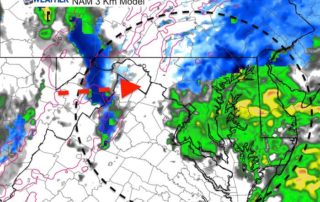
10 PM Tuesday March 6 2018 Doppler radar has shown the steady shield of snow and rain spreading across our area this evening and tonight. I understand the critics of
Tuesday March 6 2018 A few showers have spread across the area already mid afternoon. You may have seen flurries, sleet, or graupel mixed in. Temperatures have reached the middle
Monday January 22 2018 We are on the warm side of the storm track and will get warm air surging in ahead of rain. Most of today will be dry,
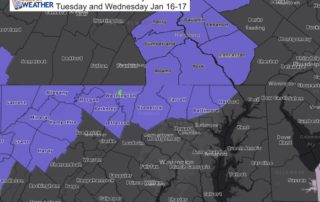
Monday Jan 15 2018 A Winter Weather Advisory has been issued for our region for snow Tuesday and Wednesday. It is going to snow Tuesday and early Wednesday this week