 Saturday March 17 2018
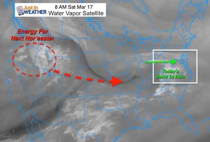
St. Patricks Day brings a lot of green on the local radar screen. A jet streak is targeting a narrow band of moisture right towards Baltimore with snowing the mountains and rain across central Maryland. Perhaps cupids arrow is trying to join Cinderella pointing directly at UMBC. This will be just a nuisance event for part of our area. See the radar simulation below. The other system is just entering the west coast now and is expected to race across the US and reach us by Tuesday. There is some agreement and one big model abandoning the storm for us.
Now that we are within 72 hours, I will start to show some snow projections. I still DO NOT trust them since we need to factor in the timing of the day to battle the high solar angle and temps for compaction and melting. My first call for snowfall will be presented tomorrow.
Stats For March 17
Trivia: Today we get over the hump with more daylight than darkness (by 1 minute). This is before the equinox due to sunlight bending around the horizon and extending the daylight long than actually have the sun face us.
Average High: 54ºF
Record High: 85ºF in 1945
Average Low: 34ºF
Record Low: 15ºF in 1900
Snow Record: 5.0″ in 1931
Seasonal Snow To Date (at BWI): 10.5″
Sunrise: 7:14 AM
Sunset 7:15 PM
*Daylight = 2:35 longer than yesterday
*Bay Water Temperature = 41ºF at Thomas Pt. Light House
Keep In Touch Every Day
Click here to sign up for email alerts…. Just in case you don’t get the post on your social media feed
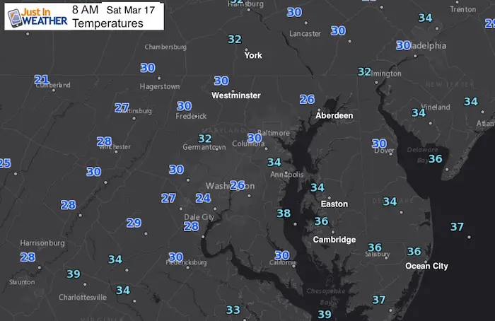
This Morning
Today
The good news is that there will be less wind today. The down side is that there will be a narrow band of rain across central Maryland.
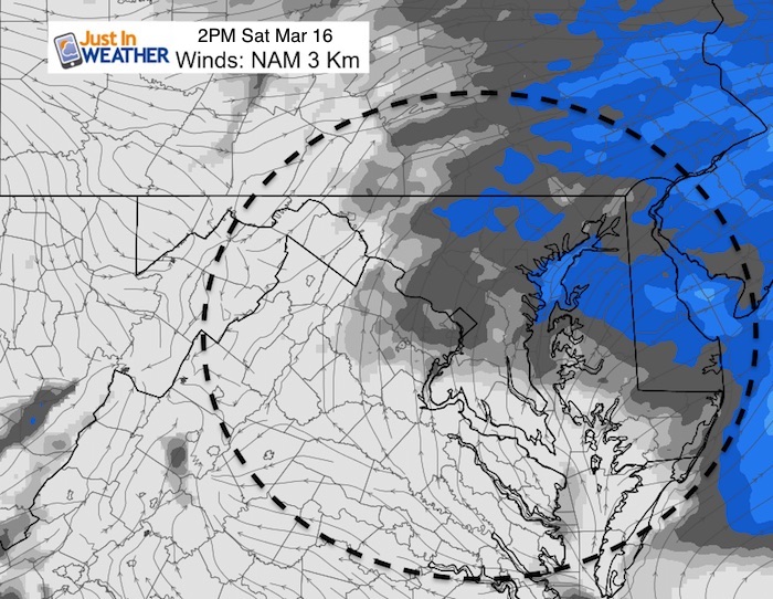
Wind
The blue shade is 10 to 15 mph
Simulated Radar —> slider
[metaslider id=60244]
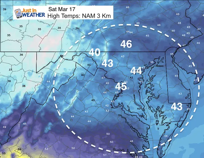
High Temperatures
Still cooler than average
Storm Outlook
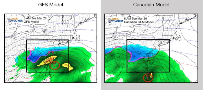
The GFS and Canadian Models have been somewhat consistent with this storm but now speeds this back up to impact Tuesday morning. I need to add in that when you see snow ‘during the day’ on Tuesday that is not beneficial to stickage and accumulation. If you want snow to pile up in late March, you should root for it to fall at night. There can be some accumulation during the day but it needs a base on the ground and heavy intensity.
For the record, the European Model that was showing the most snow for our region is still showing snow but extends it farther south keeping our region on the northern edge.
Storm Animations
These are slowed down for you to view earlier…
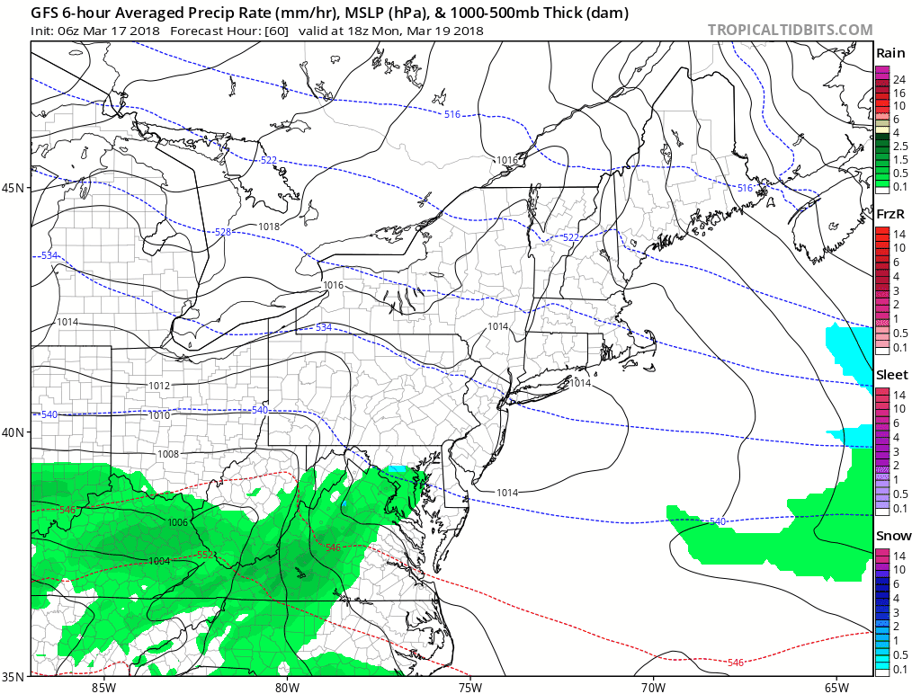
GFS Model
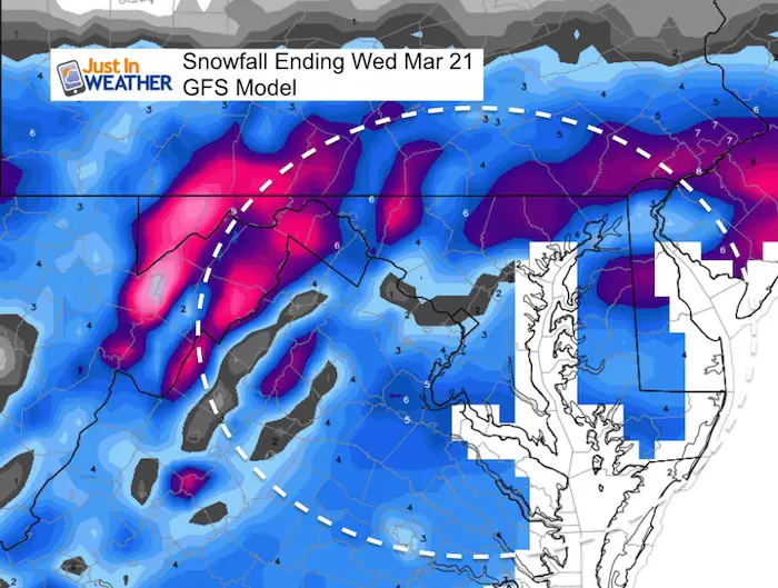
Potential Snowfall
This product erases the snow around the bay. Just a glitch in the display.
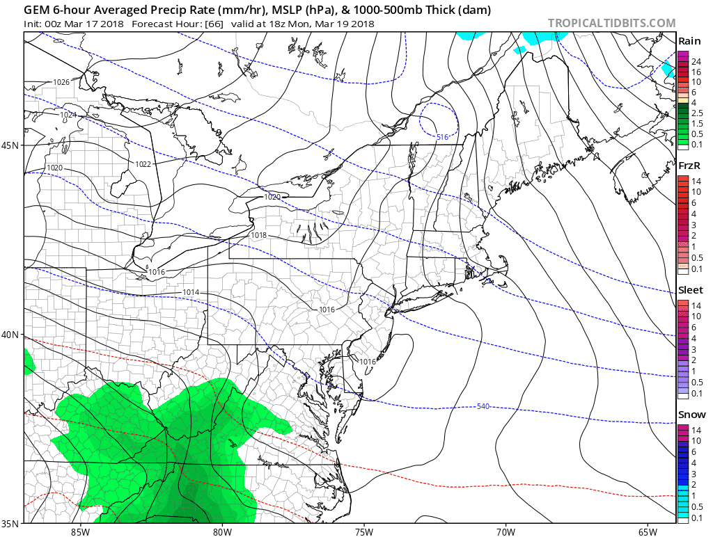
Canadian GEM
Potential Snowfall
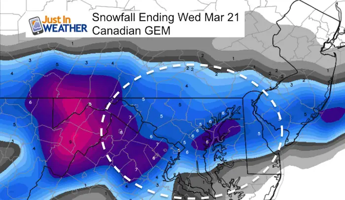
Note: These are NOT my snow forecast. I will show more in my evening post and my first call for snowfall tomorrow morning.
Please share your thoughts, best weather pics/video, or just keep in touch via social media
-
Facebook: Justin Berk, Meteorologist
-
Twitter: @JustinWeather
-
Instagram: justinweather
Keep In Touch Every Day
Click here to sign up for email alerts…. Just in case you don’t get the post on your social media feed
FITF Items Will Close At The End Of This Week For The Season
It’s almost time for spring and a new line of items.

Snowstix- We Need You To Measure Snow Too
We are giving 10% of each sale to programs that benefit pediatric oncology patients.

 Get the award winning Kid Weather App I made with my oldest son and support our love for science, weather, and technology. Our 3 year anniversary of the release and our contribution to STEM education is this November. It has been downloaded in 60 countries, and works in both temperature scales. With your support we can expand on the fun introduction to science and real weather.
Keep In Touch Via Email
Click here to sign up for email alerts…. Just in case you don’t get the post on your social media feed
Also See:
My Winter Outlook 2017-2018 for more snow
La Nina Formed: What it could mean to our winter
NOAA Winter Outlook: Not The Best But Not The Worst For Snow
Two Farmers Almanacs Winter 2018 Outlooks
Winter Weather Folkore: Suggestions from Animals and Crops
First Frost and Freeze Dates For Maryland (southern PA and northern VA)
My Preliminary Winter Outlook Notes
Low Snow Winters In Baltimore: To Repeat Or Not Repeat
NOAA Ranks Blizzard 2016 4th Worst Snowstorm On Record