Increased Snow: Winter Storm Warning Expanded In Maryland
Wednesday February 10 2021 In my last report in showed a new Snow Map where I increased my forecast in parts of north central Maryland to push the 6 inch
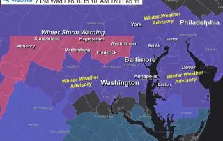
Wednesday February 10 2021 In my last report in showed a new Snow Map where I increased my forecast in parts of north central Maryland to push the 6 inch
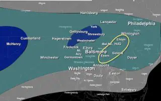
Wednesday February 10 Afternoon Update Tonight will be the start of our very active weather pattern. Now that the first system is on our doorstep, it is coming into focus.
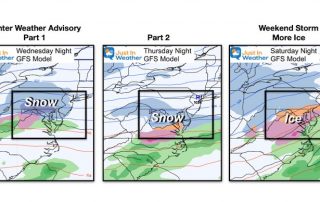
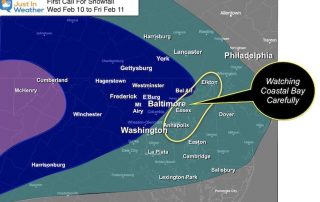
February 10 2021 We have a very busy stretch of weather starting tonight and going to the weekend. It does look like we are in a pattern for quick movers,
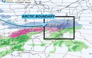
February 9 2021 The arctic air we’ve been talking about has made a move into the central US and will be the driving force for a few impulses of snow
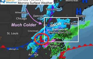
Tuesday Morning we will watch a developing system to our north and south. Our region is caught in the middle as they ‘almost phase’. The net result could be some
Monday February 8 2021 This morning our temperatures are frigid as we catch a breather between weather systems. This will be a very active week with multiple weather systems and

Sunday February 7 2021 at 9:45 AM I know there were doubters, but the snow has taken over for most of our region. The transition may have been an hour
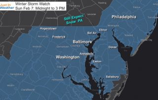
Sunday February 7 2021 Snow and rain began earlier this morning as expected, with temperatures above freezing as expected. Our region remains under either a Winter Storm Warning or Winter
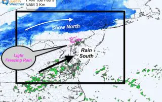
Friday February 5 Evening Update This is a follow up to my earlier forecast for Sunday snowfall. New updates include a look at the European and NAM KM model animation.
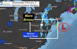
Wednesday February 3 2021 A narrow band of snow was falling across Frederick County MD to the west side of Washington and south into Virginia. This was influence by snow