4th Noreaster Outlook 3 Days Away Snow At Night Determines Totals
Saturday March 17 2018 The energy for this next Nor'easter is completed in the grid now. That means it is over the continental US, so wee have more complete date

Saturday March 17 2018 The energy for this next Nor'easter is completed in the grid now. That means it is over the continental US, so wee have more complete date
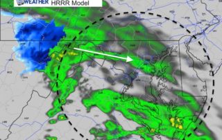
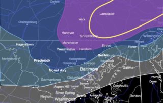
Saturday March 17 2018 St. Patricks Day brings a lot of green on the local radar screen. A jet streak is targeting a narrow band of moisture right towards Baltimore
Thursday March 15 2018 Beware the ides of March... The wind will be less intense today and temperatures will be close to average. But we are still under the influence
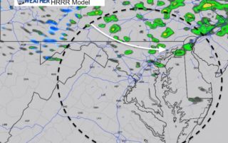
March 12 2018 4:20 PM The coastal storm is taking form and looking at Doppler Radar it does appear to have some influence over our region. But, it is really

Monday March 12 2018 6 AM This is just NOT our storm. I wanted to get through the weekend with a break from the storm chat but with area roads
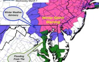
Wednesday March 7 2018 A Winter Storm Warning was expanded to include all of Harford County. A Winter Weather Advisory continues in central Maryland where this snow is over achieving.
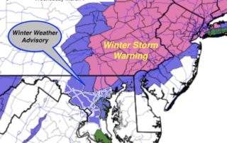
The National Weather Service has finally jumped on the snow bandwagon and upgraded the alerts for this storm. A Winter Storm Warning is now in place for northern Baltimore and
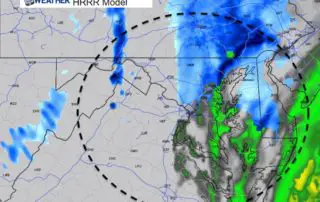
10 PM Tuesday March 6 2018 Doppler radar has shown the steady shield of snow and rain spreading across our area this evening and tonight. I understand the critics of
Tuesday March 6 2018 A few showers have spread across the area already mid afternoon. You may have seen flurries, sleet, or graupel mixed in. Temperatures have reached the middle
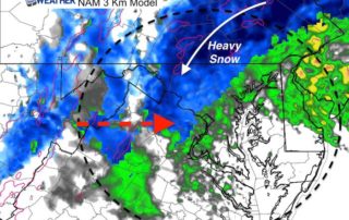
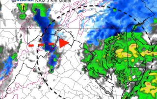
Tuesday March 6 2018 The morning run of the NAM 3 Km Model has put the sweet spot of the heavy snow a little west. This includes more of our