High Wind Warning Expanded North: Rain and Snow Timeline
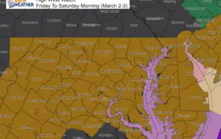
March 1 2018 Today is the first day of meteorological spring and we have a very strong storm developing. Perhaps the full moon is also helping to enhance the pull
March 1 2018 Today is the first day of meteorological spring and we have a very strong storm developing. Perhaps the full moon is also helping to enhance the pull
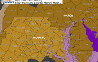
Wednesday February 28 2018 A High Wind Watch will go into effect for primary Friday and into Saturday morning as a very strong storm moves off of the east coast.

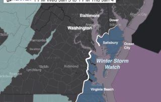
10 PM Wed January 3 2018 The snow appears to be here already on Doppler Radar. There may be some virga so that not all is reaching the ground. The

January 3 2018 The storm is just forming this morning and already producing freezing rain down to Jacksonville, FL. Today we will watch it develop and track out way with
January 2 2018 The return back to work and school comes with bitter cold air and a super moon. The moon was 221,584 miles away, compared to the average of

Monday January 1 2018 This evening post is just a quick note to highlight how cold it will be in the morning as we still have about a week left
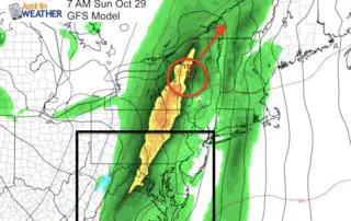
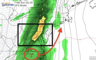
Saturday October 28 There is a distinct line of rain this morning from the Great Lakes to the Gulf Coast. The back side shows a band of snow around Indianapolis
Friday October 27 Widespread 30s this morning has expanded the frost across a large area. If you park your car outside in areas (away from the Bay), you might want
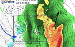
Wednesday October 25 A strong cold front moved through yesterday but we had another 70 degree day. Say goodbye to that for a while. Today will be close to 'normal'
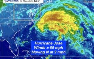
Monday September 18 Today is when the tropical coverage and local weather cross paths. Some morning fog will burn off and give way to another warm later summer day with