 Friday October 27
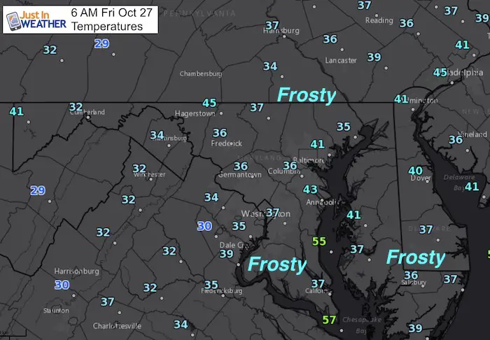
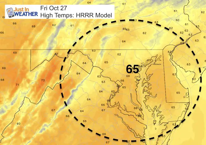
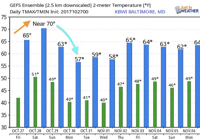
Widespread 30s this morning has expanded the frost across a large area. If you park your car outside in areas (away from the Bay), you might want to allow a few minutes to scrape. This goes beyond the normally colder spots to include southern Maryland and much of Delmarva. Temps will recover to the mid 60s today and perhaps near 70ºF Saturday. Saturday will be the best outdoors day, but showers will be arriving from the west in the late afternoon and evening. The next storm will get a tropical infusion and a few waves of low pressure to bring heavy rain. Sunday will be a soaker with the heaviest rain in the morning. But strong winds will drop the temperatures in the afternoon. Then we can look to western Maryland and West Virginia for possible snow into Monday morning. The chilly pattern will last through a dry Halloween.
Weather maps are below
Stats For October 27
Check out the record temperatures only 1 year apart.
Normal High: 63ºF
Record High: 82ºF in 1963
Normal Low: 42ºF
Record Low: 29ºF in 1988; 1962
Sunrise: 7:28 AM
Sunset 6:13 PM
Keep In Touch All Winter: Sign up for email updates on new posts
Since you may miss some posts via social media, click here for email alerts as a way to make sure you don’t miss any. *You may have to refresh that page once for your browser to clear out the images.
Warming Up Today
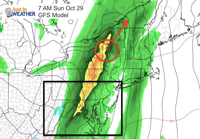
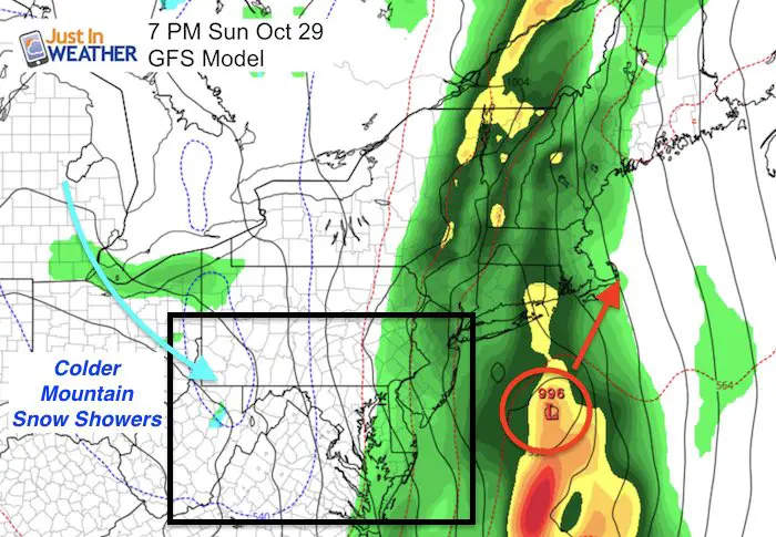
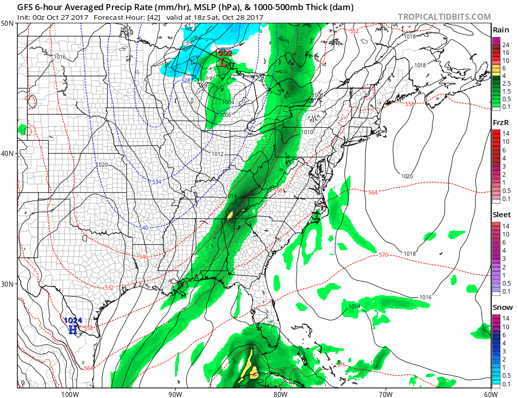
Weekend Storm
The leading edge of showers might arrive late Saturday, but Sunday will be our stormy day. These snapshots show the two waves of Low Pressure along the front. As I suggested in my winter outlook, this pattern is falling into line:
Sunday Morning: Low Pressure ridges to our west and north keeping us on the warm side
Sunday Evening: Coastal Storm will be far to the east. Heavy coastal rain while strong winds will develop as the back edge of the rain passes through central Maryland/PA. Snow showers will develop in western Maryland and WV. There could be over 1 inch of stickage by Monday morning. No snow east of the mountains.
Storm Animation:
Notice the connection to the Gulf of Mexico and tropical Atlantic feeding moisture into the front
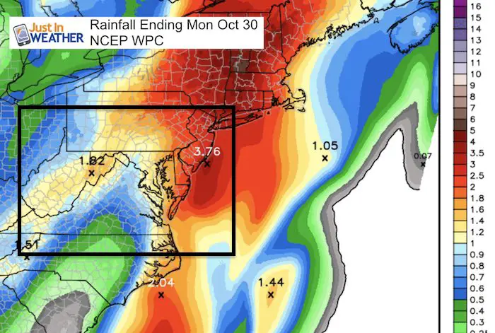
Rainfall Total
A widespread 1 inch rainfall is expected. Heavier rain of 2 inches or more on the Eastern Shore and up into metro Philadelphia and the Poconos.
Outlook
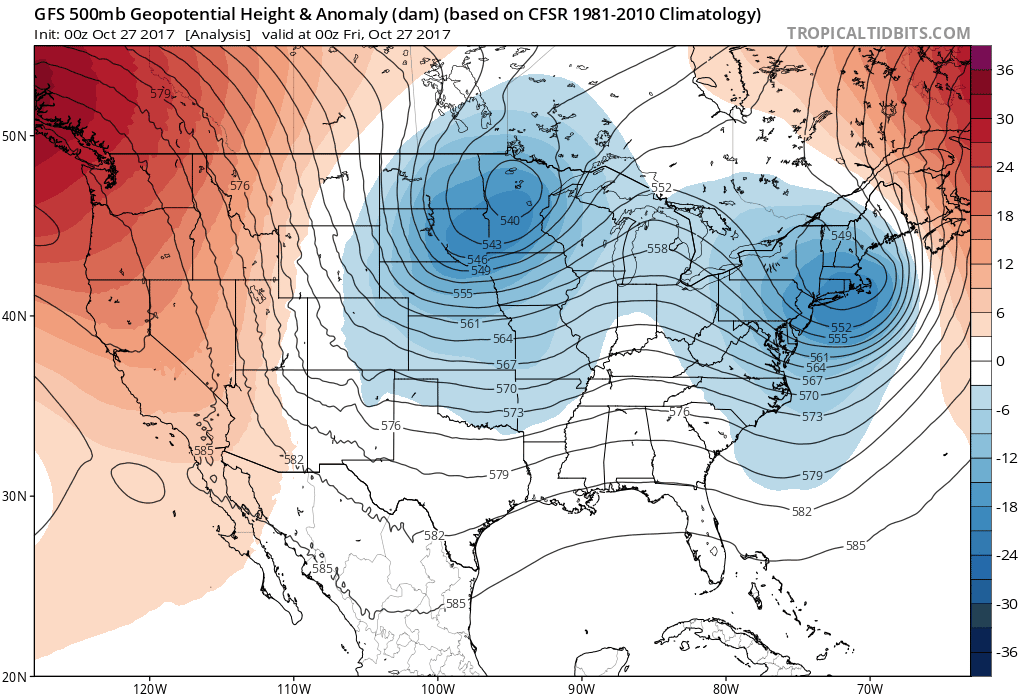
The jet stream shows the colder air (in blue) lasting through Halloween, then we get back to a slightly milder pattern for the start of November.
Temperatures
Winter Stuff
NOAA Winter Outlook: Not The Best But Not The Worst For Snow
Two Farmers Almanacs Winter 2018 Outlooks
My Preliminary Winter Outlook Notes
First Frost and Freeze Dates For Maryland (southern PA and northern VA)
NOAA Ranks Blizzard 2016 4th Worst Snowstorm On Record
Extreme Weather of 2015 balanced out on both ends
 Get the award winning Kid Weather App I made with my oldest son and support our love for science, weather, and technology. Our 3 year anniversary of the release and our contribution to STEM education is this November. It has been downloaded in 60 countries, and works in both temperature scales. With your support we can expand on the fun introduction to science and real weather.
Please share your thoughts, best weather pics/video, or just keep in touch via social media
-
Facebook: Justin Berk, Meteorologist
-
Twitter: @JustinWeather
-
Instagram: justinweather