Hey Rain And Fog This Morning: Timeline And Warming Up
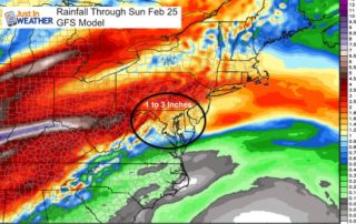
Sunday February 25 2018 Do you remember that severe drought we were in? I think its safe to say it is pretty much over. We have had plenty of rain
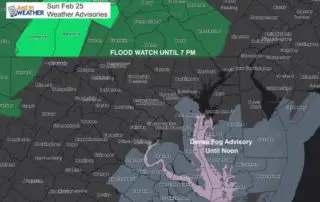
Sunday February 25 2018 Do you remember that severe drought we were in? I think its safe to say it is pretty much over. We have had plenty of rain
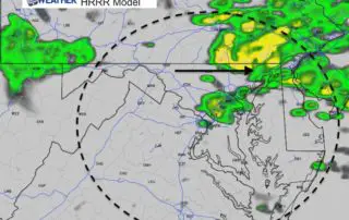
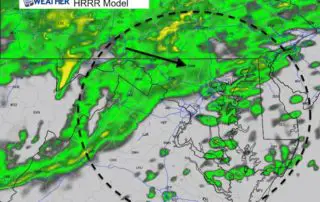
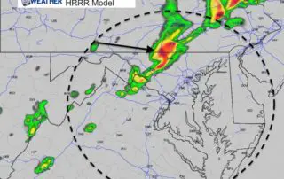
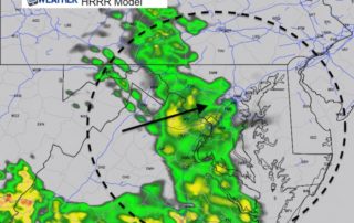
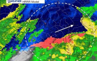
Friday February 23 2018 A band of rain already moved through this morning, but the good news is that the heaviest rain is moving out... for now. We are in
Thursday February 22 2018 The record high temperatures set Wednesday are part of an air mass pushed to the south. We can see the result this morning with the transition
February 21 2018 It feels like spring for sure and these morning temperatures in the 50s and 60s prove it. It might be hard to image but just three days
Tuesday February 20 2018 The warmer air trying to move it over the colder Chesapeake Bay and ground has produced some very thick fog this morning. Some counties on the
Monday February 19 2018 After the weekend snow, we will jump back with warm air this week that brings at least two days into the 70s. A record heat wave

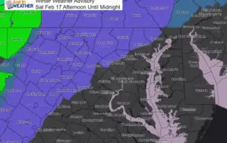
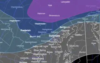
Saturday February 17 2018 The Winter Weather Advisory has been expanded south to include Annapolis, more of central Maryland and Washington DC. The thing about this storms is that is
February 17 2018 A Winter Weather Advisory is in effect for parts of our region for this afternoon and tonight. I wanted to start with morning temperatures to show that
Friday February 16 2018 A Winter Weather Advisory has been issued for parts of our region for Saturday afternoon through midnight. This is based on the event that will ride
Friday February 16 2018 The rain today is part of a cold front that will eventually drop our temperatures and set the stage for a moderate snow event Saturday. The