Thursday February 22 2018
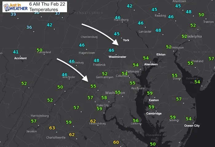
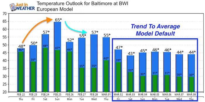
The record high temperatures set Wednesday are part of an air mass pushed to the south. We can see the result this morning with the transition still taking place as the 40s are creeping in from the north. It is still somewhat mild around central Maryland but it will get cooler throughout the day. This will come with more rain ad the front will be stuck overhead through Sunday. So plan for a soggy set up, even through it will not rain the entire time. Some breaks between storms are expected. But overall, the spring preview is gone. The long range outlook still shows colder air and a better chance for snow in early March.
Stats For February 22
Note: A few people have asked me about the term normal vs using average. Scientifically ‘average’ is a better term for the stats below, but The National Weather Service has used the ‘normal’ term in their climate data. I have switched it below to satisfy the fellow science geeks.
Average High: 47ºF
Record High: 74ºF in 1874
Average Low: 28ºF
*Former Record Low: +7ºF in 1963
Snow Record: 10.3″ in 1929
Seasonal Snow To Date (at BWI): 8.7″
Sunrise: 6:49 AM
Sunset 5:51 PM
*Daylight = 2:28 longer than yesterday
*Bay Water Temperature = 41ºF at Thomas Pt. Light House
Keep In Touch Every Day
Click here to sign up for email alerts…. Just in case you don’t get the post on your social media feed
This Morning
Rain Timeline Today
—> slider
[metaslider id=58267]
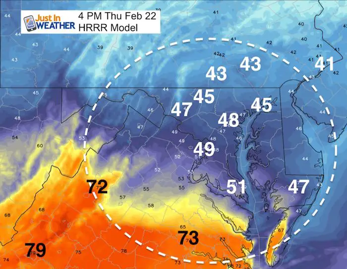
Afternoon Temperatures
Getting cooler, many in central Maryland will be in the 40s later today. Notice the warm air hanging on the other side of the front in the Southern Virginia and across the Blue Ridge.
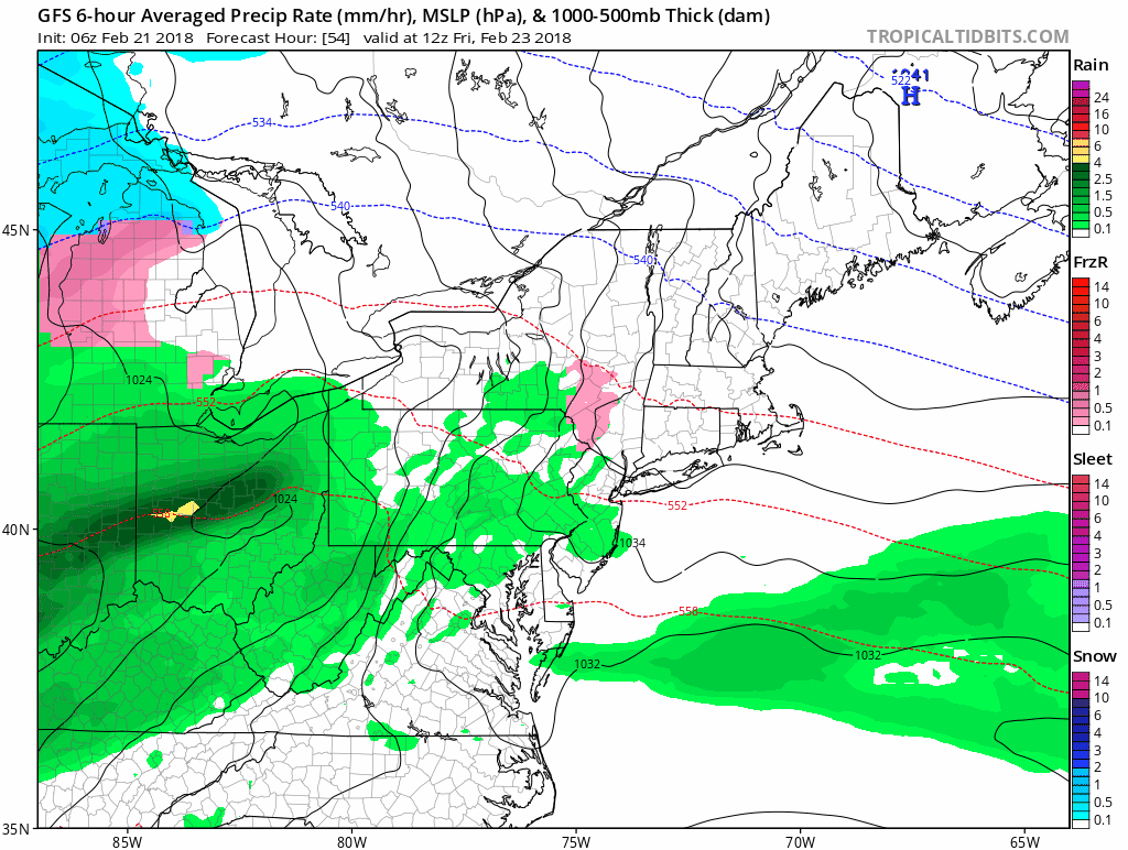
Rainy Animation (Through Sunday)
We may get a break on Saturday but steady rain expected much of Sunday.
Temperature Outlook
Please share your thoughts, best weather pics/video, or just keep in touch via social media
-
Facebook: Justin Berk, Meteorologist
-
Twitter: @JustinWeather
-
Instagram: justinweather
Keep In Touch Every Day
Click here to sign up for email alerts…. Just in case you don’t get the post on your social media feed
FITF Gear

Snowstix- We Need You To Measure Snow Too
We are giving 10% of each sale to programs that benefit pediatric oncology patients.

 Get the award winning Kid Weather App I made with my oldest son and support our love for science, weather, and technology. Our 3 year anniversary of the release and our contribution to STEM education is this November. It has been downloaded in 60 countries, and works in both temperature scales. With your support we can expand on the fun introduction to science and real weather.
Keep In Touch All Winter
Click here to sign up for email alerts…. Just in case you don’t get the post on your social media feed
Also See:
My Winter Outlook 2017-2018 for more snow
La Nina Formed: What it could mean to our winter
NOAA Winter Outlook: Not The Best But Not The Worst For Snow
Two Farmers Almanacs Winter 2018 Outlooks
Winter Weather Folkore: Suggestions from Animals and Crops
First Frost and Freeze Dates For Maryland (southern PA and northern VA)
My Preliminary Winter Outlook Notes
Low Snow Winters In Baltimore: To Repeat Or Not Repeat
NOAA Ranks Blizzard 2016 4th Worst Snowstorm On Record
Blizzard 2016 Record Top Snowstorm: Area Totals
Extreme Weather of 2015 balanced out on both ends