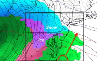
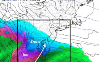
The Focus Is Still On A Winter Storm Next Week
Saturday February 16 2019 Today is the anniversary of the second largest February single day snow. The super storm of 2003 dropped 21.8" of snow on Baltimore on this date.
Saturday February 16 2019 Today is the anniversary of the second largest February single day snow. The super storm of 2003 dropped 21.8" of snow on Baltimore on this date.
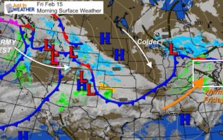
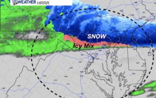
Friday February 15 2019 I was downplaying the snow on Saturday and now it appears even southern Maryland will get less. The warm air today will be replaced by a

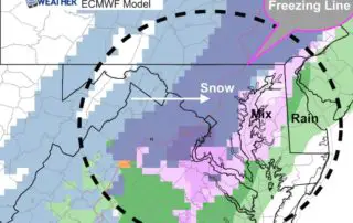
Tuesday February 12 2019 This is a legitimate ice storm. The results of the cold air and freezing rain have coated much of the region in a thick layer of
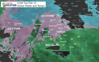
Tuesday February 12 2019 The areas under a Winter Storm Warning are still below freezing as of 6 AM. The freezing line is slowly pushing north and there is a
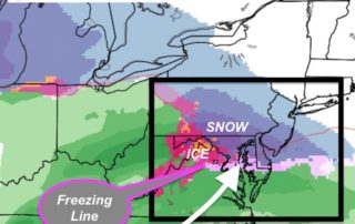
Monday February 11 2019 The snow and ice are barely letting up on the north and and it will continue. This update for the Winter Weather Advisory covers the areas
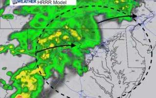
Friday February 8 2019 There are showers and some fog to start this Friday, and this morning may be the warmest part of the day. A cold front will be
Thursday February 7 2019 We are still on the cool side of this frontal boundary, but it is trying to move back north. The result will bring some light scattered
Wednesday February 6 2019 It might be hard to imagine after reaching 71ºF in Baltimore yesterday, but winter is still here. A cold front has dropped south and will be
Sunday January 27 2019 Today brings a little warm up ahead of some showers. Snow this morning in the mountains will fade as it moves east, but could redevelop some
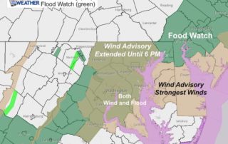
Thursday January 24 2019 We have a very energetic storm passing through this morning. Winds are already whipping up, but expect them to get stronger over the next few hours.