Wednesday February 6 2019
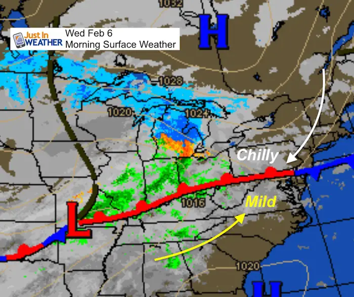
It might be hard to imagine after reaching 71ºF in Baltimore yesterday, but winter is still here. A cold front has dropped south and will be stalling over our region for a few days. This has brought a chill back in the air today and will bring rain showers by this evening. Showers we linger through Friday, but the big shock might be the return of snow next week. However history has proven in recent years but all through the record books that big winter warm up is often followed by snow within a week or two.
Morning Weather Map
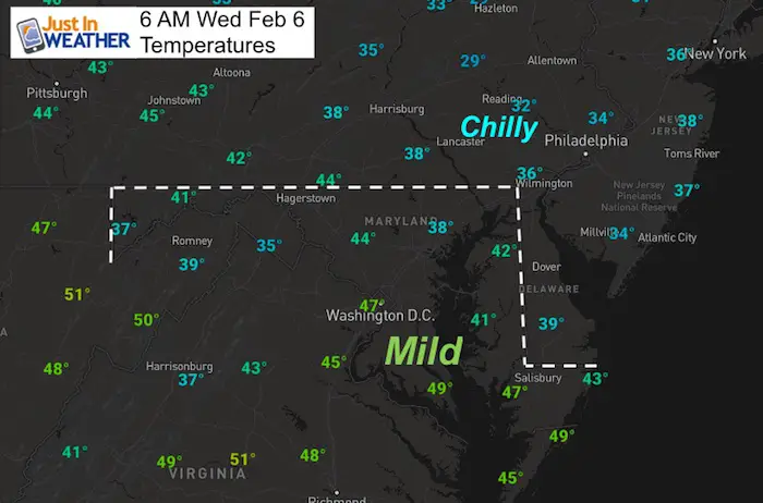
Morning Temperatures Map
Local Weather Stats For February 6, 2019 in Baltimore
Average High: 43ºF
Record High: 72ºF in 2008
Average Low: 25ºF
Record Low: 1ºF in 1895
*Record Snow: 16.0″ in 2010 (25″ in two days)
Sunrise: 7:08 AM
Sunset 5:32 PM
*Daylight = 2:12 longer than yesterday
*Bay Water Temperature = 35ºF at Thomas Pt. Light House
Keep In Touch Every Day
Just in case you don’t get all posts on your social media feed, stay up to date with the latest info…
Click here to sign up for email alerts…. Be the first to hear any new weather.

New Partner
Buchanan Kia of Westminster is a supporter of Just In Power Kids and Maryland Trek 6 in August 2019.
Afternoon High Temperatures

Rain Timeline —> slider
Showers in the mountains will spread east today. Northern counties may get some rain this afternoon. Most metro areas turn wet tonight.
[metaslider id=72593]
Rain Animation
The bulk of the rain will be tonight, but showers will linger through Friday.
Snow Next Week:
Snow is showing up early next week on many models. But, the timing is not agreed upon. I have seen this many times, where the physics support ‘something’ but when is still uncertain. That is why I am showing two models with snow a day apart. I would expect to see snow in the range between Monday and Wednesday. There is support that it will be longer event, that could mix with ice.
The European Model shows snow developing Monday and lasting into Tuesday then dancing to freezing rain into Wednesday.

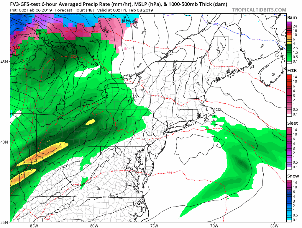
The FV3- GFS is a day later
This shows snow developing Tuesday into Wednesday with the change over to freezing rain


New Colors
We are giving 10% of each sale to Just In Power Kids: Providing FREE holistic care for pediatric oncology patients.

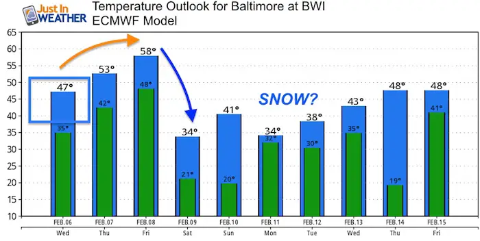
Temperature Outlook
The European Model shows highs above freezing Monday and Tuesday, but look at the lows. I see snow and remaining below freezing most of Monday into most of Tuesday… then the attempt of warmer air to move in later Tuesday into Wednesday.
Note: It is too early to lock into specifics. This is just an idea and a gauge to compare any model trends against. We have a benchmark to work from.
Please share your thoughts, best weather pics/video, or just keep in touch via social media
-
Facebook: Justin Berk, Meteorologist
-
Twitter: @JustinWeather
-
Instagram: justinweather
FITF and SnowStix

Related Links:
Winter Outlook
My Winter Outlook 2018-19: Multiple Nor’Easters and more snow

Interactive Snow Report
November 15 Snow Reports- Interactive Map Compared To My Forecast

Winter Snow And Top 5 Wet Years
Snowfall Seasons at Beginning and End of Top 5 Wet Years In Baltimore

Related Winter Outlooks
Solar Cycle: When Sun Spots Are Low We Get More Snow
El Nino Modoki May Enhance Snow Chances
Sweet Spot: Hitting 70ºF on Halloween is followed by more winter snow
Will A Wet Summer Bring A Snowy Winter?
NOAA Winter 2018-2019 Outlook Explained: This Actually Supports Snow
Winter Outlook From Two Different Farmers Almanacs
Maryland Winters: Snowfall Maps and Baltimore Snow History
