Thursday January 24 2019
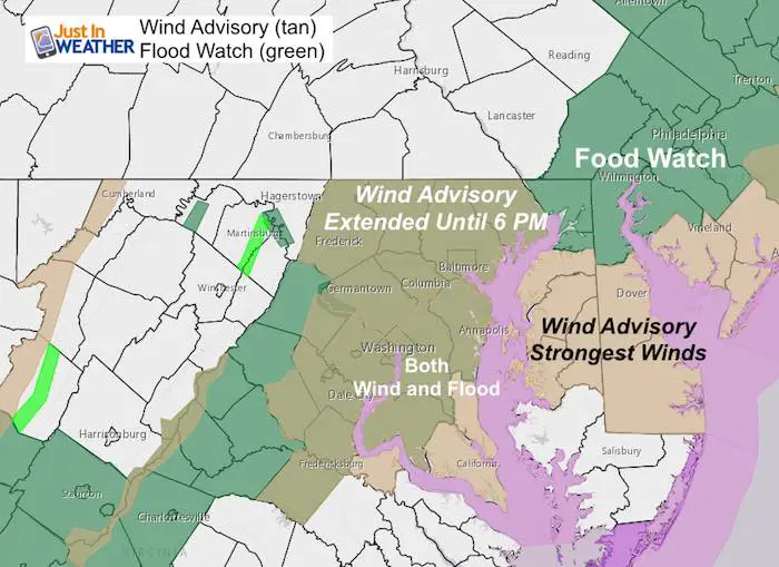
We have a very energetic storm passing through this morning. Winds are already whipping up, but expect them to get stronger over the next few hours. This is a legitimately serious concern as we just went from a hard freeze, the thawed with heavy rain. There is a Flood Watch in our area for an additional 1 inch or more rain today. Winds will gust between 50 and 60 mph which can soften the soil to knock down some trees. There will also be branches break and other debris that can take out power lines.
Other travel concerns are: Restrictions on area bridges and flight delays
- Wind Advisory: Until noon for most of the area. Metro Baltimore has been extended until 6 PM
- Flood Watch overlaps with the wind advisory over central Maryland.
Local Weather Stats For January 24, 2019 in Baltimore
Average High: 41ºF
Record High: 74ºF in 1967
Average Low: 24ºF
Record Low: 1ºF in 1963
*Record Snow: 25.5* in 2016
Sunrise: 7:19 AM
Sunset 5:17 PM
*Daylight = 1:48 longer than yesterday
*Bay Water Temperature = 36ºF at Thomas Pt. Light House

New Partner
Buchanan Kia of Westminster is a supporter of Just In Power Kids and Maryland Trek 6 in August 2019.
Keep In Touch Every Day
Just in case you don’t get all posts on your social media feed, stay up to date with the latest info…
Click here to sign up for email alerts…. Be the first to hear any new weather.
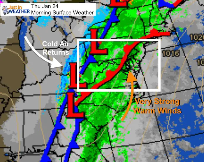
Morning Set Up
Baltimore at 6 AM
- Temperature = 51ºF
- Wind Gusts: SE at 10 (gust to 25 by the Bay)

Morning Surface Weather
Radar Loop
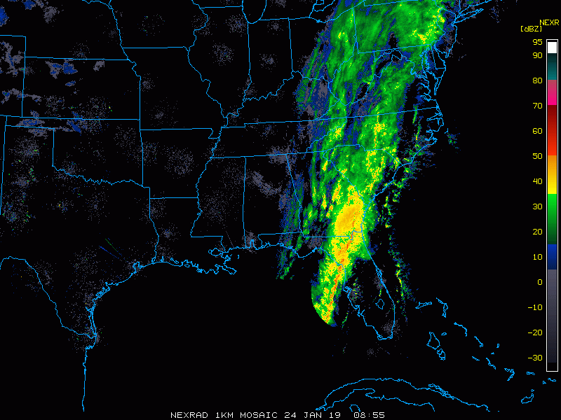
Radar Simulation –> slider
These downpours may be blinding at times. It’s best to pull over and wait it out if you are driving.
Western MD gets a snow burst, but that will be confined to the mountains.
[metaslider id=71800]
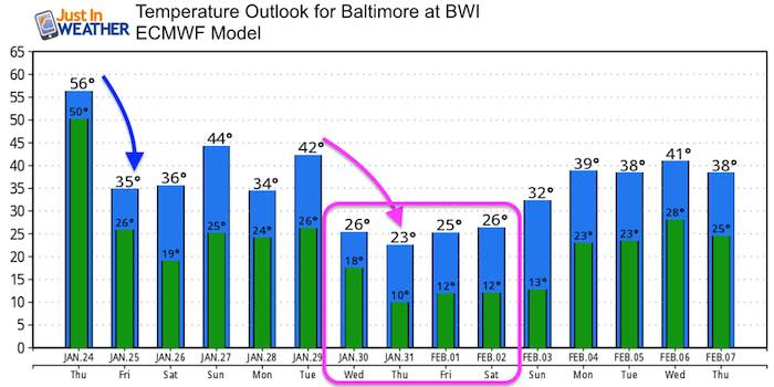
Temperatures
The energy will come from the temperature contrast. Baltimore shoots for the lower 60s before noon, then falls fast through the 40s after noon.


Wind Gust Timeline —> slider
The strongest winds will be this morning for most, but last into the afternoon on Delmarva. That is until the front passes through. Winds will be form the Southeast ahead of the front and will gust between 50 and 60 mph. Beach areas may exceed 60 mph. The afternoon winds shift from the Northwest and will gust 30 to 45 mph.
[metaslider id=71783]
Outlook
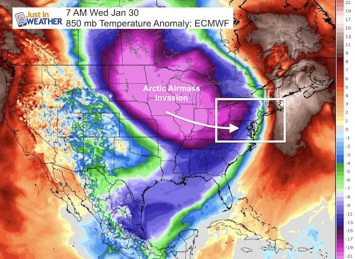
We will hav colder air arrive tomorrow. We might have some snow showers in the mountains this weekend. But nothing organized at this time. The next shot of arctic air will arrive Wednesday. This may end up colder than indicated here:
SnowStix
We have added a bunch of new color options

We are giving 10% of each sale to Just In Power Kids: Providing FREE holistic care for pediatric oncology patients.
Please share your thoughts, best weather pics/video, or just keep in touch via social media
-
Facebook: Justin Berk, Meteorologist
-
Twitter: @JustinWeather
-
Instagram: justinweather
FITF and SnowStix

Related Links:
Winter Outlook
My Winter Outlook 2018-19: Multiple Nor’Easters and more snow

Interactive Snow Report
November 15 Snow Reports- Interactive Map Compared To My Forecast

Winter Snow And Top 5 Wet Years
Snowfall Seasons at Beginning and End of Top 5 Wet Years In Baltimore

Related Winter Outlooks
Solar Cycle: When Sun Spots Are Low We Get More Snow
El Nino Modoki May Enhance Snow Chances
Sweet Spot: Hitting 70ºF on Halloween is followed by more winter snow
Will A Wet Summer Bring A Snowy Winter?
NOAA Winter 2018-2019 Outlook Explained: This Actually Supports Snow
Winter Outlook From Two Different Farmers Almanacs
Maryland Winters: Snowfall Maps and Baltimore Snow History
