Friday January 25 2019
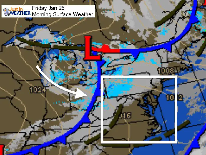
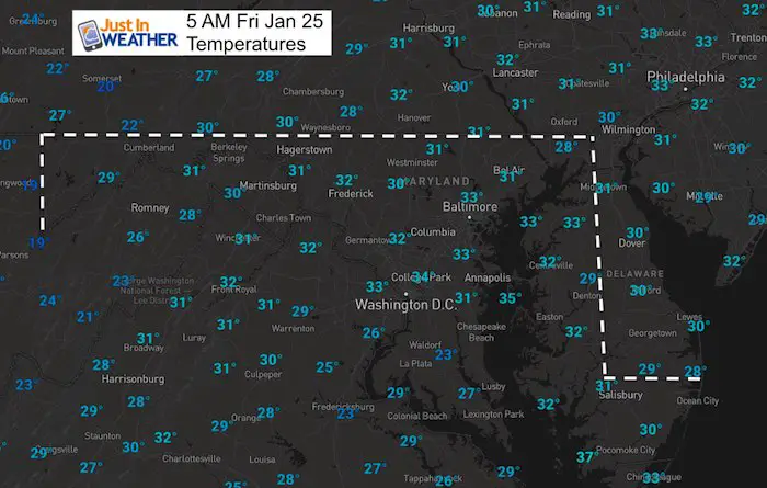
This morning temperatures have dropped back close to freezing and there is one more push of cold air. This cold front will increase the winds this afternoon. Ahead of it, some flurries might survive the trip over the mountains. Just for ambiance. Otherwise we aim for quiet weather this weekend. Next week, that’s when we have some action.
Last night I posted about the epic cold. Since then some models have made a slight adjustment, which includes generating snow along that arctic boundary. This may be enough to accumulate and shift the core of the coldest air a little north. Don’t worry, it will still be very cold next week!
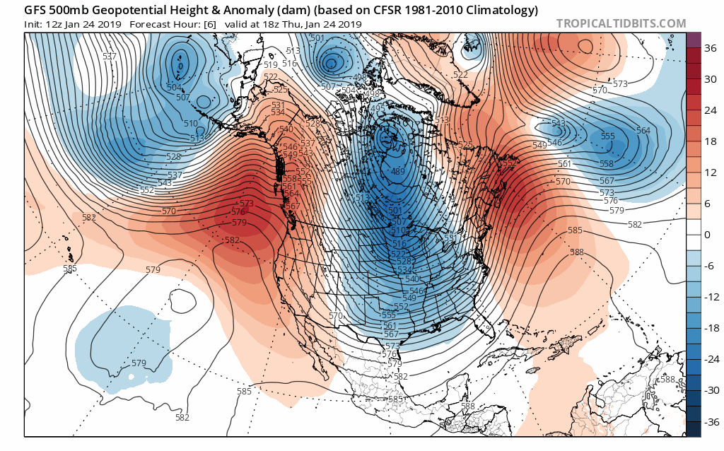
Morning Weather Map
Local Weather Stats For January 25, 2019 in Baltimore
Average High: 42ºF
Record High: 75ºF in 1967
Average Low: 24ºF
Record Low: 0ºF in 1987
*Record Snow: 14.9* in 2000
Sunrise: 7:19 AM
Sunset 5:18 PM
*Daylight = 1:51 longer than yesterday
*Bay Water Temperature = 38ºF at Thomas Pt. Light House

New Partner
Buchanan Kia of Westminster is a supporter of Just In Power Kids and Maryland Trek 6 in August 2019.
Keep In Touch Every Day
Just in case you don’t get all posts on your social media feed, stay up to date with the latest info…
Click here to sign up for email alerts…. Be the first to hear any new weather.
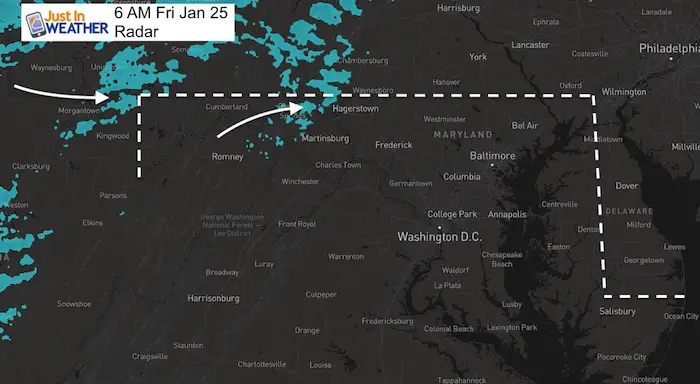
Morning Set Up
Baltimore at 6 AM
- Temperature = 33ºF
- Wind Gusts: W 12
- Wind Chill = 24ºF
Afternoon
It will be chilly and breezy. We might have some flurries, but nothing widespread or concerning to travel in metro areas.


Weekend:
Expect quite weather locally; Snow showers in the mountains. Saturday in the mid to upper 30s. Sunday in the mid to upper 40s.
Arctic Front/Snow?
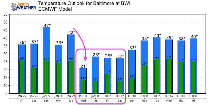
Tuesday evening into Wednesday morning. At this point it looks like rain to snow with the arctic air moving in. This timing at night and transition could make for minor accumulation and icing. Since the arctic air arriving will be potent, the modeling is still trying hard to handle this and will likely have some more adjustments. Just plan for the big changes between Wednesday and Thursday.
Two Models Agree: Compare the GFS and European Models below.
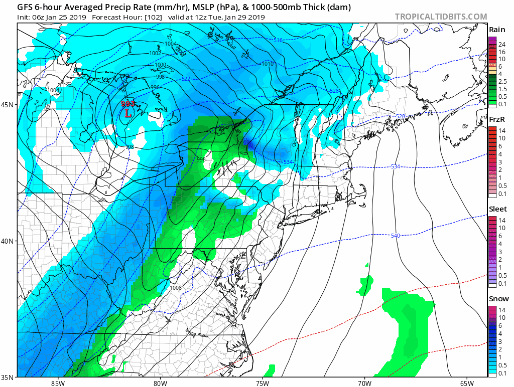
European Model Snow —> slider
[metaslider id=71845]
Temperature Outlook
Jet Stream Animation
Watch the center of the screen here and see the blue circle. That is the Polar Vortex around the North Pole. There is one drop south, then it redevelops and the second push dives from the Arctic starting Sunday January 27. This reaches Minnesota, Wisconsin, and northern Michigan Tuesday and Wednesday. The core will pass to our north but bring us our coldest air next Wednesday and Thursday.
SnowStix
We have added a bunch of new color options

We are giving 10% of each sale to Just In Power Kids: Providing FREE holistic care for pediatric oncology patients.
Please share your thoughts, best weather pics/video, or just keep in touch via social media
-
Facebook: Justin Berk, Meteorologist
-
Twitter: @JustinWeather
-
Instagram: justinweather
FITF and SnowStix

Related Links:
Winter Outlook
My Winter Outlook 2018-19: Multiple Nor’Easters and more snow

Interactive Snow Report
November 15 Snow Reports- Interactive Map Compared To My Forecast

Winter Snow And Top 5 Wet Years
Snowfall Seasons at Beginning and End of Top 5 Wet Years In Baltimore

Related Winter Outlooks
Solar Cycle: When Sun Spots Are Low We Get More Snow
El Nino Modoki May Enhance Snow Chances
Sweet Spot: Hitting 70ºF on Halloween is followed by more winter snow
Will A Wet Summer Bring A Snowy Winter?
NOAA Winter 2018-2019 Outlook Explained: This Actually Supports Snow
Winter Outlook From Two Different Farmers Almanacs
Maryland Winters: Snowfall Maps and Baltimore Snow History
