Tornado Watch Issued For Most Of Maryland Through Midnight
April 19 2019 Tornado Watch was issued for most of Maryland west of the Chesapeake Bay through Midnight. This means that conditions are present for some severe storms to rotate
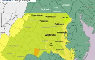
April 19 2019 Tornado Watch was issued for most of Maryland west of the Chesapeake Bay through Midnight. This means that conditions are present for some severe storms to rotate
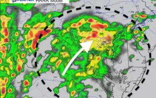
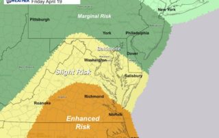
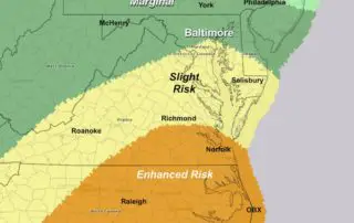
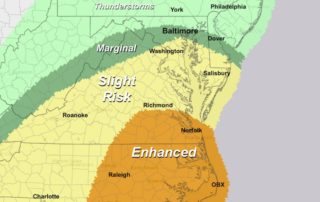
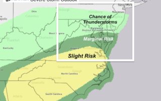
Friday April 19 2019 The Severe Storm Risk across our region this afternoon and tonight is one of many things to be concerned with today' weather. The start of Passover
Thursday April 18 2019 As the storm approaching from the south gets closer, the data continues to show a similarity to last weekend's storm. As I suggested, the risk for
Thursday April 18 2019 The warm front finally broke through and we will get temperatures to jump close to 80ºF today in central Maryland. Some light showers are around this
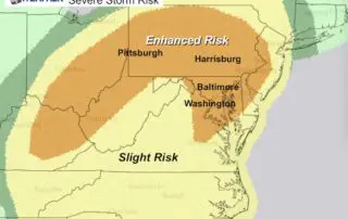
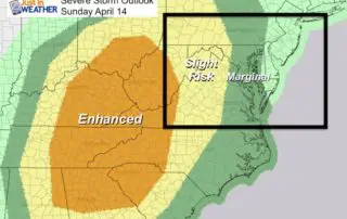
Wednesday April 17 2019 We are in the middle of severe storm season and the next three days will bring another outbreak across the country that may make news headlines.
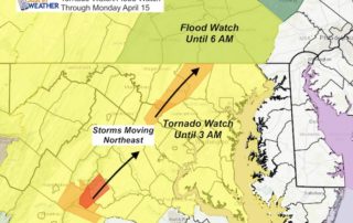
Sunday Evening Update: April 14 2019 A Tornado Watch has been expanded and lasts through 3 AM Monday April 15. This includes most of Pennsylvania, Maryland, Virginia, and northern Delmarva.
Sunday April 14 2019 We have a potentially dangerous weather situation for tonight. Please take this seriously and spread the word to your friends at least to just be aware.
Saturday April 14 2019 You want it, we've got it in Maryland this weekend. After bands of heavy rain overnight passed through, this morning we have areas of fog and
Monday April 8 2019 There is an old saying in Maryland that we often jump right from winter to summer. It might feel like that for the next two days

March 15 2019 This morning may feel like spring or even summer depending on your location. Temperatures range form the mid 50s to mid 60s, thanks to warm winds ahead