Friday April 19 2019
The Severe Storm Risk across our region this afternoon and tonight is one of many things to be concerned with today’ weather. The start of Passover and Easter Weekend may be impacted as storms have the potential for destructive winds, our outages, and flooding. My best suggestion now is to fully charge all of your devices and battery back ups. Also check back frequently as this event will intensity rapidly and last through the night.
SEE THIS UPDATE: Tornado Watch Issued for Maryland west of the Bay trough Midnight
There is a lot of information to digest in this update, so I want to simplify what you will see below:
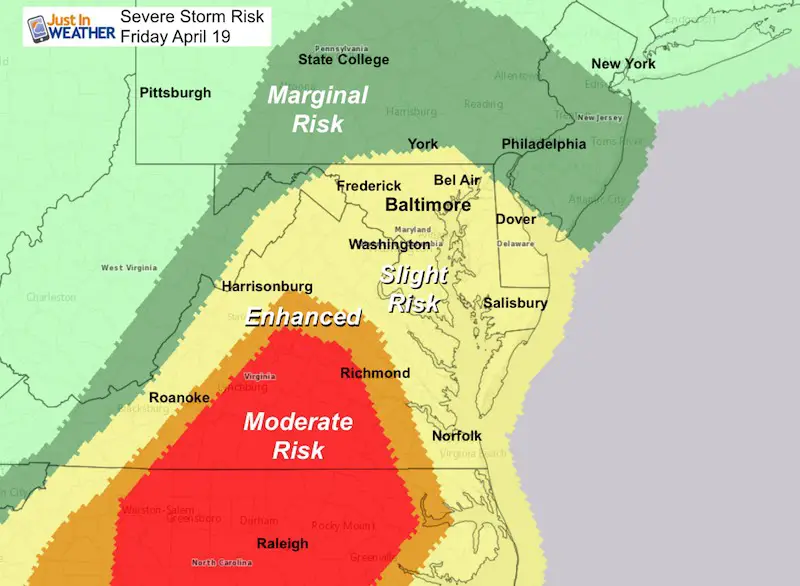
- Severe Storm Risk- Most of our area is under a slight to enhanced risk for any storms to turn severe. Not all will reach those limits, but need to be watched.
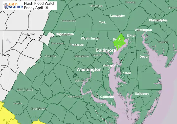
- Flood Watch– New map expands it region wide. Multiple storms may produce up to 3 inches of rain. Coastal flooding on the west side of the Chesapeake Bay due to wind shifting to the southeast and full moon high tide adding to the sloshing.
- Regional Radar – Two hour loop ending at noon shows two clusters of storms to our south heading our way.
- Severe Weather Terms – Refresher for what you might hear on TV or see online as storms develop and pass through.
- Radar Simulation – This is the best estimate (not a promise) of the storm timeline based on current conditions and expected development.
Severe Storm Risk
This is the same as this morning. Most of our area is still under a slight to enhanced risk for any storms to turn severe. Not all will reach those limits, but need to be watched. The most intense storms are most likely between Richmond, Lynchburg, and Raleigh. This is NOT a Watch or Warning. Those (definitions below) are expected to be issued later. I will update when they are posted. I can’t issue them. Those come from The National Weather Service (government agency)
Flood Watch
New map expands it region wide. Multiple storms may produce up to 3 inches of rain. Coastal flooding on the west side of the Chesapeake Bay due to wind shifting to the southeast and full moon high tide adding to the sloshing.
Radar Loop AND Radar Simulation Below
Severe Weather Terms
A WATCH means it MIGHT happen.
- This is often issued for a large region covering a time span up to 6 hours.
- The conditions may produce severe weather within the alter area, but it is not guaranteed for all.
A WARNING means it IS HAPPENING NOW!
- This is issued for a county or part of a county and within a 30 to 60 minute time span.
- This can be tracked across counties and towns with more precision and need to seek strong shelter.
Severe Storm Qualifier
- Winds over 58 mph
- Hail over 1” diameter (size of a quarter)
- Isolated tornado
Rotating Storm– As seen on radar, there is circulation in the storm or at least on the velocity scan detection wind flow.
Funnel Cloud– rotating cloud dropping below the base
Tornado-Funnel Cloud teaching the ground
Straight Line Winds: Line of severe winds covering a broad area moving in a straight line. A tornado would show rotating winds in a specific path.
Microburst: Push of colder air dropping down form top of clouds.
On radar:
Supercell Storm – Freely rotating large structure that can remain severe for a few hours. Often a single severe cell burns out in an hour or two.
Comma Head– May be the size of a single or few counties
Hook Echo– On Radar often the size of a town.
- Large hail often located in a comma head and not the same location as funnel cloud or tornado
Bow Echo: On Radar looks like a bow with a distinct line that has abortion of the center moving faster and more forward than the rest. This often indicates straight line winds
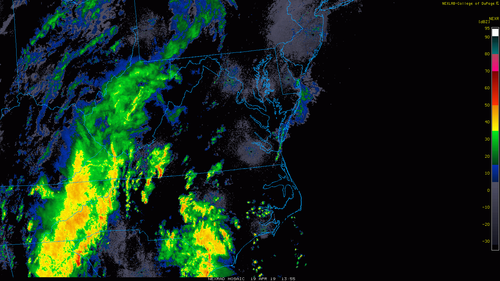
Regional Radar Composite Loop
Two clusters of storms to our south. This will tack our way. One will arrive mid afternoon. Mostly between 2 PM and 5 PM. The second will be tonight after dark and last past midnight.
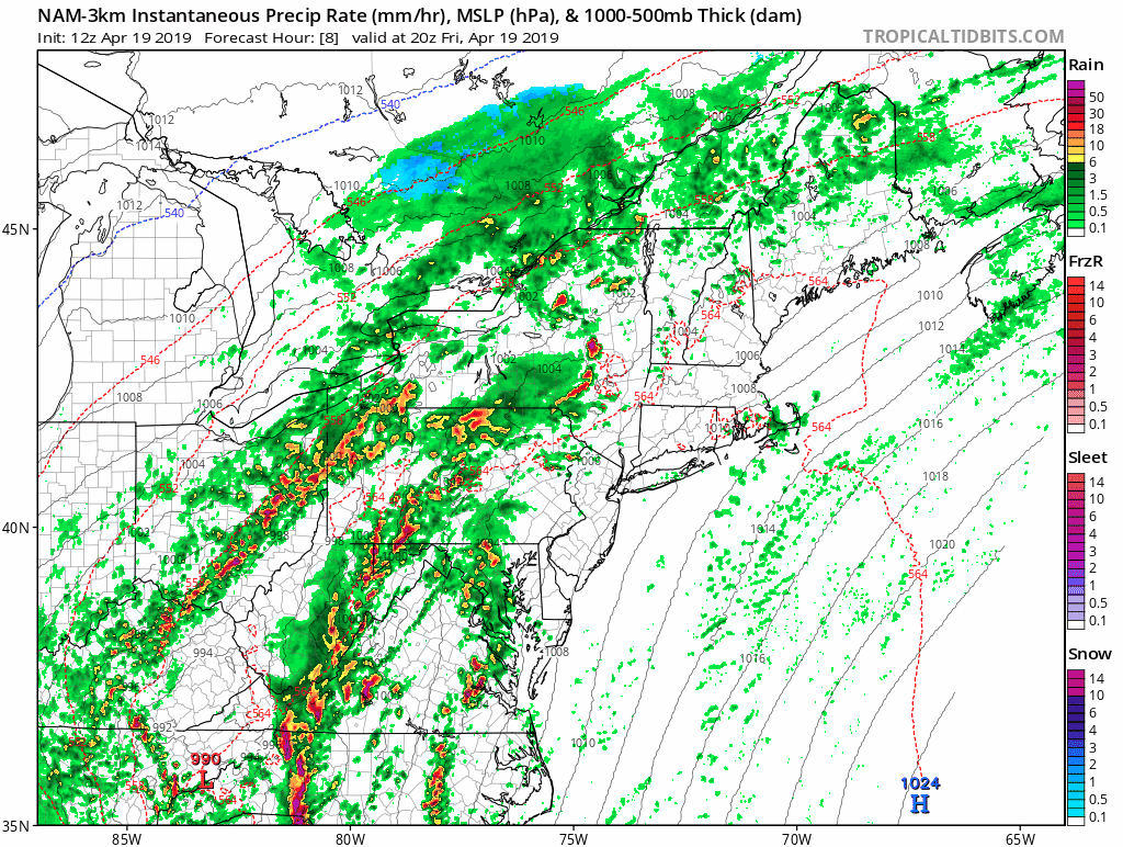
Radar Simulation Timeline —> slider
TURN YOUR PHONE SIDEWAYS FOR LARGER VIEW
- This is the best estimate (not a promise) of the storm timeline based on current conditions and expected development.
- Two clusters from the south work watching for rotation between 4 PM and 8 PM.
- Plan for multiple storms mid afternoon through tonight. The final push should pass the beaches between 3 AM and 5 AM.
[metaslider id=75907]
Storm Animation
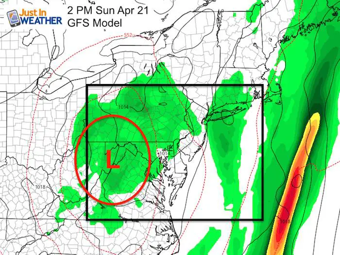
Easter Sunday
The upper level Low will be crossing our region. This will be cool and unstable so expect it to be chilly and cloudy with periods of rain developing. It should not be severe, just wet.
Keep In Touch Every Day
Just in case you don’t get all posts on your social media feed, stay up to date with the latest info…
Click here to sign up for email alerts…. Be the first to hear any new weather.
Please share your thoughts, best weather pics/video, or just keep in touch via social media
-
Facebook: Justin Berk, Meteorologist
-
Twitter: @JustinWeather
-
Instagram: justinweather
Maryland Trek 6
Our look got an upgrade, but we have the same purpose. Please click the logo take a look at our new page.
- Consider joining our team for the week, a single day, or even as a sponsor.


New Partner
Buchanan Kia of Westminster is a supporter of Just In Power Kids and Maryland Trek 6 in August 2019.
Related Links:
Was Your County Not Included?
Click this map for more on the regional forecast zones
