Friday April 19 2019
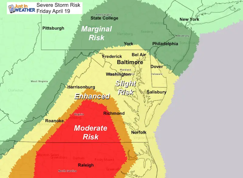
There are multiple weather concerns today so I encourage you to take them seriously and keep checking in often. The Severe Storm risk has continue to expand northward and it will be active from mid afternoon through tonight. The warm start to the day in the mid 60s will get a boost with some breaks of sun. That will fuel a widespread outbreak of active weather just as holiday travel increases for the first night of Passover and Easter Weekend. Storms may contain all severe qualifiers in addition to flooding both from heavy rain and water bing pushed up the Chesapeake Bay.
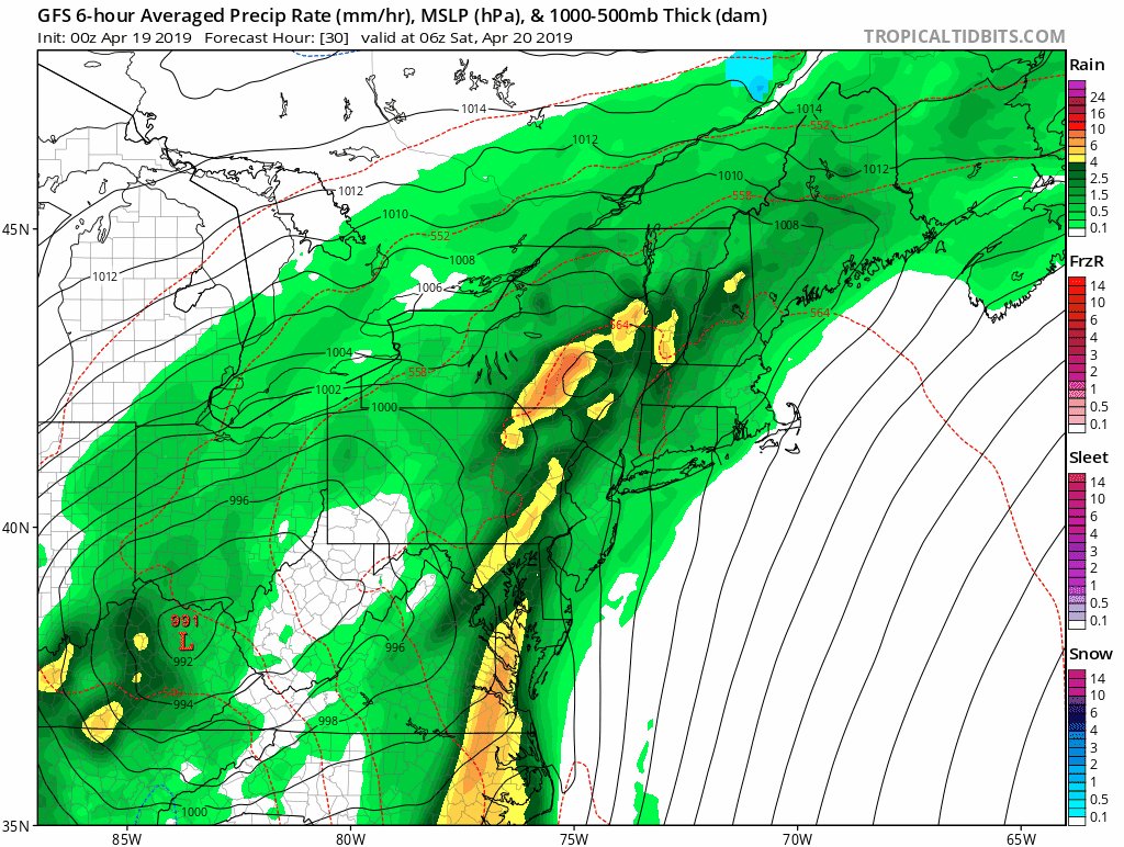
Here is a look at the severe storms today and radar simulation timeline. We may have showers lingering Saturday morning, but the storms should be exiting the beaches around sunrise. Then we may dry out Saturday evening with more showers returning in the cooler air Easter Sunday.
Severe Storm Risk
- Winds reaching 60 mph
- Large hail 1 inch in diameter (quarter size)
- Isolated Tornadoes
Severe Alert Notes:
IF we get any severe weather alerts, this is what is most important to keep in mind:
A WATCH means it MIGHT happen
A WARNING means it IS HAPPENING NOW! This can be tracked across counties and towns with more precision and need to seek strong shelter.
Flood Watch
- Flash Flood: Rainfall may reach 3 inches in ‘training’ storms (multiple storms tracking over the same area)
- Coastal Flood: Winds from the south to southeast will push water up the Bay. Also, today is a full moon, already increasing the high tides

Local Weather Stats For April 19, 2019 in Baltimore
FULL MOON Today
Average High: 66ºF
Record High: 93ºF in 1896
Average Low: 44ºF
Record Low: 24ºF in 1875
*Record Snow: = T in 1983
Sunrise: 6:24 AM
Sunset 7:47 PM
*Daylight = 2:24 longer than yesterday
*Bay Water Temperature = 52ºF at Thomas Pt. Light House
Keep In Touch Every Day
Just in case you don’t get all posts on your social media feed, stay up to date with the latest info…
Click here to sign up for email alerts…. Be the first to hear any new weather.
Morning Set Up
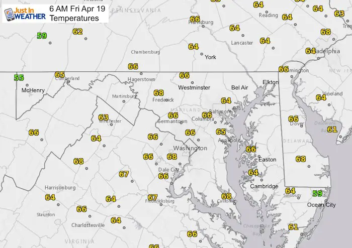
Already a warm start!
Storm line already igniting tornado watches in the south

Afternoon High Temperatures
These temps may top out by 1 PM. Any sun will add more fuel and instability to afternoon storms

Radar Simulation Timeline —> slider
Note that giving specific times for storms is difficult since one cluster will be exiting through the eastern Shore as anther will arrive from the west and south.
[metaslider id=75870]
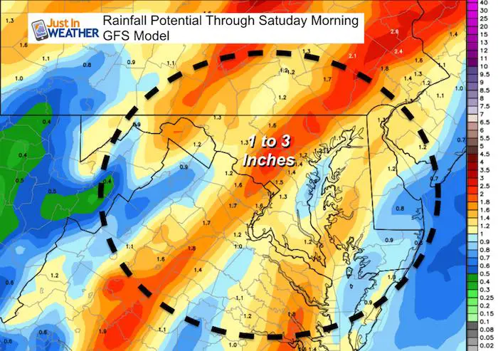
Rain Total
Storm Animations
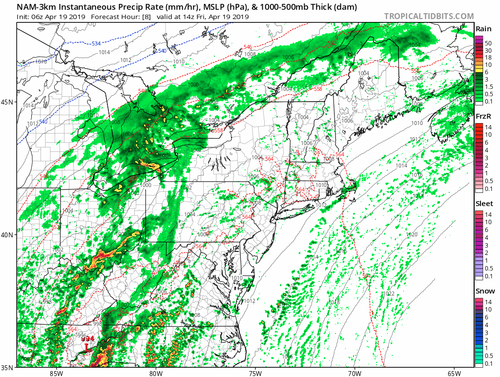
NAM 3 Km Model Through Saturday Morning
Notice the storm line at the beaches Monday Morning
Easter Weekend Rain
The GFS Model shows rain lingering Saturday morning, but a break later in the day. Then more showers with cooler air Easter Sunday
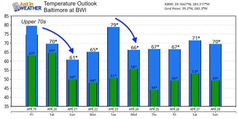
Temperature Outlook
Please share your thoughts, best weather pics/video, or just keep in touch via social media
-
Facebook: Justin Berk, Meteorologist
-
Twitter: @JustinWeather
-
Instagram: justinweather
Maryland Trek 6
Our look got an upgrade, but we have the same purpose. Please click the logo take a look at our new page.
- Consider joining our team for the week, a single day, or even as a sponsor.


New Partner
Buchanan Kia of Westminster is a supporter of Just In Power Kids and Maryland Trek 6 in August 2019.
Related Links:
Was Your County Not Included?
Click this map for more on the regional forecast zones
