Thursday April 18 2019
The warm front finally broke through and we will get temperatures to jump close to 80ºF today in central Maryland. Some light showers are around this morning, and there will be some scattered showers around through Friday. But two main stories will be the warm air and more importantly the severe storm risk. The threat of severe weather continues across the Southern US today and will shift to our region tomorrow afternoon and night.


The active weather will shift our way in the perfect impact storm so to speak. The timing for coincides not only with a Friday afternoon and evening the is normally busy with weekend travelers, but the start of Passover and Easter weekend. See the closer look below.
Local Weather Stats For April 18, 2019 in Baltimore
Average High: 66ºF
Record High: 94ºF in 1896
Average Low: 44ºF
Record Low: 34ºF in 1875
*Record Snow: = T in 2001
Sunrise: 6:25 AM
Sunset 7:46 PM
*Daylight = 2:25 longer than yesterday
*Bay Water Temperature = 55ºF at Thomas Pt. Light House
Keep In Touch Every Day
Just in case you don’t get all posts on your social media feed, stay up to date with the latest info…
Click here to sign up for email alerts…. Be the first to hear any new weather.
Maryland Trek 6
Our look got an upgrade, but we have the same purpose. Please click the logo take a look at our new page.
- Consider joining our team for the week, a single day, or even as a sponsor.


New Partner
Buchanan Kia of Westminster is a supporter of Just In Power Kids and Maryland Trek 6 in August 2019.
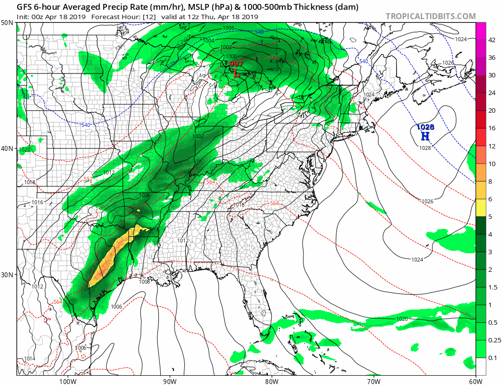
Thursday Morning

Thursday Afternoon

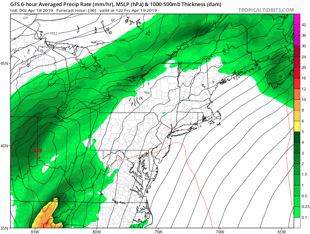
Friday Morning

Friday Afternoon
This heat may determine the best chance for severe storms to erupt.

Severe Storm Outlook
There has been an expansion of the Marginal Risk area through Southern PA. The rest has remained the same since yesterday. However, as I already mentioned, I would expect there to be a spread of the slight risk to include more to the north. There is some evidence in the modeling to show more of us will be impacted.

East Coast Stormy Friday
I do not have a close hourly look at the radar simulation today. I think that might be a disservice since I don’t trust the depiction of severe storm timing and tracking this early. But this wider region look for now is worth showing as this will impact the entire east coast. See the rain animation below. If you are flying this Friday, this may lead to widespread delays.

Forecast Animation
Thursday afternoon through Saturday afternoon.
Weekend Rain?
The best suggestion we can see here is this:
- Friday afternoon/Night: Storms
- Saturday Morning: Storms move off of the coast
- Saturday Afternoon: Dry air returns
- Easter Sunday: Dry start, rain returns in the afternoon and evening.
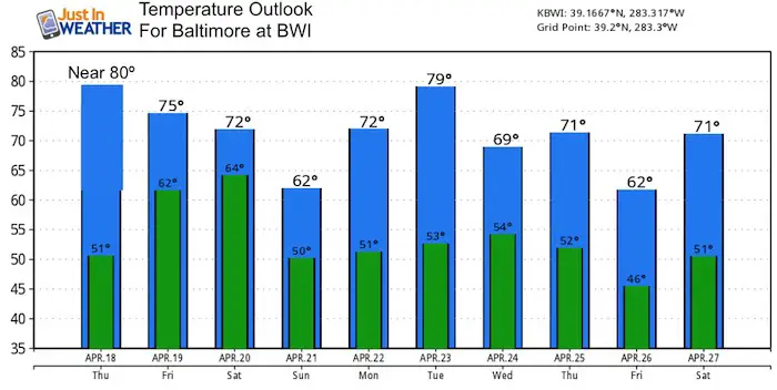
Temperature Outlook
Please share your thoughts, best weather pics/video, or just keep in touch via social media
-
Facebook: Justin Berk, Meteorologist
-
Twitter: @JustinWeather
-
Instagram: justinweather
Related Links:
Was Your County Not Included?
Click this map for more on the regional forecast zones
