Updated Flash Freeze Temperature Timeline Plus Winds and Chill Advisories
Noon Sunday January 20 2019 The freezing air is already reaching the northern and western parts of our area. Thew winds will pick up as the cold air arrives and
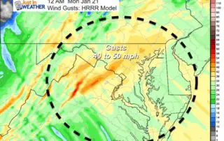
Noon Sunday January 20 2019 The freezing air is already reaching the northern and western parts of our area. Thew winds will pick up as the cold air arrives and
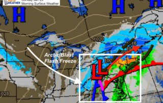
Sunday January 20 2019 Today is the big Flash Freeze Day. My wife asked what that really meant and I figured I should explain quickly. Temperatures will fall well below
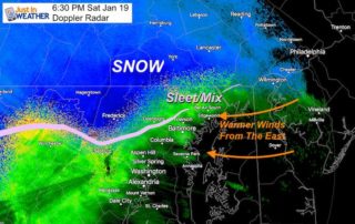
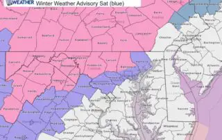
January 19 2019 A Winter Weather Advisory is in place for our Northern Counties and that is exactly where snow and sleet burst open this evening. I have been watching
Saturday Afternoon January 19 2019 I hope you read my morning post and saw my notes on the track more north and thus warmer storm. There will still be some
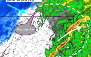
Saturday January 19 2019 There is a change with this storm and as I write think I realize it should have been anticipated. Do you remember me pointing out the
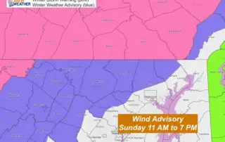
Friday January 18 2019 This is update is from Friday evening, with confirmation of my earlier forecast for the northern zones. This is a complex storm and we will be
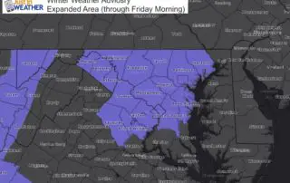
January 18 2019 We are still dealing with the light snow and icy roads this morning. A Dense Fog Advisory is in place where warmer air is trying to move
Friday January 18 2019 The overnight snow was moving out of central Maryland by 5 AM. This was a little later, but the snow still left the expected dusting to
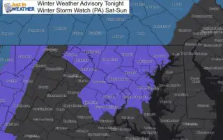
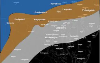
Thursday January 17 2019 The next few days will be very fast and complex with multiple weather events. The first one tonight is why we have a Winter Weather Advisory.
Thursday January 17 2019 The snow event on the way will arrive this evening with most falling overnight. The Winter Weather Advisory in place has been expanded south to now