Updated Radar Simulation For Tuesday Morning Snow
Monday January 29 2018 The latest run of the High Resolution Rapid Refresh Model (HRRR) shows the cold front and the push of snow through most of our areas before sunrise.
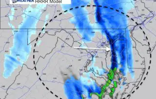
Monday January 29 2018 The latest run of the High Resolution Rapid Refresh Model (HRRR) shows the cold front and the push of snow through most of our areas before sunrise.
Monday January 29 2018 Do you remember the few days in the 60s last week and Saturday? Well, the ground does. Snow will arrive early Tuesday morning, but the freezing
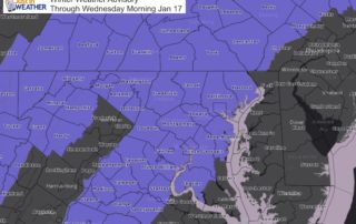
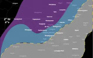
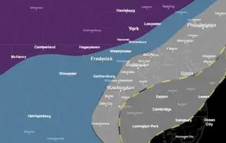
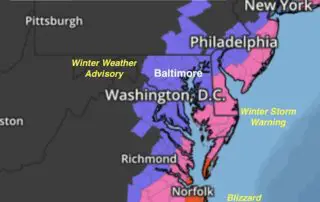
January 16 2018 The Winter Weather Advisory has been expanded to include metro Baltimore and Washington into southern Maryland through 9 AM Wednesday January 17. This follows my forecast for
January 16 2018 The light snow early this morning on the north side of Baltimore is a reminder that even a little bit can lead to big problems. This is

Tuesday January 16 2018 A band of light snow moved through northern Maryland and southern PA this morning. The light coating between Westminster and York seemed to pale in comparison
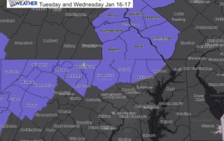
Monday Jan 15 2018 A Winter Weather Advisory has been issued for our region for snow Tuesday and Wednesday. It is going to snow Tuesday and early Wednesday this week
January 4 2018 Roads are covered in with snow and ice this morning. This view was in Arlington VA at 2 AM from one of my clients out treating the

10 PM Wed January 3 2018 The snow appears to be here already on Doppler Radar. There may be some virga so that not all is reaching the ground. The
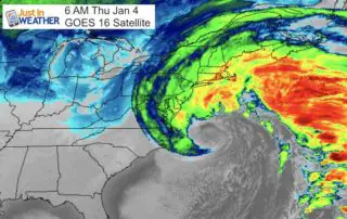
January 3 2018 The warnings and advisories are expanding inland as expected. The storm in the southeast will be hugging the coast a little tighter and will be spreading snow

January 3 2018 The storm is just forming this morning and already producing freezing rain down to Jacksonville, FL. Today we will watch it develop and track out way with