 January 16 2018
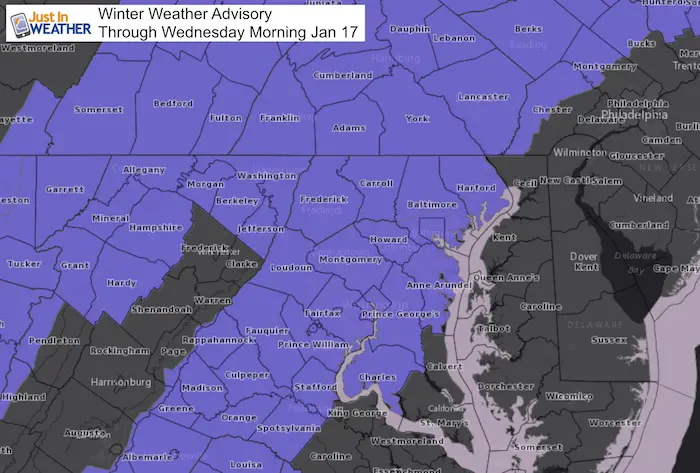
The Winter Weather Advisory has been expanded to include metro Baltimore and Washington into southern Maryland through 9 AM Wednesday January 17. This follows my forecast for around 1 inch of snow in these areas as seen in my final Snowcast map below. While this is a light snow event, it will impact most of our region overnight and likely lead to school delays Wednesday morning.
Added in this Advisory are these counties:
District of Columbia-Southern Baltimore-Prince Georges-Anne Arundel-Charles-Northwest Montgomery-Central and Southeast Montgomery-Northwest Howard-Central and Southeast Howard-Southeast Harford-Prince William/Manassas/Manassas Park-Fairfax-Arlington/Falls Church/Alexandria-Stafford-Spotsylvania-Northern Fauquier-Southern Fauquier-Western Loudoun-Eastern Loudoun-
Highlights:
- Most of the day we will see snow on the radar near Hagerstown and along I-81. Then watch the slow progress eastward after dark so that the western and norther suburbs will get the snow this evening, but metro areas my not until after midnight.
- Flurries may break out long before the radar can show it. We already have a low cloud deck and some elevation fog, so there is plenty of moisture available and waiting for the trigger from the front to put it to work.
- Arctic air will follow. So the ground will be icy and snow will be light and blow around easy Wednesday morning.
Below is the latest snow timeline and my updated Snowcast map below. I apologize for the color code being misleading in my prior report. That has been fixed.
Keep In Touch All Winter
Click here to sign up for email alerts…. Just in case you don’t get the post on your social media feed

Two Sliders To Make The Tracking Easier
It is important to note that there may be flurries and light snow breaking out later today and this evening that the radar will have trouble showing. Your reporting and crowdsourcing will help us pin that down as even the modeling here is having some issues with the leading edge.
—-> slider: This Evening
[metaslider id=56952]
—-> slider: Wednesday Midnight-Morning
[metaslider id=56965]
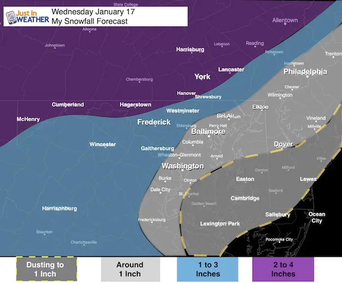
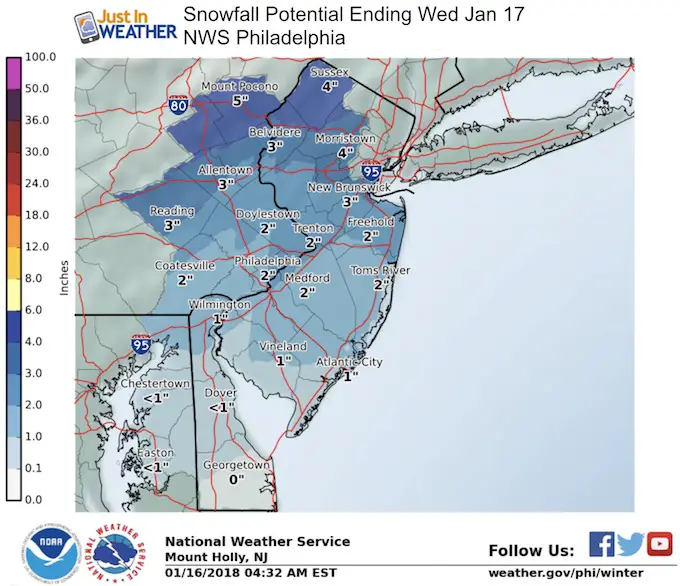
My Snowcast Ending Wednesday Morning
While I still see a general 1 to 3 inches in our area, there will be slight more to the north and perhaps a surge of snow west and south of Washington. Metro areas will get close to 1 inch with the higher range in the colder western and northern suburbs.
Shirts
A Portion of the proceeds will go to Integrated Wellness programs for Pediatric Oncology Patients
May The Flakes Be With You- Limited Edition Shirt

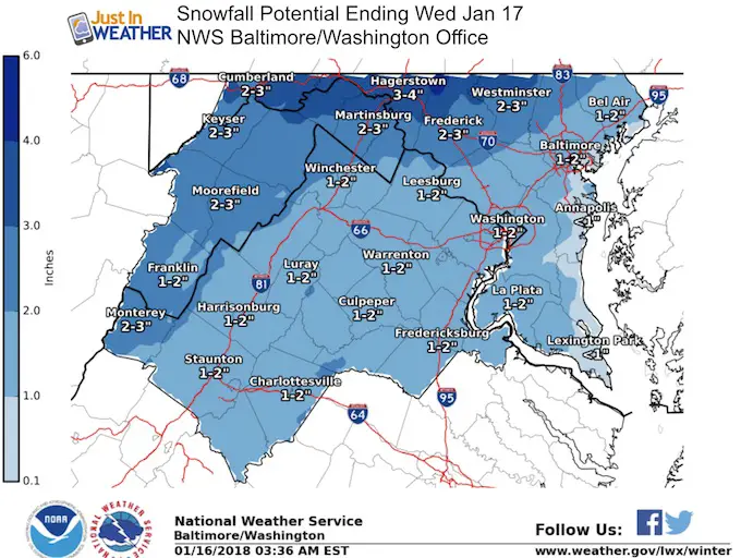
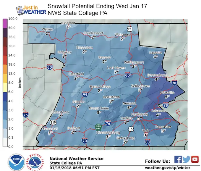
National Weather Service Snow Forecasts
FITF Gear

Please share your thoughts, best weather pics/video, or just keep in touch via social media
-
Facebook: Justin Berk, Meteorologist
-
Twitter: @JustinWeather
-
Instagram: justinweather
Snowstix- We Need You To Measure Snow Too
We are giving 10% of each sale to programs that benefit pediatric oncology patients.

 Get the award winning Kid Weather App I made with my oldest son and support our love for science, weather, and technology. Our 3 year anniversary of the release and our contribution to STEM education is this November. It has been downloaded in 60 countries, and works in both temperature scales. With your support we can expand on the fun introduction to science and real weather.
Keep In Touch All Winter
Click here to sign up for email alerts…. Just in case you don’t get the post on your social media feed
Also See:
My Winter Outlook 2017-2018 for more snow
La Nina Formed: What it could mean to our winter
NOAA Winter Outlook: Not The Best But Not The Worst For Snow
Two Farmers Almanacs Winter 2018 Outlooks
Winter Weather Folkore: Suggestions from Animals and Crops
First Frost and Freeze Dates For Maryland (southern PA and northern VA)
My Preliminary Winter Outlook Notes
Low Snow Winters In Baltimore: To Repeat Or Not Repeat
NOAA Ranks Blizzard 2016 4th Worst Snowstorm On Record