Tuesday January 16 2018
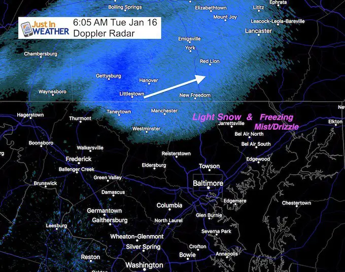
A band of light snow moved through northern Maryland and southern PA this morning. The light coating between Westminster and York seemed to pale in comparison to the light snow and freezing mist and fog in Harford County MD. Not all has been showing up on radar, making it difficult to track. Numerous accidents have been reported… and a 2 Hour school delay was issued there. This is NOT the main event. The Winter Weather Advisory is still in effect tonight and tomorrow morning for light snow that will impact driving. The arrival now appears to be later tonight and lasting into Wednesday morning. More on the timing and snowfall potential below.
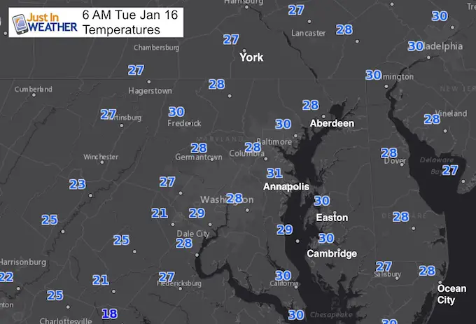
Temperatures This Morning
Stats For January 16
Normal High: 41ºF
Record High: 71ºF in 1953
Normal Low: 24ºF
*Former Record Low:+1ºF in 1893
Snow Record: 7.0″ in 1945
Seasonal Snow To Date (at BWI): 5.2″
Sunrise: 7:24 AM
Sunset 5:09 PM
*Daylight = 1:30 longer than yesterday
*Bay Water Temperature = 32ºF at Thomas Pt. Light House.
Keep In Touch All Winter
Click here to sign up for email alerts…. Just in case you don’t get the post on your social media feed

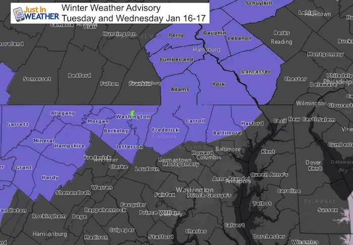
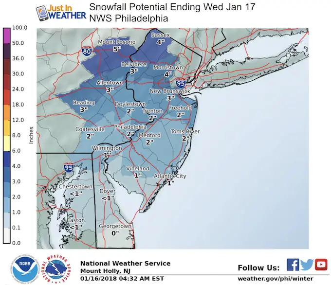
Winter Weather Advisory
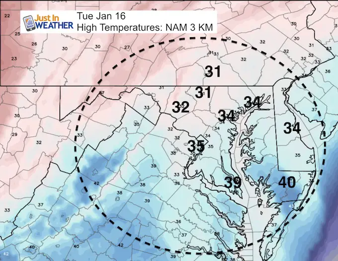
This Afternoon
Temperatures will briefly rise above freeing in metro areas, but will cool down tonight
Snow Timeline
This Evening:
The leading edge of snow will be back into our far northwestern areas to this evening…
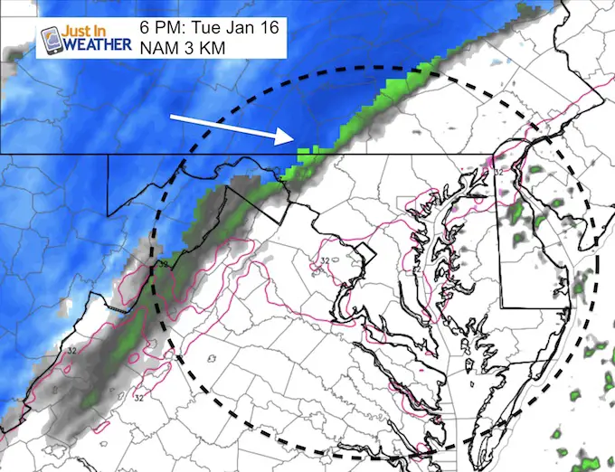
—> slider: Tonight
The arrival of snow in metro areas will be overnight.
[metaslider id=56933]
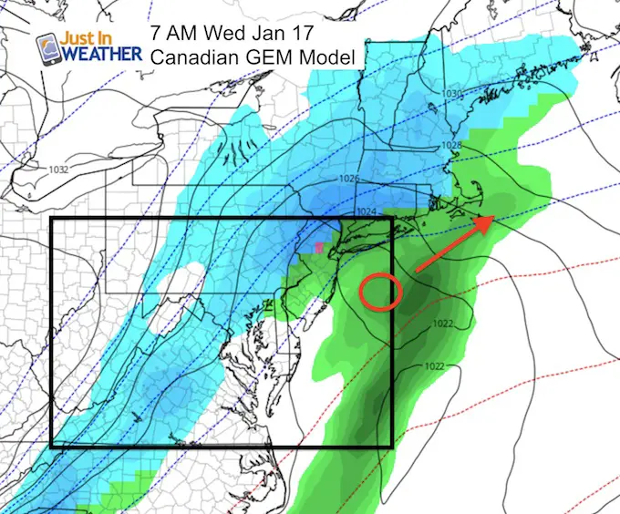
Wednesday Morning
The Canadian Model I showed yesterday is back on the ‘up the coast’ solution. This does linger the snow a little longer on Monday.. but we should see it pulling away between 7 and 10 AM
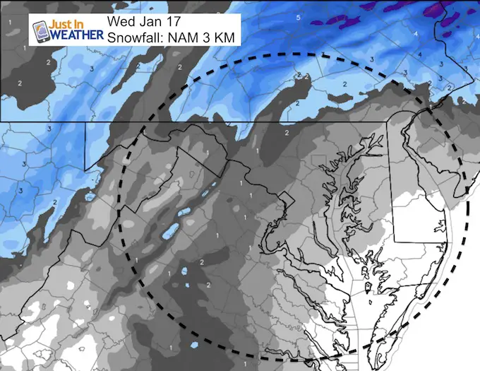
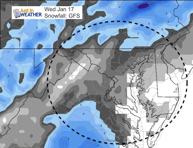
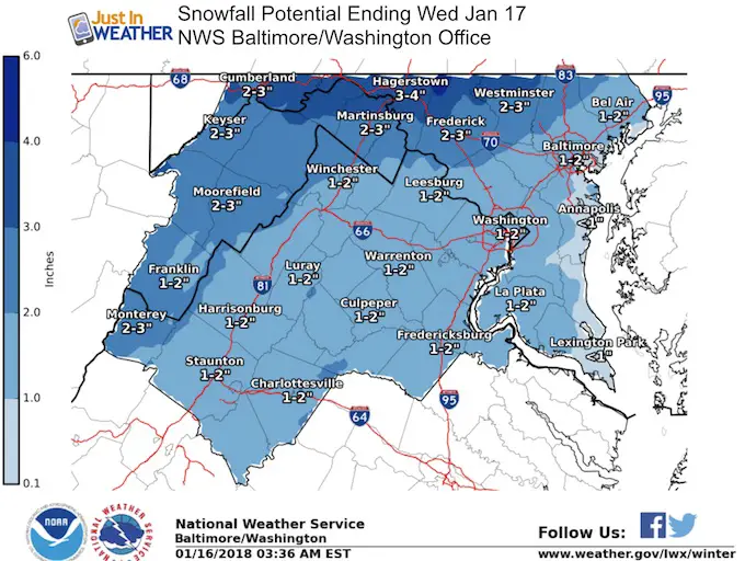
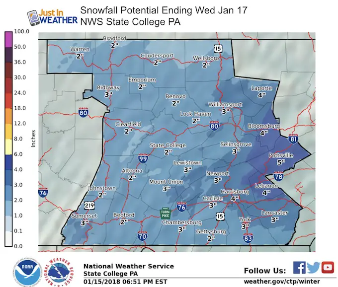
Snow Forecast
My Snowcast:
Compare to the computer models and NWS Zone Maps below
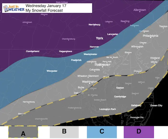
A: Dusting up to 1″
B: Around 1 inch
C: 1 to 2 inches
D: 2 to 4 inches
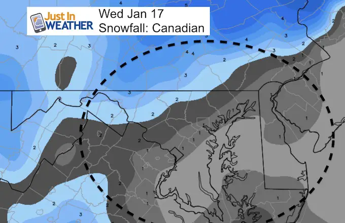
Computer Model Forecast
National Weather Service Forecasts
Shirts
I do these for fun, but also:
A Portion of the proceeds will go to Integrated Wellness programs for Pediatric Oncology Patients
May The Flakes Be With You- Limited Edition Shirt

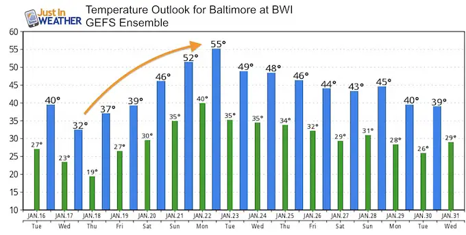
Temperature Outlook:
Another Thaw on the way
Please share your thoughts, best weather pics/video, or just keep in touch via social media
-
Facebook: Justin Berk, Meteorologist
-
Twitter: @JustinWeather
-
Instagram: justinweather
FITF Gear

Snowstix- We Need You To Measure Snow Too
We are giving 10% of each sale to programs that benefit pediatric oncology patients.

 Get the award winning Kid Weather App I made with my oldest son and support our love for science, weather, and technology. Our 3 year anniversary of the release and our contribution to STEM education is this November. It has been downloaded in 60 countries, and works in both temperature scales. With your support we can expand on the fun introduction to science and real weather.
Keep In Touch All Winter
Click here to sign up for email alerts…. Just in case you don’t get the post on your social media feed
Also See:
My Winter Outlook 2017-2018 for more snow
La Nina Formed: What it could mean to our winter
NOAA Winter Outlook: Not The Best But Not The Worst For Snow
Two Farmers Almanacs Winter 2018 Outlooks
Winter Weather Folkore: Suggestions from Animals and Crops
First Frost and Freeze Dates For Maryland (southern PA and northern VA)
My Preliminary Winter Outlook Notes
Low Snow Winters In Baltimore: To Repeat Or Not Repeat
NOAA Ranks Blizzard 2016 4th Worst Snowstorm On Record