 January 4 2018
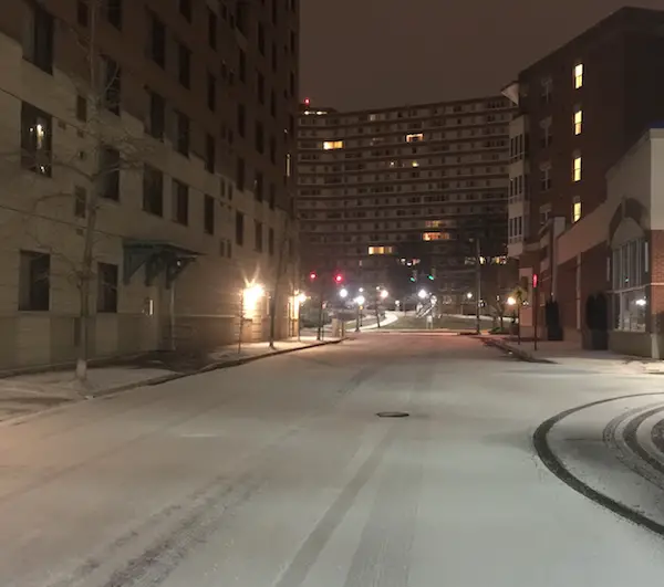
Roads are covered in with snow and ice this morning. This view was in Arlington VA at 2 AM from one of my clients out treating the pavement. The best advise I can give for traveling is that not all roads are the same. Some treated will be wet but could get snow blown over. Plus its cold enough to refreeze quickly. Other roads are just covered and slick. School delays and closings are widespread.
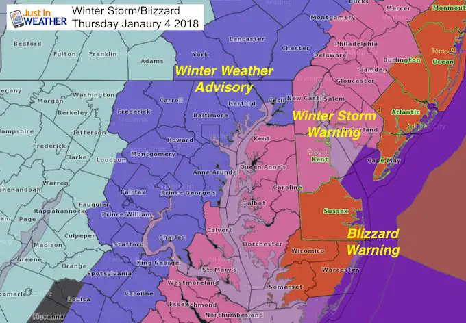
Watches and Warnings
Amazing GOES Satellite
Bombongeneis is the formal term for a storm dropping 24 mb in air pressure in 24 hours. This storm may drop 48 mb in that time frame.
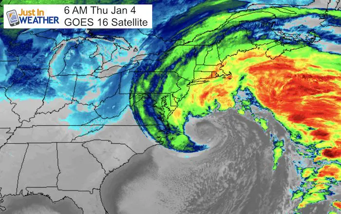
14 Loop from GOES 16
Watch the storm wrap up and bomb out quickly over the past 14 hours.
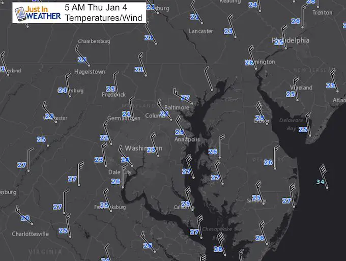
Morning Temperatures
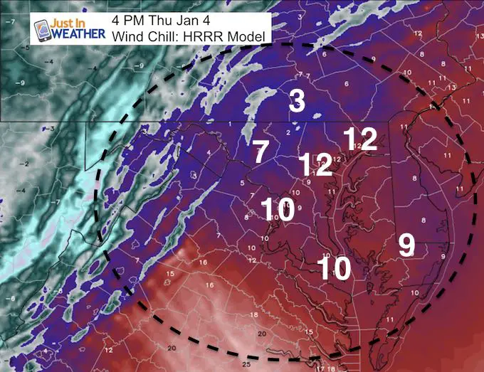
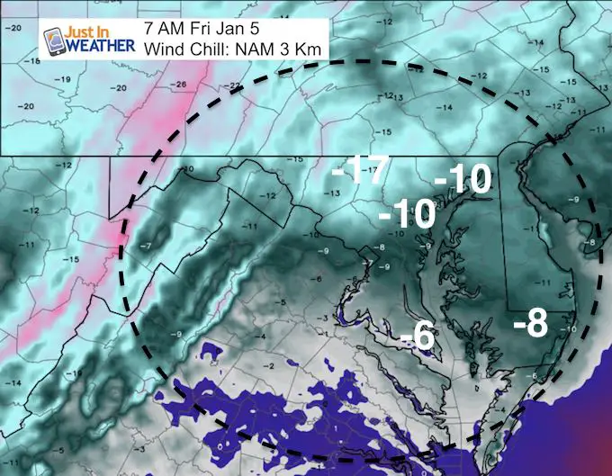
Wind Chills are in the low teens and single digits
Stats For January 4
Normal High: 42ºF
Record High: 70ºF in 2000
Normal Low: 25ºF
Record Low: 4ºF in 1918
Snow Record: 1.8″ in 1980
Sunrise: 7:26 AM
Sunset 4:57 PM
*Daylight = 47 seconds longer than yesterday
*Bay Water Temperature = 36ºF at Thomas Pt. Light House
Seasonal Snow To Date (at BWI): 4.3″
Keep In Touch All Winter
Click here to sign up for email alerts…. Just in case you don’t get the post on your social media feed

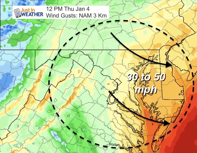
Winds Whip Up During The Morning
‘Near’ blizzard conditions away from the beaches with blowing snow after it stops falling.
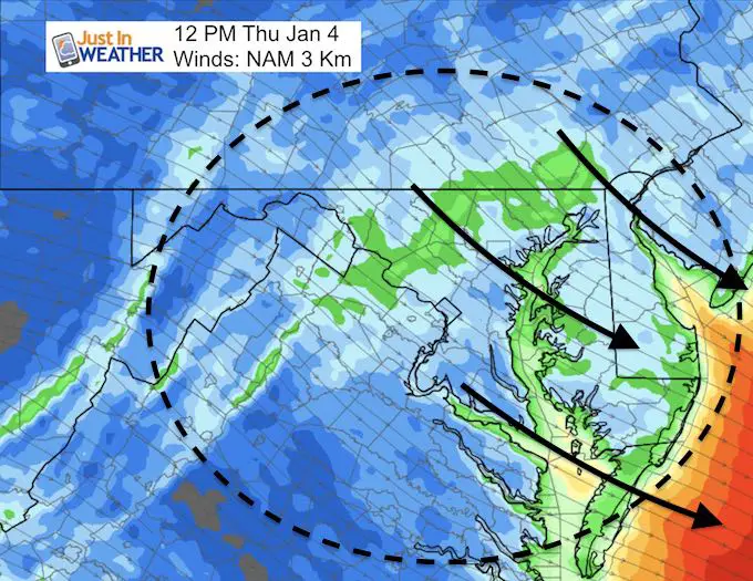
Winds will increase all morning as the snow pulls away
Wind Chills Another Factor
These numbers will be similar from morning to afternoon.
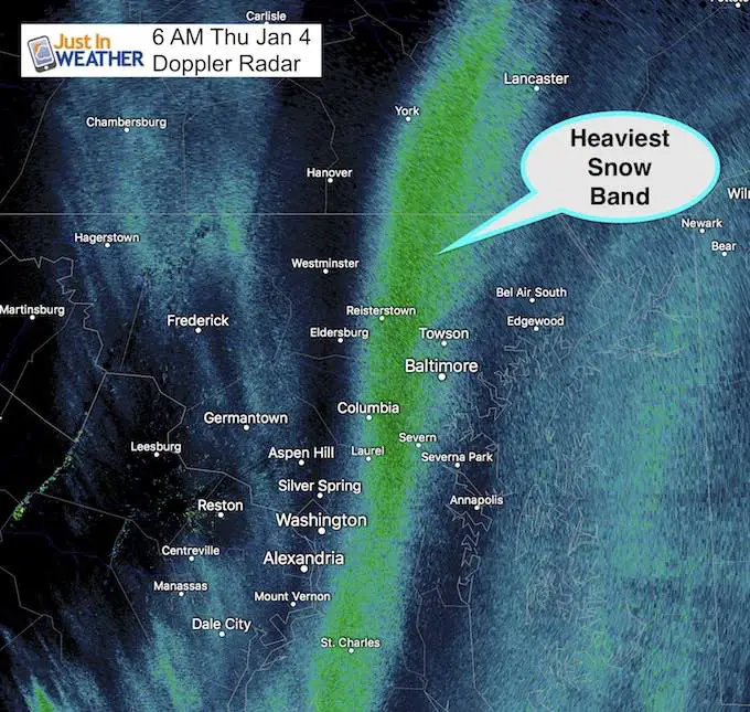
Morning Radar
Doppler Radar may have trouble showing all of the fine snow flakes, but this depiction shows the heaviest snow band. This has been wobbling around the west and west side of I-83 and Baltimore. This helps prove the sharp cutoff mentioned in all the forecasts leading up to this event.
—-> slider: Radar Simulation
[metaslider id=56665]
Snow Amounts
East Gets The Beast, Less West
Here is my snow-cast from yesterday
Please note that a shift of 50 miles west could double your snow totals, while a 50 mile shift east can cut them in half or off all together.
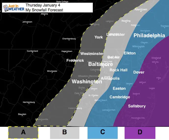
- A: Dusting to 2 Inches
- B: 2 to 4 Inches
- C: 3 to 6 inches
- D: 6 to 12 inches
May The Flakes Be With You
A Portion of the proceeds will go to Integrated Wellness programs for Pediatric Oncology Patients

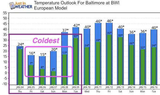
COLD AIR/Wind Chill Advisory Friday To Saturday Morning
Looking Ahead:
Temperature Outlook
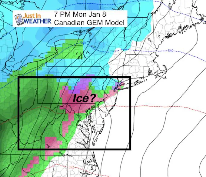
Ice May Arrive With Warmer Air
Keep In Touch All Winter
Click here to sign up for email alerts…. Just in case you don’t get the post on your social media feed
Please share your thoughts, best weather pics/video, or just keep in touch via social media
-
Facebook: Justin Berk, Meteorologist
-
Twitter: @JustinWeather
-
Instagram: justinweather
FITF Gear

Snowstix- We Need You To Measure Snow Too
We are giving 10% of each sale to programs that benefit pediatric oncology patients.

 Get the award winning Kid Weather App I made with my oldest son and support our love for science, weather, and technology. Our 3 year anniversary of the release and our contribution to STEM education is this November. It has been downloaded in 60 countries, and works in both temperature scales. With your support we can expand on the fun introduction to science and real weather.
Keep In Touch All Winter
Click here to sign up for email alerts…. Just in case you don’t get the post on your social media feed
Also See:
My Winter Outlook 2017-2018 for more snow
La Nina Formed: What it could mean to our winter
NOAA Winter Outlook: Not The Best But Not The Worst For Snow
Two Farmers Almanacs Winter 2018 Outlooks
Winter Weather Folkore: Suggestions from Animals and Crops
First Frost and Freeze Dates For Maryland (southern PA and northern VA)
My Preliminary Winter Outlook Notes
Low Snow Winters In Baltimore: To Repeat Or Not Repeat
NOAA Ranks Blizzard 2016 4th Worst Snowstorm On Record
Blizzard 2016 Record Top Snowstorm: Area Totals
Extreme Weather of 2015 balanced out on both ends