Friday Afternoon Snow Update and Tracking: Repost
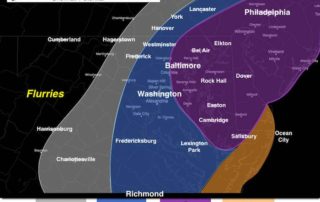
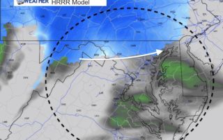
Friday December 15 2017 2 PM (reposted after site crashing) Light snow mixed with some sleet and freezing temperatures. That what we finally settled on and it has shown itself.
Friday December 15 2017 2 PM (reposted after site crashing) Light snow mixed with some sleet and freezing temperatures. That what we finally settled on and it has shown itself.
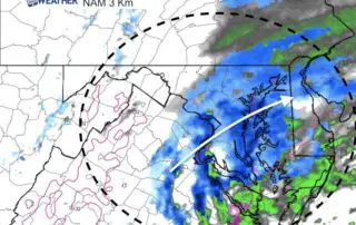
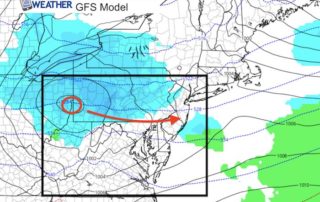
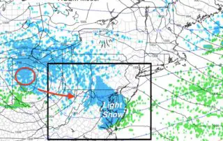
December 15 2017 10 AM (reposted after site crash) The small winter event on the way is causing big problems. First, the timing of the worst impact will be during

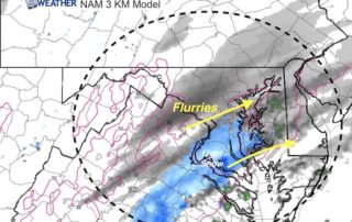
Friday December 15 This is the third light event that seemed to ramp up right right before reaching us. The trend is for us to get these systems to over
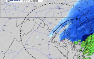
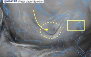
Thursday December 14 2017 at 10:10 PM Looking at the maps tonight, I have to draw back on one basic rule of meteorology I learned back in college: The trend
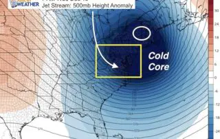
Thursday December 14 This active weather pattern has one more burst of snow up its sleeve. This one will be an upper level feature or jet streak that develops over
Wednesday December 13 The clipper on the move will arrive with some flurries and snow showers by evening. The tricky part of this forecast is plotting a fast moving upper
Wednesday December 13 2017 It's really cold outside! The arctic air is undeniable as temperatures have dropped into the teens and lower 20s with wind chills in the single digits.
December 12 2017 The system on the move this morning brought wintry weather as close as Harrisburg PA, but the warm air did hang on for us. Do not be
Monday December 11 The clipper system racing across the northern Plains and Great Lakes looks impressive on satellite. This has expanded the snow region and something I mentioned last night
December 11 2017 We had some flurries overnight that you may have slept through, but it shows the atmosphere is ready. There next event will be more of a wintry