 Friday December 15
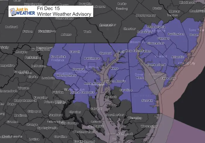
This is the third light event that seemed to ramp up right right before reaching us. The trend is for us to get these systems to over achieve and that is the case this time. We have a similar set up to what we had last weekend, but with colder air and ground that means a rough afternoon for traveling. Temperatures stay below freezing and there will be stickage during the day. A Winter Weather Advisory has been issued for central Maryland and Delaware from 1 PM to 7 PM. Snow covered roads will be an issue getting kids and yourself home today.
I now believe York and Lancaster Counties in PA should be considered for possible road issues as well. While there is no advisory here, treat this the same way as metro Baltimore. Also, southern Maryland will be cold enough for snow to stick on the roads. That includes Lexington Park to Easton, Cambridge… and Salisbury. The Delmarva will have problems lasting longer due to snow falling into the evening hour.
I spoke with Charlie Brinton of McDonogh School and they closed in anticipation of rough roads that their buses and large coverage area can’t cover. This could be a logistic headache for many this afternoon. Please plan ahead. Just a little snow at the wrong time can be a big problem.
Stats For December 15
Normal High: 45ºF
Record High: 70ºF in 1971
Normal Low: 28ºF
Record Low: 9ºF in 1962
Snow Record: 5.7″ in 1905
Sunrise: 7:19 AM
Sunset 4:45 PM
*Bay Water Temperature = 45ºF at Thomas Pt. Light House
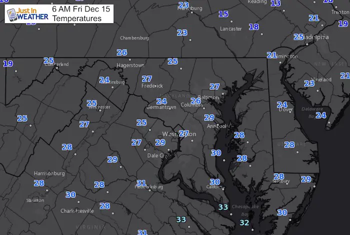
6 AM Temperatures
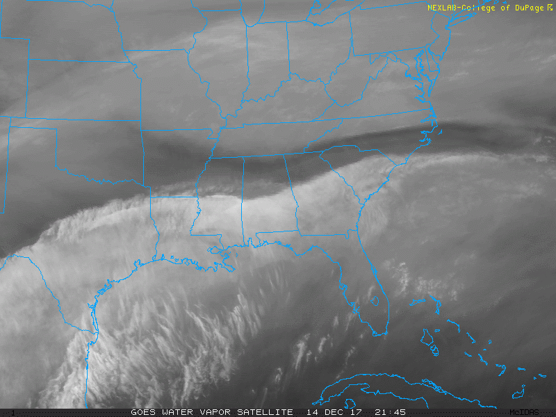
Satellite: Water Vapor 24 Hour Loop
Notice the push of moisture to the north. This is a similar set up to what we had last weekend.
—> slider: Radar Simulation
Note: This will be developing on top of us. So we can’t track the forward push much before 10 or 11 AM. Then watch it evolved and increase during the afternoon. This is similar to how last Saturday played out… just colder.
- Metro Washington to Baltimore : Flurries begin 11 AM to 1 PM. Steady snow until 5 PM
- The northern edge will reach near York PA , but high cut off near Frederick and Hagerstown for the coating.
- Similar to last Saturday, this will enhance during the mid to late afternoon.
- Lasting into the evening on Delmarva. Their problems will be after 3 PM through 8 PM.
[metaslider id=55811]
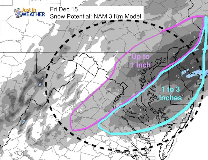
Snow Total Potential:
- Metro Washington, Annapolis, Baltimore up to York PA = Around 1 inch with some spots up to 2 inches
- Less west near Frederick
- Souther Maryland = 1 to 2 inches
- Eastern Shore/Delmarva = 1 to 3 inches
Faith in the Flakes Online Store
FITF Gear
We can promise all apparel orders in by midnight Friday will be delivered before Christmas.
Click here or see the shop below
- Bulk Orders over $299 get 15%- Use Promo Code friendsbofjb
- Free Shipping to orders over $199- Use Promo Code shipmefree

Snowstix- We Need You To Measure Snow Too
We are giving 10% of each sale to programs that benefit pediatric oncology patients.

 Get the award winning Kid Weather App I made with my oldest son and support our love for science, weather, and technology. Our 3 year anniversary of the release and our contribution to STEM education is this November. It has been downloaded in 60 countries, and works in both temperature scales. With your support we can expand on the fun introduction to science and real weather.
Please share your thoughts, best weather pics/video, or just keep in touch via social media
-
Facebook: Justin Berk, Meteorologist
-
Twitter: @JustinWeather
-
Instagram: justinweather
Keep In Touch All Winter
Click here to sign up for email alerts…. Just in case you don’t get the post on your social media feed
Also See:
My Winter Outlook 2017-2018 for more snow
La Nina Formed: What it could mean to our winter
NOAA Winter Outlook: Not The Best But Not The Worst For Snow
Two Farmers Almanacs Winter 2018 Outlooks
Winter Weather Folkore: Suggestions from Animals and Crops
First Frost and Freeze Dates For Maryland (southern PA and northern VA)
My Preliminary Winter Outlook Notes
Low Snow Winters In Baltimore: To Repeat Or Not Repeat
NOAA Ranks Blizzard 2016 4th Worst Snowstorm On Record
Blizzard 2016 Record Top Snowstorm: Area Totals
Extreme Weather of 2015 balanced out on both ends