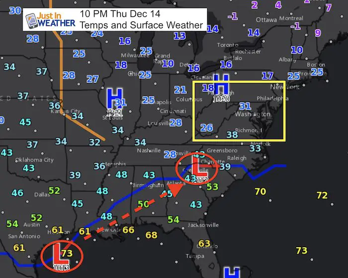
Thursday December 14 2017 at 10:10 PM
Looking at the maps tonight, I have to draw back on one basic rule of meteorology I learned back in college: The trend if your friend. We are in a pattern where these little systems not only appear to shift to impact central Maryland, but they over achieve. We have anther little system but it looks quite familiar. The other brach of the jet stream is active and making a move to the north. There will be a weak Low Pressure forming along the coast plus a jet streak aloft that will spread light snow in our region by lunchtime Friday.
The difference is that temperatures have been cold. The ground has chilled quite a bit this week and the air will likely stay near or below freezing all day Friday. So when I would normally point to the solar influence, we have the lower sun angle (week) of the year. Basically, light snow could cause a big headache.
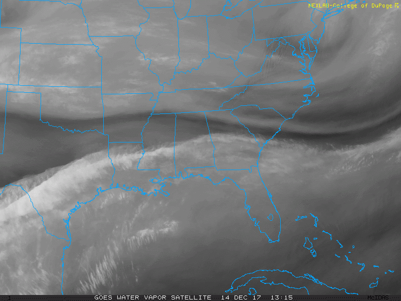
Here is the upper level system this evening. I’ve highlighted the region to focus on. Watch the animated water vapor loop below and see the shift to the north…
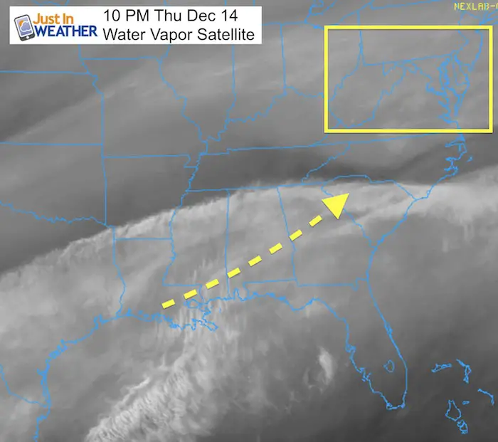
24 Hour Water Vapor Loop
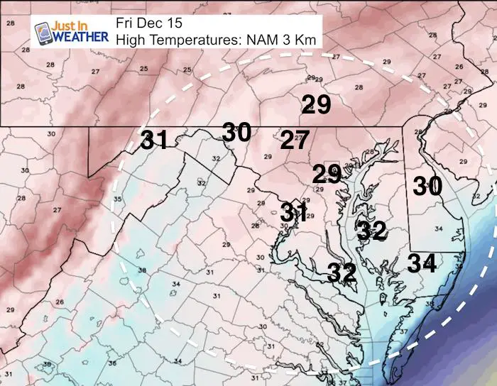
Snowy Friday:
This looks like a late morning development of flurries and then light snow through the afternoon.
High Temperatures will remain cold enough to support stickage
—> slider: Radar Simulation
- Metro Washington to Baltimore could get a coating of snow and should see it end by 4 PM
- The northern edge might be near York PA and Hagerstown/Frederick.
- Similar to last Saturday, this may enhance during the mid to late afternoon.
- Lasting into the evening on Delmarva. Their problems will be after 3 PM through late evening
[metaslider id=55778]
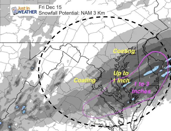
Snow Total Potential:
- Metro Washington and Baltimore = A coating
- Less up near the PA line and west of Frederick
- Annapolis = a litte more
- Souther Maryland = 1 to 2 inches
- Eastern Shore/Delmarva = 1 to 3 inches
Faith in the Flakes Online Store
FITF Gear
We can promise all apparel orders in by midnight Friday will be delivered before Christmas.
Click here or see the shop below
- Bulk Orders over $299 get 15%- Use Promo Code friendsbofjb
- Free Shipping to orders over $199- Use Promo Code shipmefree

Snowstix- We Need You To Measure Snow Too
We are giving 10% of each sale to programs that benefit pediatric oncology patients.

 Get the award winning Kid Weather App I made with my oldest son and support our love for science, weather, and technology. Our 3 year anniversary of the release and our contribution to STEM education is this November. It has been downloaded in 60 countries, and works in both temperature scales. With your support we can expand on the fun introduction to science and real weather.
Please share your thoughts, best weather pics/video, or just keep in touch via social media
-
Facebook: Justin Berk, Meteorologist
-
Twitter: @JustinWeather
-
Instagram: justinweather
Keep In Touch All Winter
Click here to sign up for email alerts…. Just in case you don’t get the post on your social media feed
Also See:
My Winter Outlook 2017-2018 for more snow
La Nina Formed: What it could mean to our winter
NOAA Winter Outlook: Not The Best But Not The Worst For Snow
Two Farmers Almanacs Winter 2018 Outlooks
Winter Weather Folkore: Suggestions from Animals and Crops
First Frost and Freeze Dates For Maryland (southern PA and northern VA)
My Preliminary Winter Outlook Notes
Low Snow Winters In Baltimore: To Repeat Or Not Repeat
NOAA Ranks Blizzard 2016 4th Worst Snowstorm On Record
Blizzard 2016 Record Top Snowstorm: Area Totals
Extreme Weather of 2015 balanced out on both ends