 Wednesday December 13
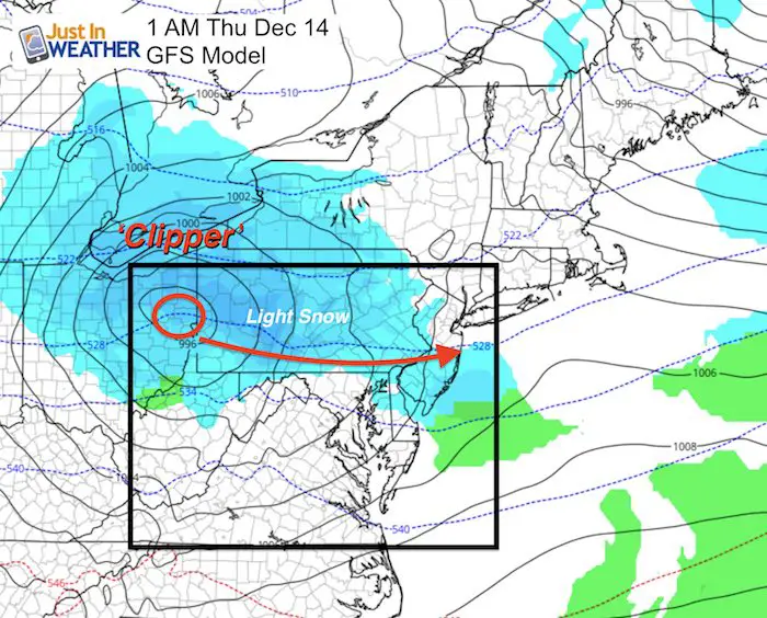
The clipper on the move will arrive with some flurries and snow showers by evening. The tricky part of this forecast is plotting a fast moving upper level storm that is expected to track right along the Pennsylvania and Maryland line. This puts the classic ‘north and west’ pattern into play. You know the areas that often are colder and get more snow… That is where this is likely to snow. The hourly plots from the radar simulation are blow.
This snow is only going to amount to a coating, maybe up to 1 inch in spots. But most of us stay below freezing today while wind chills struggle to get out of the teens. The ground is sufficiently cold for stockage. The timing may impact some late day school/sport activities, but should be done overnight. WE could get some leftover snow flurries to spread farther in the morning, but no accumulation expected.
This area this evening includes the western Maryland mountains through Frederick, maybe near Mt Airy, then northern Carroll, Baltimore, Harford, and Cecil Counties… plus most of Pennsylvania.
If this has tracked a little south, along I-70 then that would have put more of metro Baltimore into play. But the topography plays a role in where the snow will want to go.
Satellite: 24 Hour Loop

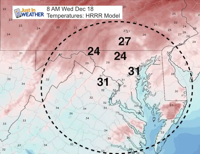
Temperatures
—> slider: Radar Simulation
The main light snow will be north of I-70, but flurries or a light shower could fall across the rest of the region. Temps will be above freezing near the Bay and eastward.
[metaslider id=55676]
Faith in the Flakes Online Store
PJ bottoms still inside out- They have to be to help bring on the snow.

Snowstix- We Need You To Measure Snow Too
We are giving 10% of each sale to programs that benefit pediatric oncology patients.

 Get the award winning Kid Weather App I made with my oldest son and support our love for science, weather, and technology. Our 3 year anniversary of the release and our contribution to STEM education is this November. It has been downloaded in 60 countries, and works in both temperature scales. With your support we can expand on the fun introduction to science and real weather.
Please share your thoughts, best weather pics/video, or just keep in touch via social media
-
Facebook: Justin Berk, Meteorologist
-
Twitter: @JustinWeather
-
Instagram: justinweather
Keep In Touch All Winter
Click here to sign up for email alerts…. Just in case you don’t get the post on your social media feed
Also See:
My Winter Outlook 2017-2018 for more snow
La Nina Formed: What it could mean to our winter
NOAA Winter Outlook: Not The Best But Not The Worst For Snow
Two Farmers Almanacs Winter 2018 Outlooks
Winter Weather Folkore: Suggestions from Animals and Crops
First Frost and Freeze Dates For Maryland (southern PA and northern VA)
My Preliminary Winter Outlook Notes
Low Snow Winters In Baltimore: To Repeat Or Not Repeat
NOAA Ranks Blizzard 2016 4th Worst Snowstorm On Record
Blizzard 2016 Record Top Snowstorm: Area Totals
Extreme Weather of 2015 balanced out on both ends