 Wednesday December 13 2017
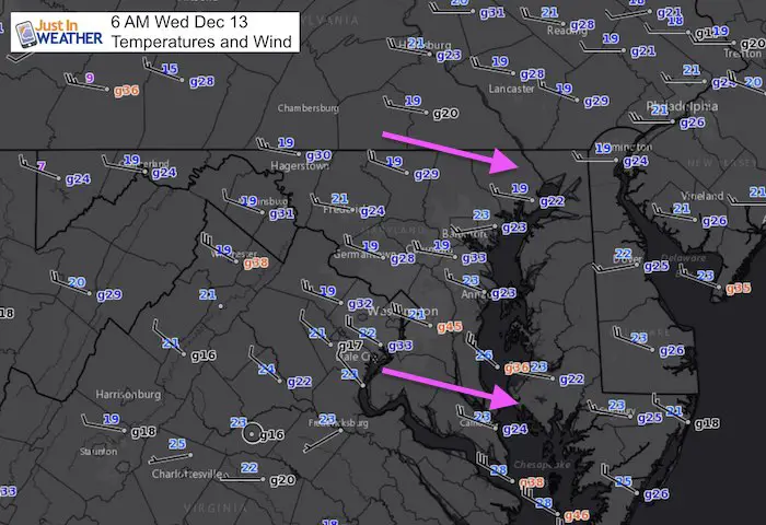
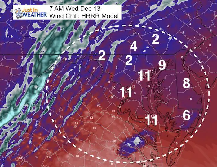
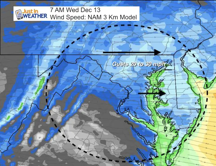
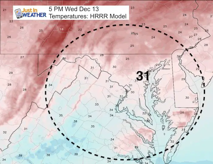
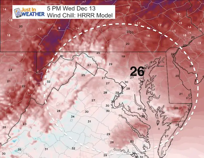
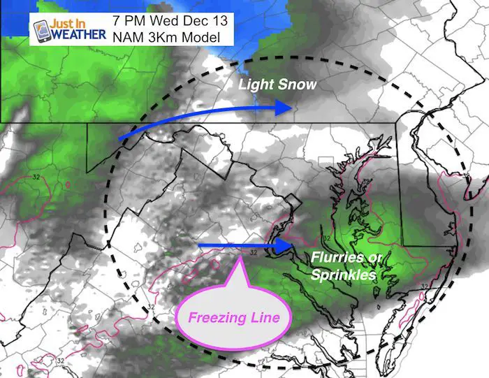
It’s really cold outside! The arctic air is undeniable as temperatures have dropped into the teens and lower 20s with wind chills in the single digits. Wind gusts between 20 and 30 mph not only make it colder, but prompted restrictions on area bridges. The cold stays with us all day, and there will be some flurries later. If you are holding out for snow, it appears as if the old pattern style is back: More snow north and west of Baltimore.
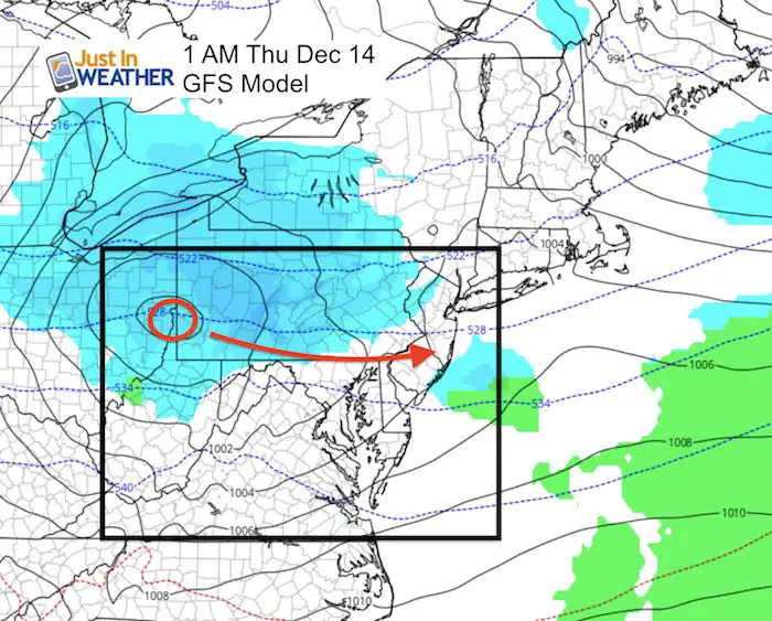
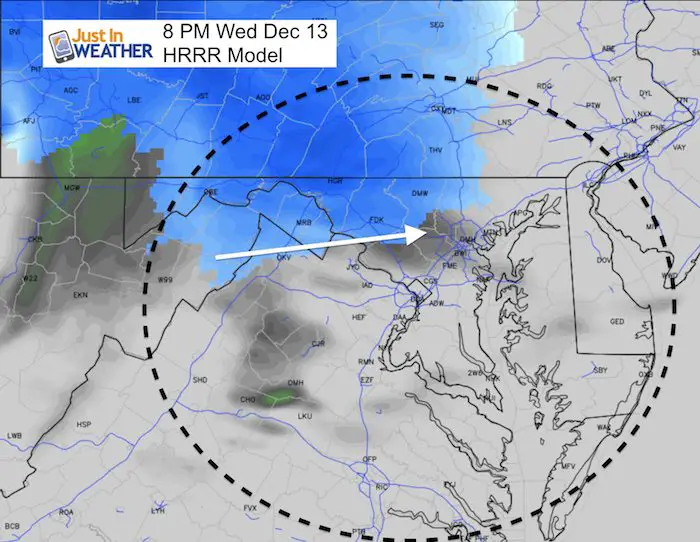
Tonight’s event looks like a non issue locally as the best chance for a coating of snow or more will be well north near the PA line and into York County. This return of pushing systems more east also breaks up the Friday chance. However if we apply that next week, the event that shows up as rain now may hold out for more snow. Yes, there is a limited mild trend in between, but we will get cold again by Christmas.
Stats For December 13
Normal High: 46ºF
Record High: 72ºF in 2015
Normal Low: 29ºF
Record Low: 8ºF in 1960
Snow Record: 7.6″ in 1966
Sunrise: 7:18 AM
Sunset 4:44 PM
*Bay Water Temperature = 46ºF at Thomas Pt. Light House
Click here to see: The December 9 Snow Report
Keep In Touch All Winter
Click here to sign up for email alerts…. Just in case you don’t get the post on your social media feed
This Morning: Bitter Winds
Afternoon
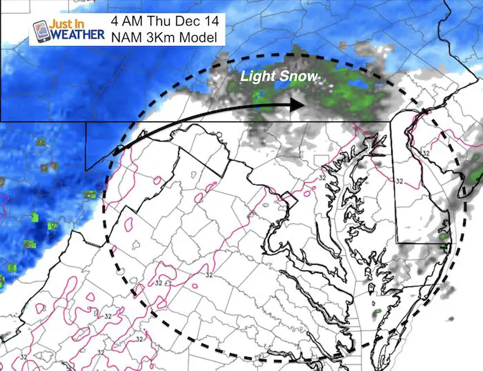
Light Snow?
The consensus is to keep the bulk of snow chances north due to the clipper tracking cross the PA line. If this has shifted 50 to 100 miles south, it would have spread much more into central Maryland. Instead the mountains will direct this north. But the same error applied to next week’s system shows promise for anther chance of snow even though it shows rain now. See that below.
Faith in the Flakes Online Store
PJ bottoms still inside out- They have to be to help bring on the snow.

Animated Outlook
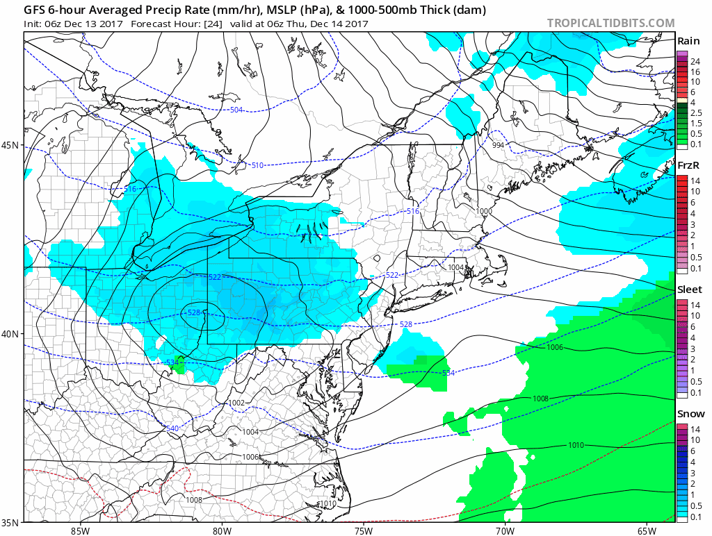
The likely shift to the east has limited the snow chance tonight and will keep the next system off the coast with little chance to develop. Look to next week for a rain system that would bring more snow chance if this tracks east as well. Something to watch and see if we can anticipate the model error.
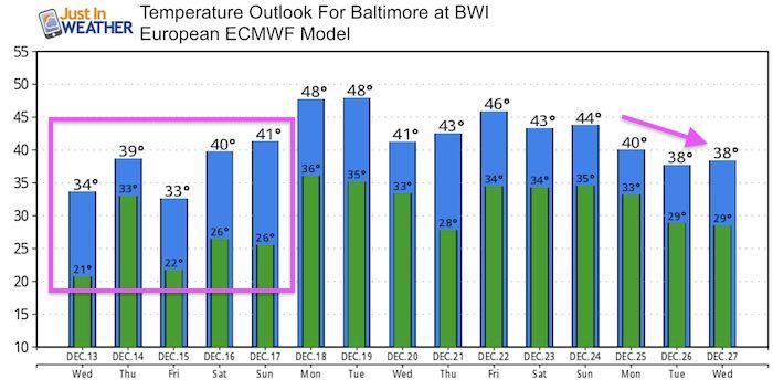
Temperature Outlook
Temperatues trend a little milder this weekend. Just a relaxation of the pattern before resetting the cold to arrive around Christmas.
Snowstix- We Need You To Measure Snow Too
We are giving 10% of each sale to programs that benefit pediatric oncology patients.

 Get the award winning Kid Weather App I made with my oldest son and support our love for science, weather, and technology. Our 3 year anniversary of the release and our contribution to STEM education is this November. It has been downloaded in 60 countries, and works in both temperature scales. With your support we can expand on the fun introduction to science and real weather.
Please share your thoughts, best weather pics/video, or just keep in touch via social media
-
Facebook: Justin Berk, Meteorologist
-
Twitter: @JustinWeather
-
Instagram: justinweather
Also See:
My Winter Outlook 2017-2018 for more snow
La Nina Formed: What it could mean to our winter
NOAA Winter Outlook: Not The Best But Not The Worst For Snow
Two Farmers Almanacs Winter 2018 Outlooks
Winter Weather Folkore: Suggestions from Animals and Crops
First Frost and Freeze Dates For Maryland (southern PA and northern VA)
My Preliminary Winter Outlook Notes
Low Snow Winters In Baltimore: To Repeat Or Not Repeat
NOAA Ranks Blizzard 2016 4th Worst Snowstorm On Record
Blizzard 2016 Record Top Snowstorm: Area Totals
Extreme Weather of 2015 balanced out on both ends