Winter Storm Watch Expanded And My First Look At Snow And Ice Wednesday
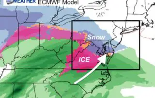
Monday February 18 2019 The Winter Storm Watch now includes all counties west of the Chesapeake Bay and Susquehanna River in our region. The timing across the area varies as
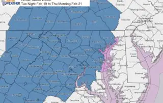
Monday February 18 2019 The Winter Storm Watch now includes all counties west of the Chesapeake Bay and Susquehanna River in our region. The timing across the area varies as
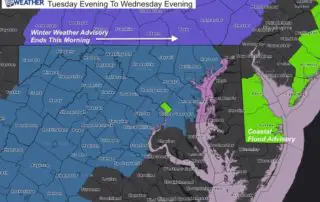
Monday February 18 2019 The big story is the Winter Storm Watch issued in central Maryland (there will be other areas to follow). The statement has it Tuesday evening to
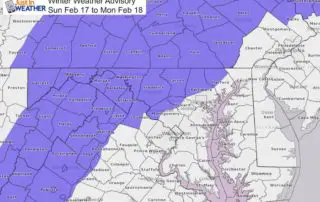
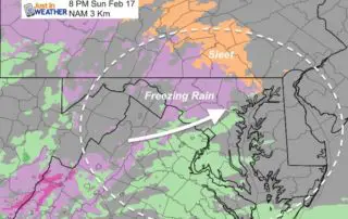
Sunday February 17 2019 Cold air has returned this morning and we will be right on the edge of that air mass as the next system arrives this evening. A
Saturday February 16 2019 The system today is passing to the south with rain and some snow mixed in crossed the very southern edge of Maryland. Meanwhile in the sun,
Saturday February 16 2019 Today is the anniversary of the second largest February single day snow. The super storm of 2003 dropped 21.8" of snow on Baltimore on this date.
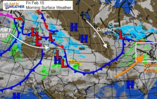
Friday February 15 2019 I was downplaying the snow on Saturday and now it appears even southern Maryland will get less. The warm air today will be replaced by a
February 14 2019 We finally started to turn mild on this Valentines Day afternoon, and a big warm up is expected tomorrow. The snow is still set for this weekend,
Wednesday February 13 2019 The last week has been very active with winter weather events, and we are not done yet. I realize that with the over achiever snow and
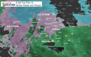
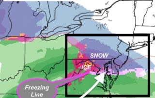
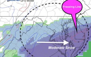
Tuesday February 12 2019 The areas under a Winter Storm Warning are still below freezing as of 6 AM. The freezing line is slowly pushing north and there is a
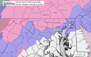
Monday Night Update February 11 2019 A Winter Storm Warning is now in effect for the northern and western suburbs of Baltimore. This follows what we have been talking about