Winter Storm Warning Radar Timeline And New Model Snow Totals
January 30 2021 Winter Storm Warnings were upgraded across much of the area this afternoon. This confirms the reality of a moderate to high impact snow event. This will be
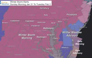
January 30 2021 Winter Storm Warnings were upgraded across much of the area this afternoon. This confirms the reality of a moderate to high impact snow event. This will be
Saturday Morning January 3 2021 The stage is set with cold air and a two part snow storm. If you have Faith in the Flakes or even some doubt: It
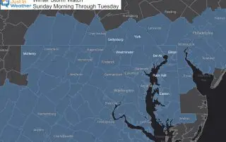
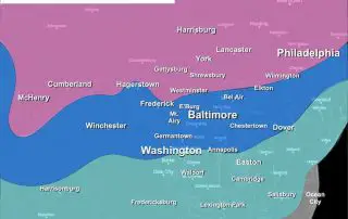
Friday Evening January 29 2021 A Winter Storm Watch was first issued for central Maryland, however some colder counties were left out. Those have since filled in with more agreement
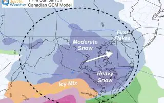
Friday January 29 2021 It will snow on Sunday! FITF! Before jumping in to the storm arrival, we should look at the cold air in place today. Arctic air continues
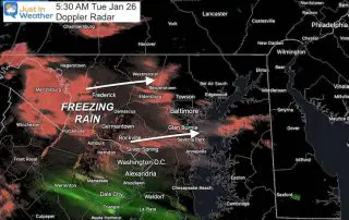
Tuesday January 26 2021 This winter weather event has been light, but jut enough to cause a problem. The snow primarily was less than 1 inch, but covered a broad
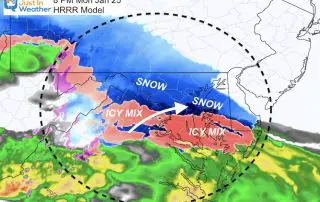
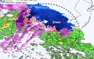
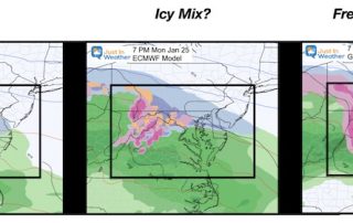
Monday January 25 2021 Evening Update As the snow and wintry mix move in this evening, I've prepared a new update with simulations for temperatures and radar. The atmosphere is
The winter weather is on target to move in this evening and all is working according to plan. The one update is that the set up is colder, which makes
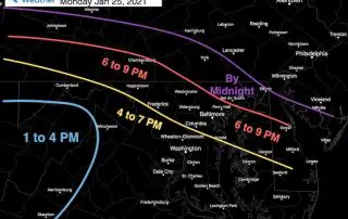
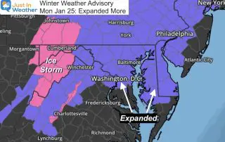
January 24 2021 The winter event on the way will bring snow, sleet, freezing rain, and rain. In this post I’ve included my expected arrival time, a radar simulation slider,
Sunday January 24 2021 This morning starts in the deep freeze for much of our region, but we remain dry to finish the weekend. This cold air is important to
January 22 2021 The first winter weather event early next week appears to be set up to arrive Monday afternoon and last into Tuesday. After our cold weekend, the ground