Weekend Storm Timeline For Rain Snow And Cold Wind
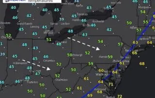
Saturday October 28 There is a distinct line of rain this morning from the Great Lakes to the Gulf Coast. The back side shows a band of snow around Indianapolis
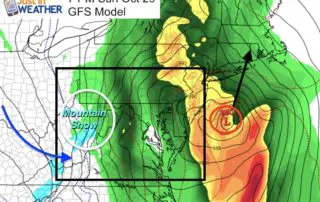
Saturday October 28 There is a distinct line of rain this morning from the Great Lakes to the Gulf Coast. The back side shows a band of snow around Indianapolis
Friday October 27 Widespread 30s this morning has expanded the frost across a large area. If you park your car outside in areas (away from the Bay), you might want
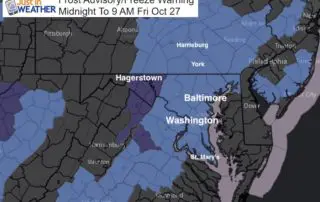
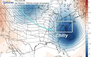
Thursday October 26 We wake up to morning showers and finish the day with a Frost Advisory and Freezing Warning. Colder air is on the way but then a quick
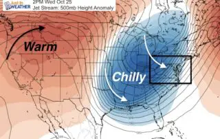
Wednesday October 25 A strong cold front moved through yesterday but we had another 70 degree day. Say goodbye to that for a while. Today will be close to 'normal'
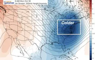
Monday October 23, 2017 Warm weather for two more days, then we get into a real chilly pattern that will want to stay this time. Yes, this faux fall is
Friday October 20 Do you remember the first frost we had a few mornings ago? That is not the case today. Temperatures are back into the mid 40s and 50s,
Thursday October 19, 2017 Today marks a unique day on the calendar pointing out how extreme weather can change from one end to the other across one year. On October
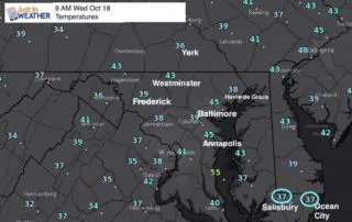
Wednesday October 18 The Frost Advisory this morning may not have been expanded east enough. While local temperatures are actually a degree or two warmer than yesterday, the chilly air
Monday October 16 After a weekend with temps in the 70s, a little bit of rain marks the cool down on this Monday. The rain will slip south and mostly
Friday October 13 2017 This morning is once again cool and damp. The wind from the east will continue to bring in Atlantic moisture, keeping us cloudy with drizzle and