 Friday October 13 2017
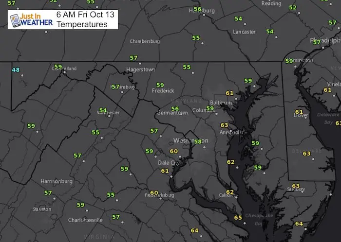
This morning is once again cool and damp. The wind from the east will continue to bring in Atlantic moisture, keeping us cloudy with drizzle and light rain showers at any point. Not much adjustment in the temperature this afternoon. So perhaps Friday the 13th is good for those that are tired of the late season heat. This will linger into Saturday with sone warming. Sunday is the pick of the weekend to be outside. Note that summer heat will return for a day, then will be replaced by another cool down back early next week. In the Atlantic, the eyes remain on the eye of Hurricane Ophelia that is still strong and moving in the direction of a landfall on Ireland. See more below
Stats For October 13
Normal High: 68ºF
Record High: 89ºF in 1954
Normal Low: 46ºF
Record Low: 32ºF in 2006
Sunrise: 7:15 AM
Sunset 6:30 PM
Sign up for email updates on new posts
Since you may miss some posts via social media, click here for email alerts as a way to make sure you don’t miss any. *You may have to refresh that page once for your browser to clear out the images.
Forecast Animation
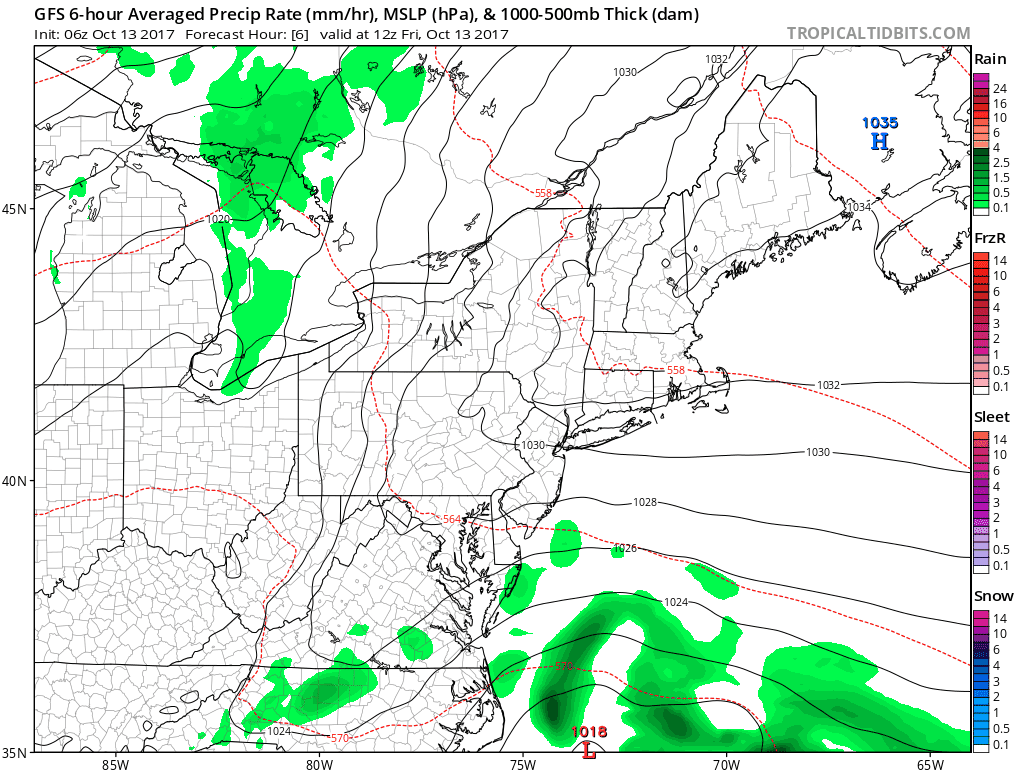
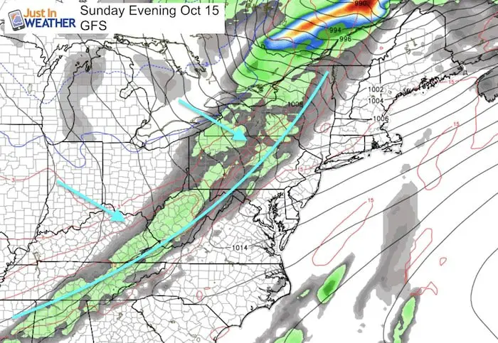
Drizzle and light rain will not show up well on radar, but the cold front arriving Sunday evening will be clearly marked. However the rain band will be weakening as it moves through the mountains.
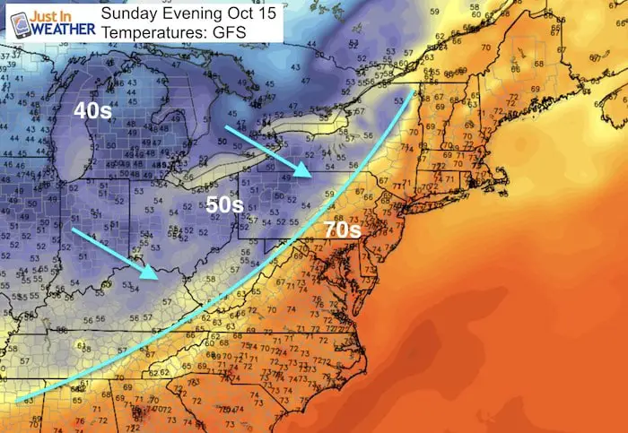
Sunday Evening Set Up
The high temperatures will reach into the mid 80s. Here in the evening we can see the 70s replaced by 50s and 40s on the other side of that cold front.
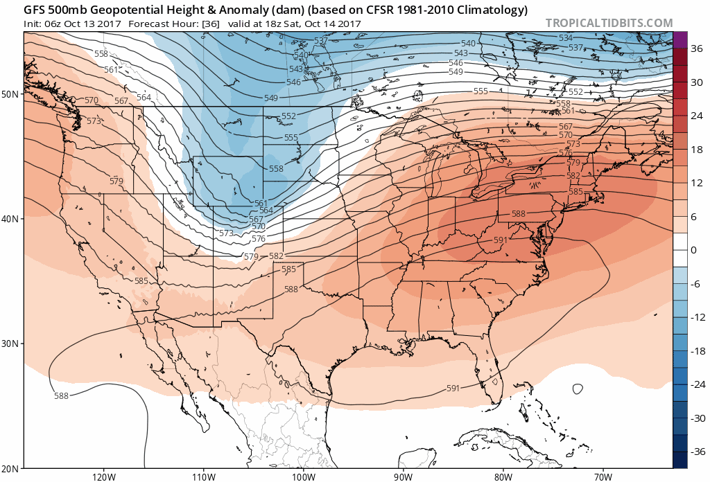
Jet Stream
The cool trough that arrives early next week will not last very long. However the cold will be building out west and eventually shift our way. I see the cold holding for us by the last week of October.
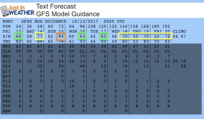
Temperature Outlook
Here is a the text output from the GFS Model. I tried to block out the additional data to focus on the high temperatures (based at BWI in Baltimore)
 Get the award winning Kid Weather App I made with my oldest son and support our love for science, weather, and technology. Our 3 year anniversary of the release and our contribution to STEM education is this November. It has been downloaded in 60 countries, and works in both temperature scales. With your support we can expand on the fun introduction to science and real weather.
Hurricane Ophelia
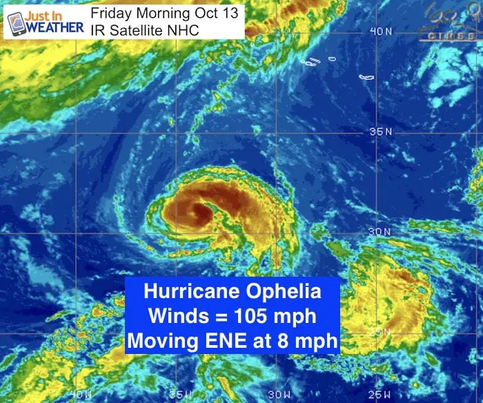
SUMMARY OF 500 AM AST…0900 UTC…INFORMATION
———————————————-
LOCATION…31.1N 33.9W
ABOUT 615 MI…995 KM SW OF THE AZORES
MAXIMUM SUSTAINED WINDS…105 MPH…165 KM/H
PRESENT MOVEMENT…ENE OR 70 DEGREES AT 8 MPH...13 KM/H
MINIMUM CENTRAL PRESSURE…970 MB…28.65 INCHES
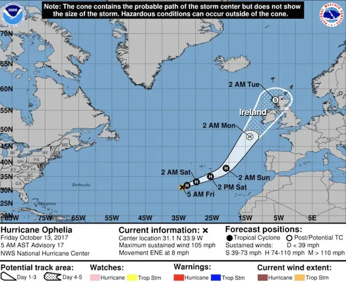
National Hurricane Center Forecast Track
The expectation still puts the hurricane on the western Ireland coast Monday noon to 2 PM local time (morning for the eastern US). I will have a follow up report later this morning. Click here to see my full report.
Trust in this Bust- Limited Edition Shirt
This is not a forecast, but a fundraiser for breast cancer research at BCRF- the highest rated cancer research charity. This soft Bella T-Shirt is to promote the strength of the ‘good bust’ and the heart that beats strong beneath it. Proceeds will be donated in honor of my mother Linda Berk, a 3-time breast cancer survivor. Click on the shirt image to join us.

Please share your thoughts, best weather pics/video, or just keep in touch via social media
-
Facebook: Justin Berk, Meteorologist
-
Twitter: @JustinWeather
-
Instagram: justinweather