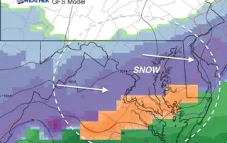
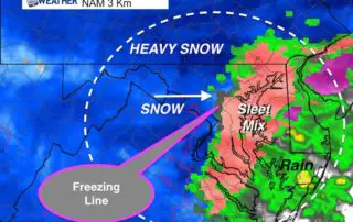
Fine Tuning Saturday Snow and Sunday Record Cold
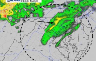
Thursday April 5 2018 The winds have been roaring overnight and restrictions are in place on area bridges this morning with gusts still to 30 mph. Overall this is setting
Thursday April 5 2018 The winds have been roaring overnight and restrictions are in place on area bridges this morning with gusts still to 30 mph. Overall this is setting
A Wind Advisory is in place for most of our are today, but this was upgraded to a High Wind Warning in Pennsylvania where gusts could reach 60 mph. We
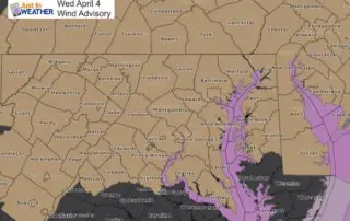
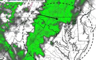
Tuesday April 3 2018 A Wind Advisory in effect for most of our region for most of the day on Wednesday. The lower Eastern Shore will miss the worst of
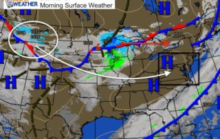
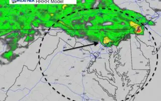
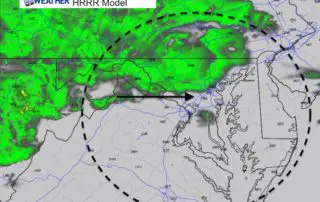
Tuesday April 3 2018 We are stuck right on the edge of warm air that will briefly reach us, but that will keep us on the track for rain. Today,
Saturday March 31 2018 March started as a lion and is going out like a lamb. The good news is that the temperatures this weekend will be close to average
Thursday March 29 2018 Dense Fog across the area this morning is a signal that the chilly damp air is trying to get pushed out. Visibility is under 0.25 mile
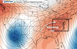
March 28 2018 One week ago we had our largest snow storm of the season. Now are setting the stage for a big warm up to time out perfectly with
Monday March 26 2018 A chilly morning has many of us below freezing, and the afternoon will remain below average. This week will bring back warmer temperatures, but also an
Friday March 23 2018 The snow pack on the ground is helping to refrigerate the atmosphere and we will remain in the daytime thaw/nighttime freeze cycle into the weekend. The
March 21 2018 With a Winter Storm Warning across our entire region we can expect significant snow most of the day. Tuesdays snow totals range from only 0.2" at BWI