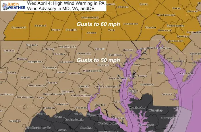
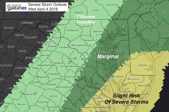
A Wind Advisory is in place for most of our are today, but this was upgraded to a High Wind Warning in Pennsylvania where gusts could reach 60 mph. We have a very volatile set up today with rapidly changing conditions. A Dense Fog Advisory this morning as cool damp air and low visibility are being squeezed out by a strong cold front. Winds will surge this morning and try to push the 60s farther north. The line of rain and developing storms could turn severe on the Lower Eastern Shore.
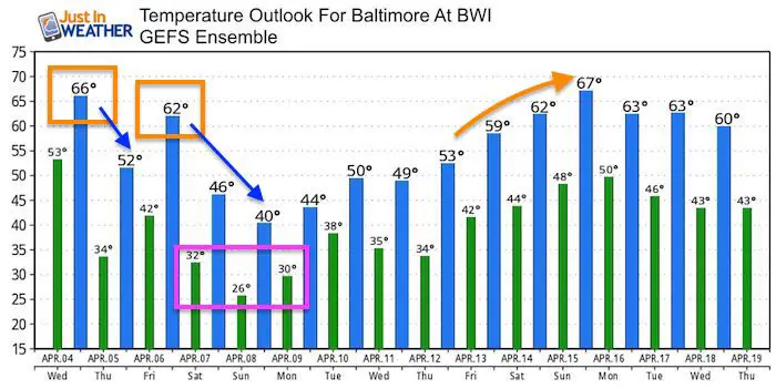
Then colder air will follow this evening when we could feel the strongest winds between 4 and 8 PM. The odd thing is that if you heard we may get snow on Saturday, we will actually warm back to the 60s Friday, then the bottom falls out this weekend. Not only will we have snow, but record low temperature possible as we dip into the 20s Sunday morning.
Stats For April 4
Average High: 61ºF
Record High: 86ºF in 2011
Average Low: 39ºF
Record Low: 20ºF in 1965
Snow Record: 1.5″ in 1944
Seasonal Snow To Date (at BWI): 15.2
Sunrise: 6:46 AM
Sunset 7:33 PM
*Daylight = 2:33 longer than yesterday
*Bay Water Temperature = 46ºF at Thomas Pt. Light House
Keep In Touch Every Day
Click here to sign up for email alerts…. Just in case you don’t get the post on your social media feed
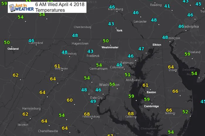
Morning Temperatures
Rain Timeline: Radar Simulation —> slider
[metaslider id=60952]
Wind Gusts Timeline —> slider
[metaslider id=60973]
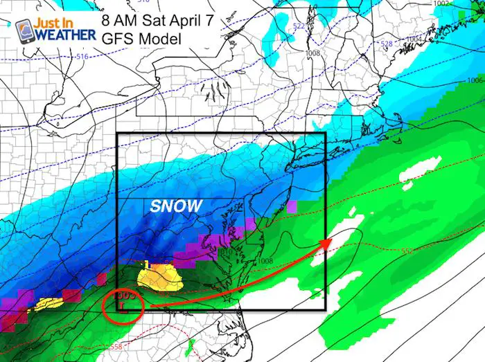
Skipping Ahead To The Weekend
This GFS Model has been most aggressive with the snow all day Saturday. I hesitate to give snow potential totals as daytime snow is not likely to stick much… but the duration and intensity in the afternoon/evening is when we may consider snow laying and staying.
Snow Simulation: ICON MODEL
This German forecast model has trended colder. I am showing this because it was this model that did the best job with our last snow event keeping the snow north of Baltimore. This time it spreads to across the Bay… and earlier than the prior run. I would plan for possible impact during the afternoon and evening.
![]()
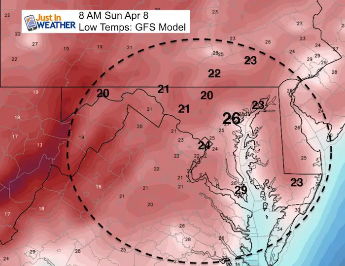
Record Cold Sunday?
The record Low on April 8 in Baltimore is 26ºF set in 1982. That is the forecast shown here on the GFS Model
Temperature Outlook
Shine On
Proceeds from all sales go to Just In Power Kids. Click the image to shop and show your support.

![]()
 Get the award winning Kid Weather App I made with my oldest son and support our love for science, weather, and technology. Our 3 year anniversary of the release and our contribution to STEM education is this November. It has been downloaded in 60 countries, and works in both temperature scales. With your support we can expand on the fun introduction to science and real weather.
Also See:
My Winter Outlook 2017-2018 for more snow
La Nina Formed: What it could mean to our winter
NOAA Winter Outlook: Not The Best But Not The Worst For Snow
Two Farmers Almanacs Winter 2018 Outlooks
Winter Weather Folkore: Suggestions from Animals and Crops
First Frost and Freeze Dates For Maryland (southern PA and northern VA)
My Preliminary Winter Outlook Notes
Low Snow Winters In Baltimore: To Repeat Or Not Repeat
NOAA Ranks Blizzard 2016 4th Worst Snowstorm On Record
Blizzard 2016 Record Top Snowstorm: Area Totals
Extreme Weather of 2015 balanced out on both ends