 Saturday March 31 2018
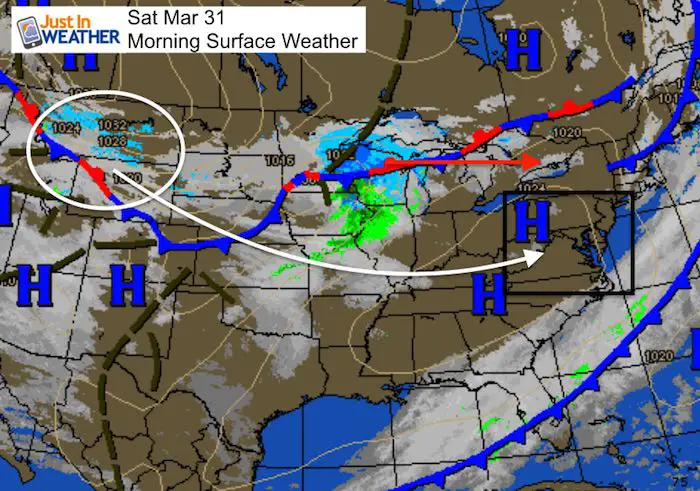
March started as a lion and is going out like a lamb. The good news is that the temperatures this weekend will be close to average for the end of the month. This times out well for our weekend and for holiday plans including Easter and Passover. But there is a system in the northern Rockies that will dive quickly across the nation and reach us Monday morning. The timing is perfect to arrive just before sunrise and tap into the cold air to produce snow for a few hours. I do not see this as a travel issue and it will be gone before noon. But still a something not welcome if you have switched momentum to Spring.
Today and Easter Sunday look to be dry and close to average temperatures.
Stats For March 30
Average High: 59ºF
Record High: 86ºF in 1998
Average Low: 38ºF
Record Low: 20ºF in 1964
Snow Record: 1.4″ in 1997
Seasonal Snow To Date (at BWI): 15.2
Sunrise: 6:52 AM
Sunset 7:29 PM
*Daylight = 2:33 longer than yesterday
*Bay Water Temperature = 45ºF at Thomas Pt. Light House
Keep In Touch Every Day
Click here to sign up for email alerts…. Just in case you don’t get the post on your social media feed
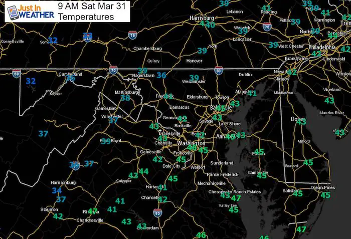
Morning Temperatures
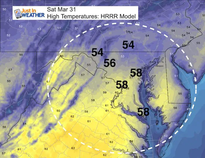
High Temperatures Today
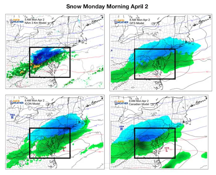
Snow Monday Morning
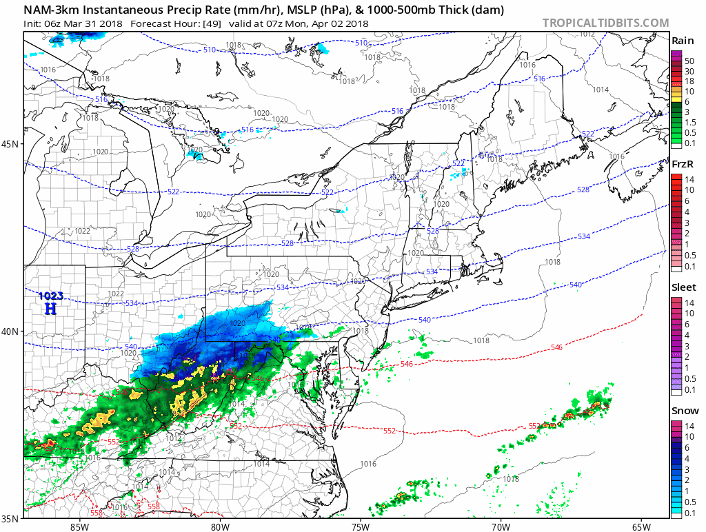
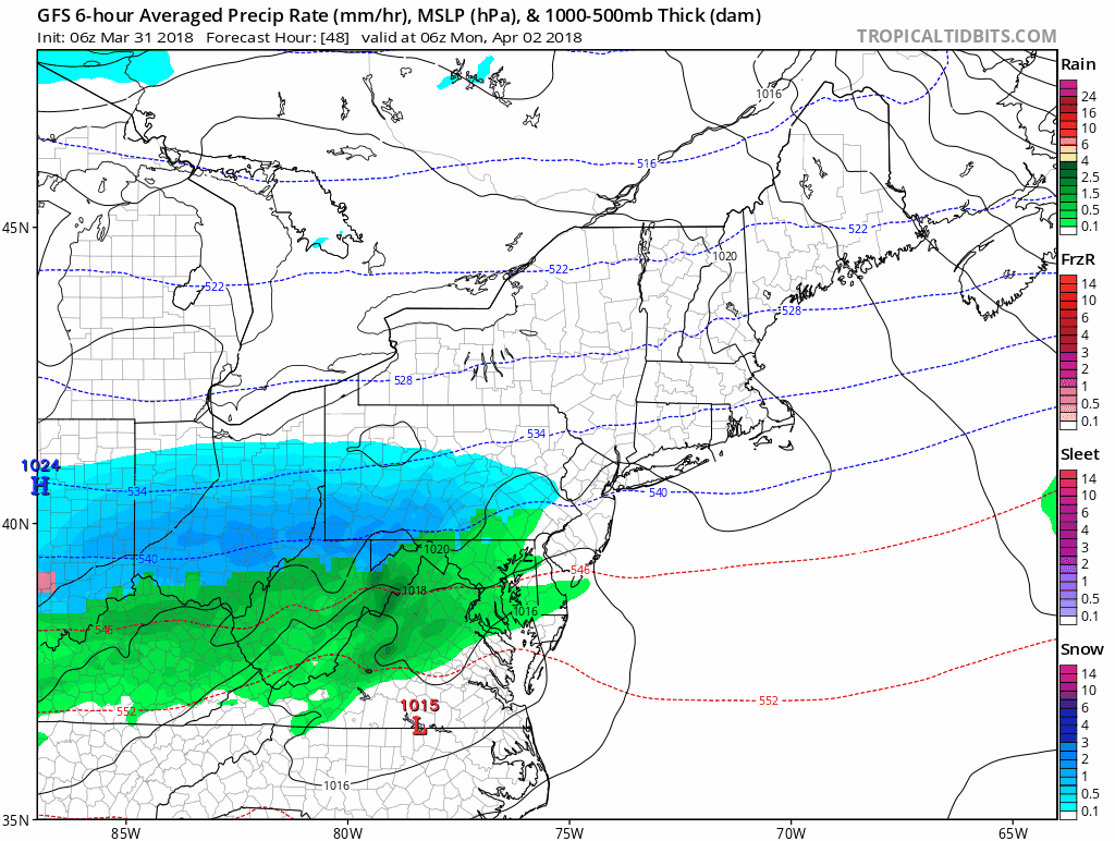
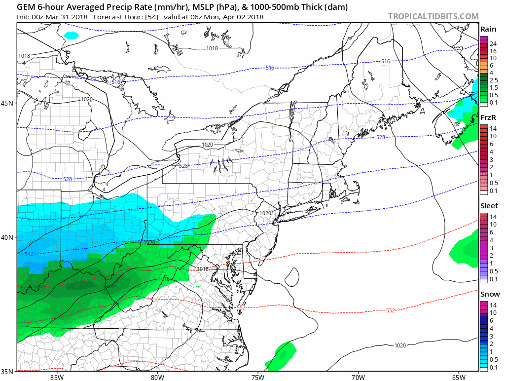
This quick moving system will be with us for about 5 to 8 hours. It is expect to arrive between 2 and 5 AM and may start with all rain, or some snow mix in the normally colder northern areas (north of I-70 and the Baltimore Beltway. The best chance for snow will spread in and expect to near Baltimore between 5 AM and 10 AM, when it departs.
It this tine I do NOT think this will be a road issue, but rather stick on the grass, and in elevations over 500 Ft.
Snow Animations
NAM 3 Km
GFS Model
ICON
![]()
Canadian GEM
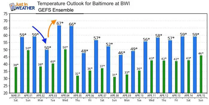
Temperature Outlook
Yes, it is possible to have snow AND 50ºF in the same day… especially in Spring if the sun comes out after morning snow. I do NOT think the snow in the morning will have cold enough air to stick on the roads. Just a grass thing.
Shine On
Proceeds from all sales go to Just In Power Kids. Click the image to shop and show your support.

![]()
 Get the award winning Kid Weather App I made with my oldest son and support our love for science, weather, and technology. Our 3 year anniversary of the release and our contribution to STEM education is this November. It has been downloaded in 60 countries, and works in both temperature scales. With your support we can expand on the fun introduction to science and real weather.
Also See:
My Winter Outlook 2017-2018 for more snow
La Nina Formed: What it could mean to our winter
NOAA Winter Outlook: Not The Best But Not The Worst For Snow
Two Farmers Almanacs Winter 2018 Outlooks
Winter Weather Folkore: Suggestions from Animals and Crops
First Frost and Freeze Dates For Maryland (southern PA and northern VA)
My Preliminary Winter Outlook Notes
Low Snow Winters In Baltimore: To Repeat Or Not Repeat
NOAA Ranks Blizzard 2016 4th Worst Snowstorm On Record
Blizzard 2016 Record Top Snowstorm: Area Totals
Extreme Weather of 2015 balanced out on both ends