Friday March 23 2018
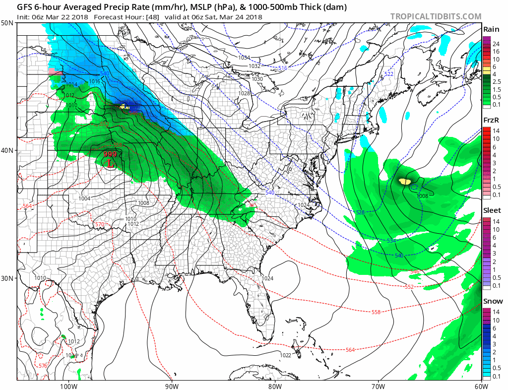
The snow pack on the ground is helping to refrigerate the atmosphere and we will remain in the daytime thaw/nighttime freeze cycle into the weekend. The Cherry Blossom Festival in Washington this weekend had to make special arrangements to accommodate, but their peak is still about 1 week away. As far as the weekend weather for us, there is another storm, that will pass to our south. This may bring snow to Virginia mountains and Southern VA Saturday night into Sunday morning. We could get some flurries or light snow on the back side Sunday morning. Then we set our sights on the warm up next week. This may time out perfectly for the Orioles home opener next Thursday.
Stats For March 23
Average High: 56ºF
Record High: 82ºF in 1907
Average Low: 36ºF
Record Low: 16ºF in 1934
Snow Record: 3.4″ in 1934
Seasonal Snow To Date (at BWI): 15.2″
Sunrise: 7:05 AM
Sunset 7:22 PM
*Daylight = 2:34 longer than yesterday
*Bay Water Temperature = 40ºF at Thomas Pt. Light House
Also See: Snow Report March 20-21 2018
Keep In Touch Every Day
Click here to sign up for email alerts…. Just in case you don’t get the post on your social media feed
Morning Temperatures

This Afternoon
We should have another mostly sunny day.

Weekend
The next storm will be doing south and just miss our region. There will be a band of snow in the West Virginia mountains to Southern Virginia Saturday night into Sunday morning. Following this there is a chance for some light snow. See more below.
Sunday Morning
The NAM 3 Km Model
This model shows a push of that system farther south and takes some energy into our area at sunrise on Sunday. This should not be a travel issue, but there might be some flakes flying for ambience.

Warm Trend: Jet Stream

The shift in the jet stream will begin next Tuesday. This will establish the warmer flow during the second half of next week

Temperature Outlook

Shine On
Proceeds from all sales go to Just In Power Kids. Click the image to shop and show your support.

Keep In Touch Every Day
Click here to sign up for email alerts…. Just in case you don’t get the post on your social media feed
Please share your thoughts, best weather pics/video, or just keep in touch via social media
-
Facebook: Justin Berk, Meteorologist
-
Twitter: @JustinWeather
-
Instagram: justinweather
 Get the award winning Kid Weather App I made with my oldest son and support our love for science, weather, and technology. Our 3 year anniversary of the release and our contribution to STEM education is this November. It has been downloaded in 60 countries, and works in both temperature scales. With your support we can expand on the fun introduction to science and real weather.
Also See:
My Winter Outlook 2017-2018 for more snow
La Nina Formed: What it could mean to our winter
NOAA Winter Outlook: Not The Best But Not The Worst For Snow
Two Farmers Almanacs Winter 2018 Outlooks
Winter Weather Folkore: Suggestions from Animals and Crops
First Frost and Freeze Dates For Maryland (southern PA and northern VA)
My Preliminary Winter Outlook Notes
Low Snow Winters In Baltimore: To Repeat Or Not Repeat
NOAA Ranks Blizzard 2016 4th Worst Snowstorm On Record
Blizzard 2016 Record Top Snowstorm: Area Totals
Extreme Weather of 2015 balanced out on both ends