
Sunday March 25 2018
Doppler Radar lit up with some blue this morning as a disturbance has brought some snow showers to northeastern Maryland. This included parts of Baltimore, Harford, and Cecil Counties. This band of snow is trying to build and push to the west. It should not be a problem, but noteworthy to show in the simulated radar slider below. This should be the last gasp as we have a warm up on the way just in time for the start of baseball season. Orioles opening day temperatures will be warming to the 60s, but there is still a split as to whether there will be showers or remain dry,
Stats For March 23
Average High: 57ºF
Record High: 85ºF in 1939
Average Low: 36ºF
Record Low: 20ºF in 1940
Snow Record: 3.2″ in 2013
Seasonal Snow To Date (at BWI): 15.2″
Sunrise: 7:01 AM
Sunset 7:23 PM
*Daylight = 2:34 longer than yesterday
*Bay Water Temperature = 42ºF at Thomas Pt. Light House
Also See: Snow Report March 20-21 2018
Keep In Touch Every Day
Click here to sign up for email alerts…. Just in case you don’t get the post on your social media feed
Ready for Spring? Shine On proceeds going to Just In Power Kids– A network of holistic integrated wellness practitioners and FREE sessions for kids in cancer treatment.
Shine On
Proceeds from all sales go to Just In Power Kids. Click the image to shop and show your support.

Morning Temperatures

Radar Simulation
slider—>
[metaslider id=60654]
High Temperatures Today

Outlook

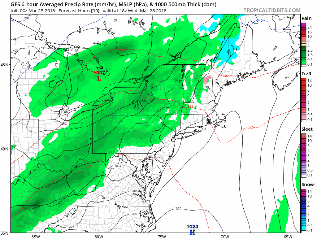
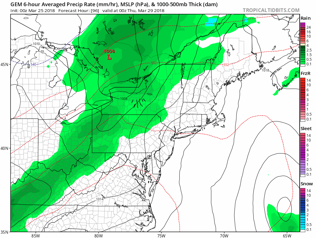
The models are split for the next round of storms. The GFS Model is bringing in rain showers Wednesday evening and Thursday, then leaving a dry weekend. The Canadian Model delays the rain another day, but brings in a more organized storm next weekend.
GFS Model Animation
Canadian Model Animation
Temperatures

Shine On
Proceeds from all sales go to Just In Power Kids. Click the image to shop and show your support.
Keep In Touch Every Day
Click here to sign up for email alerts…. Just in case you don’t get the post on your social media feed
Please share your thoughts, best weather pics/video, or just keep in touch via social media
-
Facebook: Justin Berk, Meteorologist
-
Twitter: @JustinWeather
-
Instagram: justinweather
 Get the award winning Kid Weather App I made with my oldest son and support our love for science, weather, and technology. Our 3 year anniversary of the release and our contribution to STEM education is this November. It has been downloaded in 60 countries, and works in both temperature scales. With your support we can expand on the fun introduction to science and real weather.
Also See:
My Winter Outlook 2017-2018 for more snow
La Nina Formed: What it could mean to our winter
NOAA Winter Outlook: Not The Best But Not The Worst For Snow
Two Farmers Almanacs Winter 2018 Outlooks
Winter Weather Folkore: Suggestions from Animals and Crops
First Frost and Freeze Dates For Maryland (southern PA and northern VA)
My Preliminary Winter Outlook Notes
Low Snow Winters In Baltimore: To Repeat Or Not Repeat
NOAA Ranks Blizzard 2016 4th Worst Snowstorm On Record
Blizzard 2016 Record Top Snowstorm: Area Totals
Extreme Weather of 2015 balanced out on both ends