May 21 Weather Remaining Cool With Rain On The Way But Warm Up In Sight
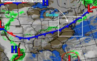
May 21 2020 The weather pattern is still dominated by the cut off Low and reverse wind flow for us off of the Atlantic Ocean. The cool winds will continue
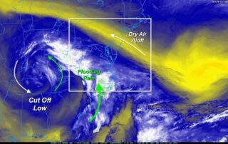
May 21 2020 The weather pattern is still dominated by the cut off Low and reverse wind flow for us off of the Atlantic Ocean. The cool winds will continue
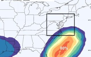
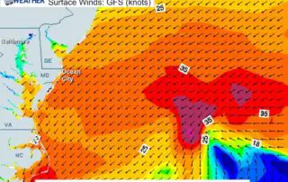
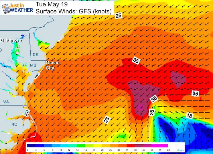
Tuesday May 19 2020 Tropical Storm Arthur has strengthened to 60 mph winds as it continues to move away from the US coast. However there is a traffic jam of

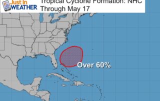
Sunday May 17 2020 Tropical Storm Arthur has strengthened a little today and is now sending rain bands to the Outer Banks of North Carolina. The storm continues to be

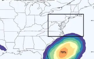
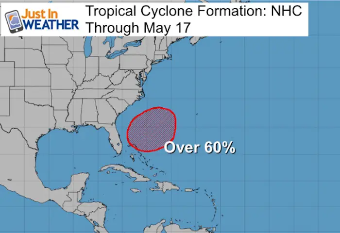
Sunday May 17 2020 Tropical Storm Arthur was named last night just east of the Florida coast. The winds are 40 mph, making this a minimum storm, but it is
Saturday May 16 2020 A cold front is moving through the region, but not a lot of rain with it. The clouds and shift in wind should keep temperatures today
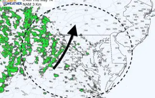
Friday May 15 I just want to remind you that this past weekend we had snow showers and early this week we had frost. Today we expect temperatures to reach
Thursday May 14 2020 We have definitely turned the corner. Yesterday morning Baltimore tied a record low of 36ºF. This morning we started off a little warmer and now we
Wednesday May 13 It really may seem like we are jumping seasons when you read this weather report. We just had snow showers over the weekend and ending what may
May 12 2020 We may be turning the corning with this chilly weather pattern. This morning's temperatures didn't get as cold as expected. Some clouds rolled in overnight and acted

April 18 2020 Another cold night ahead that is unfavorable for sensitive vegetation. Another Frost Advisory has been issued for Sunday morning April 19. Temperatures are expected to drop into