Mild Tuesday Then Snow Outlook Thursday And Friday
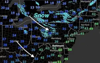
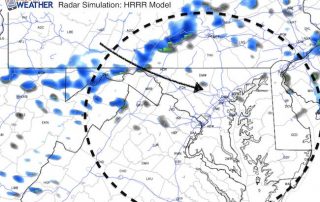
Monday December 11 The clipper system racing across the northern Plains and Great Lakes looks impressive on satellite. This has expanded the snow region and something I mentioned last night
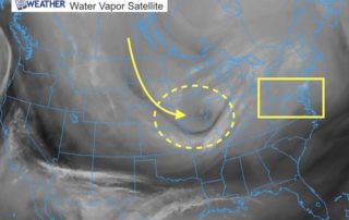
Monday December 11 The clipper system racing across the northern Plains and Great Lakes looks impressive on satellite. This has expanded the snow region and something I mentioned last night
Friday November 10 The arctic front is moving through this morning along with winds between 20 and 30 mph. Temperatures will continue to drop beyond sunrise and then struggle to
Thursday November 9 By now you may have heard about the arctic blast on the way over the next few days. While it is a sharp contrast to the 70s
March 15 - The storm is located in northern New England and is the gift that keeps on giving. We have set up a winter pattern to make up for
Friday March 3 - It will feel a lot more like winter today and the next few days. Strong winds will hold temperatures down into the 30s and much of
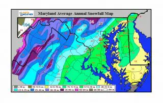
Winter can be broken down into two main categories of weather. First is how much snow will fall. The other are the temperature. See more on that below. Snow in

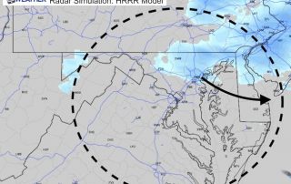
Thursday December 15 - Today will be an opposite day of sorts. The winds will pick up as the temperatures drop down. A Wind Advisory has been issued for today

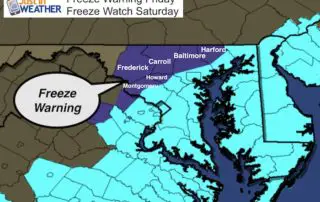
Wednesday December 14 - The arctic blast that has been advertised for many days is about to arrive. While there is not much moisture now, there is an upper level

Wednesday December 14 - The leading edge of the really cold arctic air is on the way. The Polar Vortex to our north will spill in overnight with a chance
Friday December 9 - You will feel it for sure as you step outside this morning. At 6 AM Baltimore's BWI was down to 28°F with a wind chill of