Thursday November 9
By now you may have heard about the arctic blast on the way over the next few days. While it is a sharp contrast to the 70s we had a few days ago. We have areas of drizzle and light rain already today making it feel more raw. I understand the sarcastic approach that it is November and what else should we expect. The purpose of this post is for the extreme hard core snow lovers anxious to seek out any flake that will fall within a 100 mile radius. It is also for the reality that it is going to be abnormally cold and the actual temperature is only part of the story.
First: About The Flurries
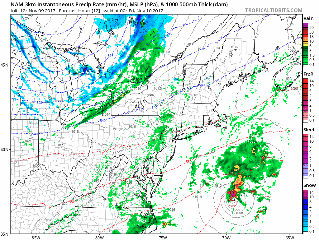
I need to preface this: The arctic front will open Lake Effect snow showers. But this usually do not make it past the mountains, unless there us upper level support. There is NOT a lot of moisture here, so we really are talking about flurries. Stickage with ground coverage is very slim to none for our immediate area. Also, the timing will be before sunrise… So you will need a light to see anything.
—> slider: Radar Simulation
[metaslider id=54540]
Faith in the Flakes Online Store Is Back Open By Popular Demand
PJ bottoms still inside out- They have to be to help bring on the snow.

Animation:
About The Cold
Two Records Within Reach:
Friday November 10: Lowest High = 41ºF in 1933
Saturday November 11: Lowest Min = 21ºF in 1973
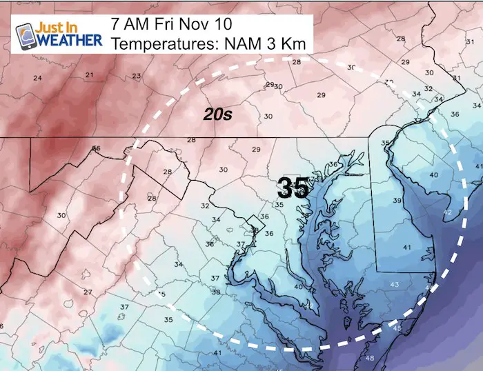
Friday morning will be our initial taste of cold air.
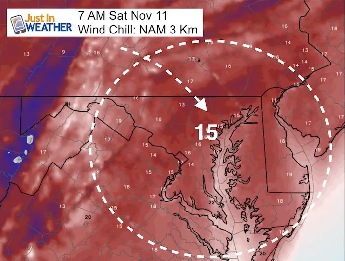
Here is what we can expect to wake up to, but scroll down to the Wind Chill Temperature.
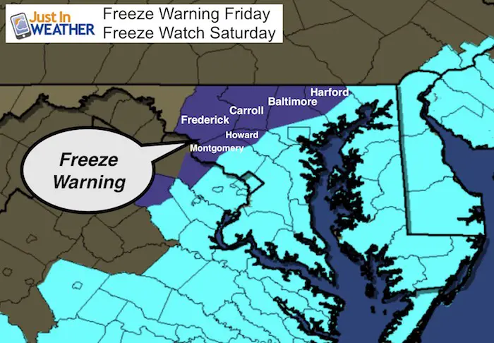
Freeze Warning:
This is new and for the northern/western suburbs including northern Harford, Baltimore, Carroll, Frederick, western Howard and Montgomery counties.
Freeze Watch still in effect for Saturday morning. This includes Delmarva, southern Maryland, and southeast Virginia.
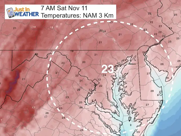
Friday Morning Temperatures
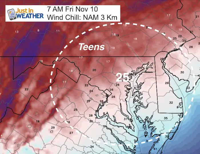
Gusty winds will make the wind chill feel about 10 degrees cooler than the actual temperature
Keep In Touch All Winter: Sign up for email updates on new posts
Since you may miss some posts via social media, click here for email alerts as a way to make sure you don’t miss any. *You may have to refresh that page once for your browser to clear out the images.
Also See: First Frost and Freeze Dates For Maryland (southern PA and northern VA)

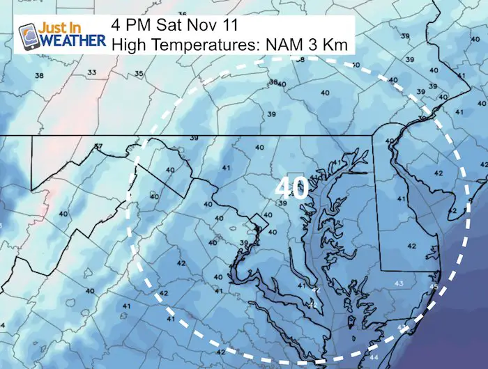
Saturday Temperatures
Morning
Afternoon
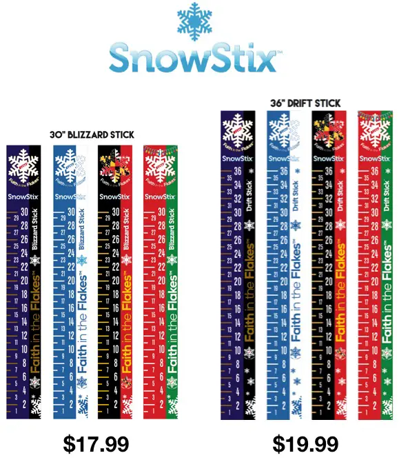
Snowstix- Ready For Delivery
We are giving 10% of each sale to programs that benefit pediatric oncology patients.
 Get the award winning Kid Weather App I made with my oldest son and support our love for science, weather, and technology. Our 3 year anniversary of the release and our contribution to STEM education is this November. It has been downloaded in 60 countries, and works in both temperature scales. With your support we can expand on the fun introduction to science and real weather.
Please share your thoughts, best weather pics/video, or just keep in touch via social media
-
Facebook: Justin Berk, Meteorologist
-
Twitter: @JustinWeather
-
Instagram: justinweather
Winter Stuff
NOAA Winter Outlook: Not The Best But Not The Worst For Snow
Two Farmers Almanacs Winter 2018 Outlooks
My Preliminary Winter Outlook Notes
First Frost and Freeze Dates For Maryland (southern PA and northern VA)
NOAA Ranks Blizzard 2016 4th Worst Snowstorm On Record
Extreme Weather of 2015 balanced out on both ends