Snow Showers And Strong Winds Then Warming Up
January 29 - Today were are caught in between a very strong developing storm over the Atlantic and the upper level energy from the Great Lakes trying to catch up

January 29 - Today were are caught in between a very strong developing storm over the Atlantic and the upper level energy from the Great Lakes trying to catch up
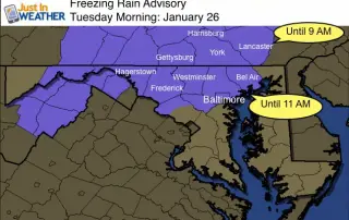
January 26 - This is a follow up to my last report about the light rain moving into freezing temperatures. As suggested, this is becoming an issue father south and
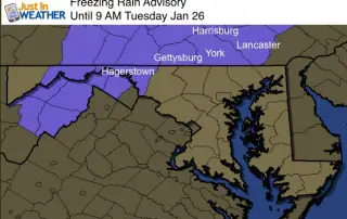
January 26 - UPDATE: This Advisory was extended through central Maryland. See the latest info in this report. Warmer air is trying to move in and with it is a
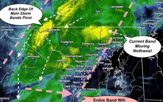
January 23 11:30 AM- We are in the time of the storm now where the surface Low will be nearly stalled. This could last 3 to 6 hours, as the

January 22- The Blizzard of 2016 is living up to all expectations. You know the expression 'a blanket of snow'? I thick this is more like a mattress and the

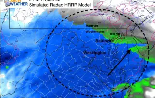
January 22- The snow bands have already hit many very hard so far, with some in Maryland measuring snow over 6 inches already as of 10 PM. Meanwhile I was
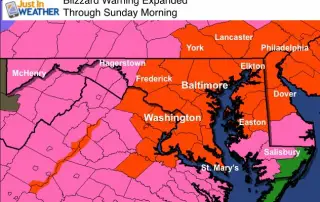
January 22 - The Blizzard Warning we have chatting about now covers a wider area. York and Lancaster along with southern Pennsylvania to Phildelphia are included. It's the National Weather

January 22- Now the the first flakes are moving in, I wanted to give another look at the storm formation before the full force of the blizzard warning kicks in.

January 22- At 1 PM, like many of you I have been watching the radar. A winter event will typically give false reading of the leading edge of snow since
January 22 2016- Today will begin a few days of The Blizzard of 2016. This will be our first storm of the kind since the twin blizzards of early February